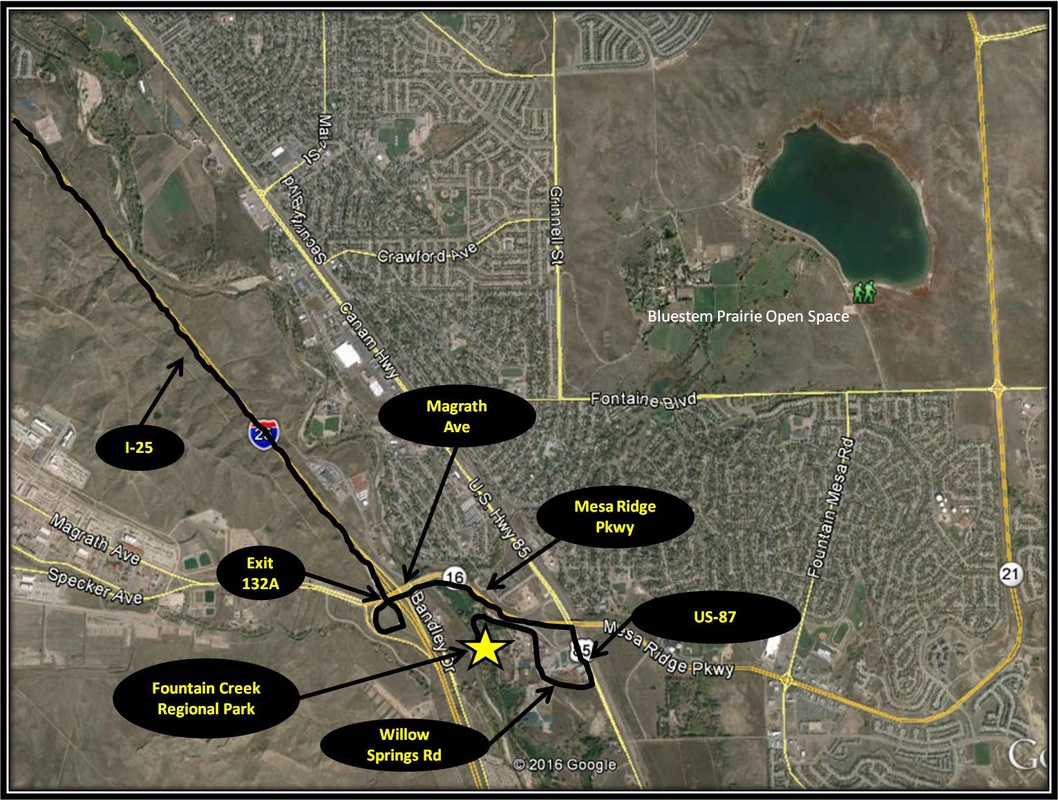
Fountain Creek Regional Park
|
Distance: Approximately 5 miles total
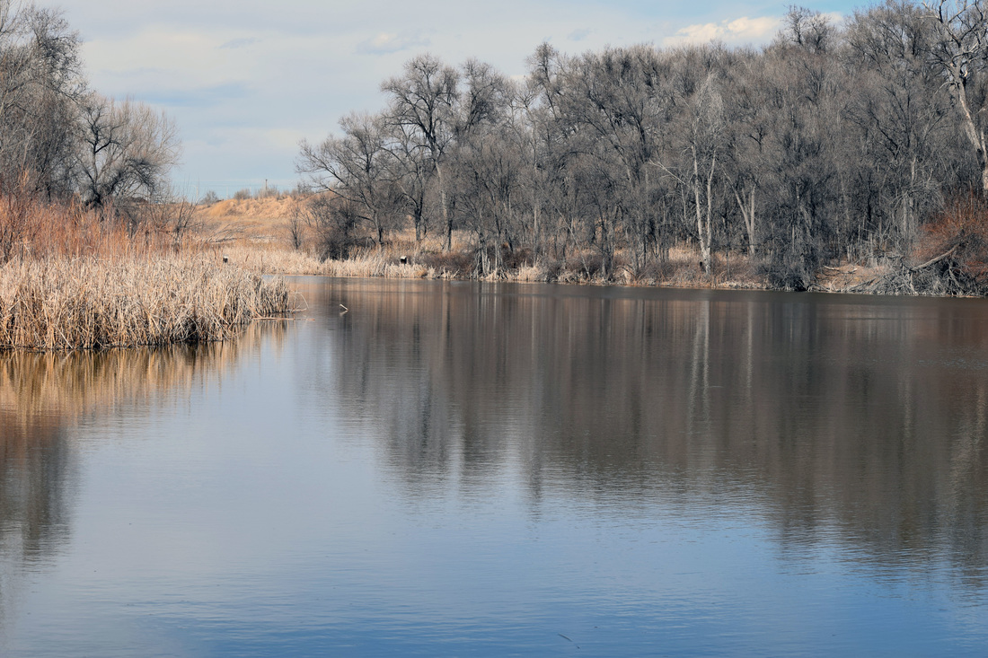
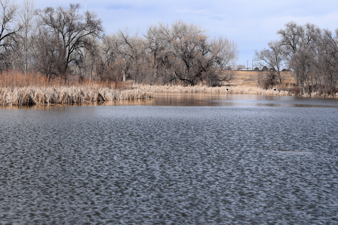
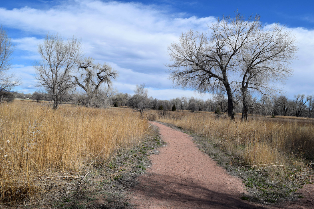
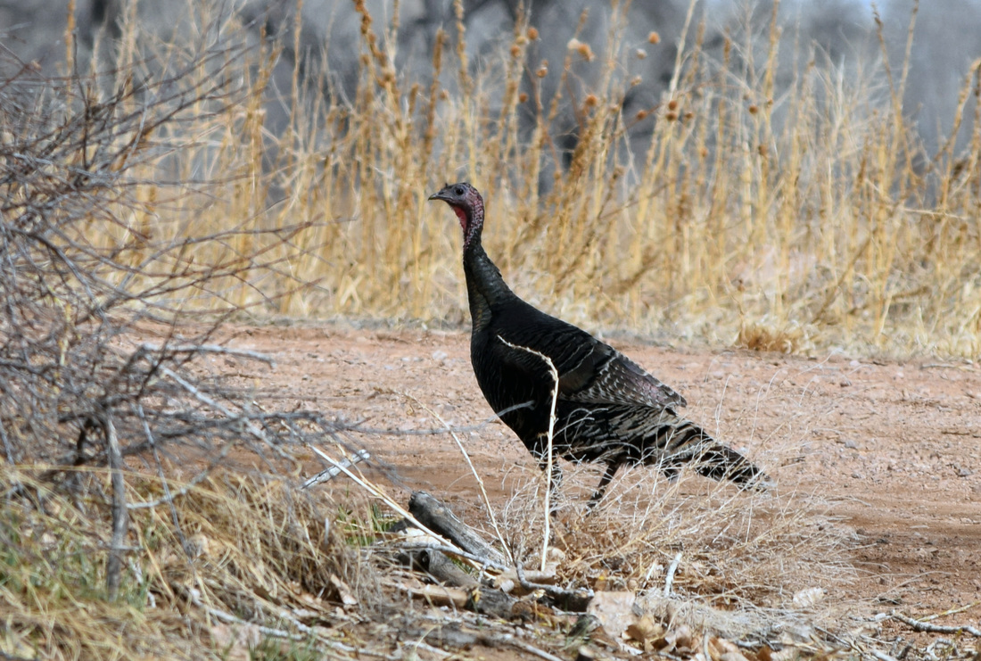
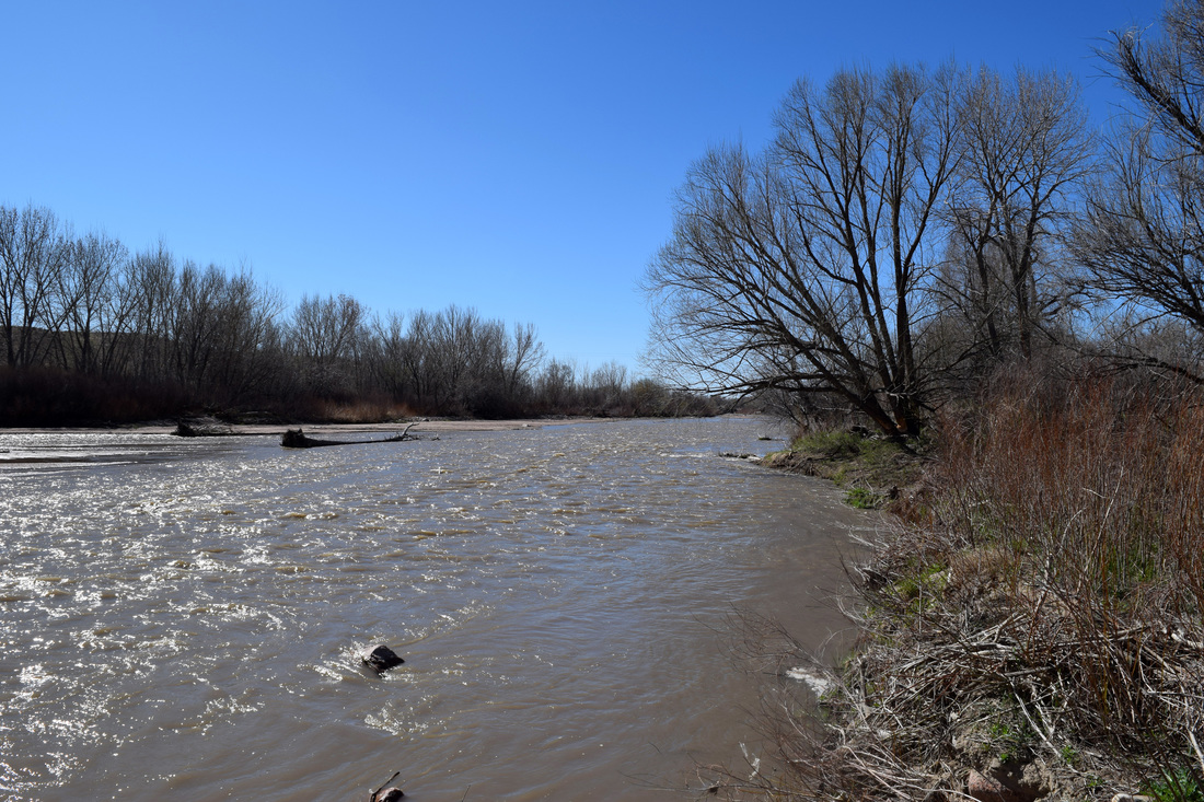
Located along Fountain Creek between Colorado Springs, Fountain, and Fort Carson, the 460 acre Fountain Creek Regional Park is a riparian environment robust with opportunity to view wildlife and is well-reputed for being the best spot in the area for bird-watching. The wetlands attract a variety of waterfowl like Canada geese, great blue herons, and sandhill cranes. Several species of divers and dabblers can also be observed from the side trails, benches and two covered lookouts bordering the park's ponds. The park itself is a combination of four smaller parks. These parks are: the Willow Springs Ponds, Cattail Marsh Wildlife Area (home of the Fountain Creek Nature Center), the Duckwood Active-Use Area, and Hanson Nature Park. Each of these areas are adjacent to Fountain Creek and connected together by the Fountain Creek Regional Trail. Fountain Creek Regional Trail is an urban trail that extends well beyond the park"s boundaries, connecting into Colorado Springs' Pikes Peak Greenway trail system. Fountain Creek Regional Trail is approximately 2.5 miles long from Fountain Creek Regional Park's northern boundary at Willow Springs Ponds to its southern boundary at Hanson Nature Park. This, makes for an approximate five mile long, there and back again hike. Starting from Willow Springs Ponds, turn left onto Fountain Creek Regional Trail traveling south. The trail ventures by both the North and South Rice Ponds before coming to an intersection near the end of South Rice Pond. Stay straight, headed toward the information kiosk pavilion. After passing through the kiosk, the trail ventures through the Cattail Marsh Wildlife Area, skirting around an open field and coming to another intersection. The left turn immediately crosses over a small foot bridge and then curves around toward the Fountain Creek Nature Center. If you have not visited the nature center, I recommend, but otherwise turn right, continuing to skirt the open field and another marsh, coming to another split in the trail. The trail that continues straight skirts the marsh closely, crossing a bridge, before heading up to the Fountain Creek Nature Center from the other side. Make a right, cross over a bridge, and then turn left back onto Fountain Creek Regional Trail. From here, the path parallels a stream pretty tightly, reaching another intersection. A left turn leads up to a nearby parking area for Fountain Creek Regional Trail, accessed from Duckwood Rd. A right turn leads back to South Rice Pond. Continue straight, as the trail skirts Fountain Creek more tightly, passing by a wooden bridge on the left, with a short trail leading to the nearby Duckwood Active-Use Area. Besides being an access point to Fountain Creek Regional Trail, Duckwood Active-Use Area also has picnic pavilions, multi-use fields, and a playground. Past the Duckwood Active-Use Area, the trail dips a little, crossing by a waste management bin, before passing through a wide, open field. Arriving at where the field borders a cottonwood forest, the path passes by a bench and a memorial to a Fallen Marine. Just past the memorial, a sign notates damage to the trail ahead. As the forest opens, Fountain Creek Regional Trail begins to traverse a levee, coming shortly to a break caused by previous floods. Not far off in the distance is the parking lot for the Hanson Nature Park, as well as a bridge crossing Fountain Creek. This is the turnaround point for the hike. From here, retrace the way back to Willow Springs Ponds, except turn left at the intersection with the nearby parking area accessed from Duckwood Rd. The trail will arrive back at South Rice Pond, just above the Information Kiosk. From here, turn left and follow the trail about half a mile back to Willow Springs Ponds. Given the levelness and the ease of navigation, this hike is rated as easy. Distance is based on the park trail mileage listed on the back of a park map found in the Fountain Creek Nature Center. Horseback-riding and bicycling are welcome on Fountain Creek Regional Trail, but the Cattail Marsh Wildlife Area is pedestrian only. Fishing is allowed with a license and the ponds are stocked regularly, but throwing back what is caught is highly recommended do to nearby industrial operations. Further information on Fountain Creek Regional Park, including the outdoor-educational opportunities offered by the Fountain Creek Nature Center is linked below. Further Online Resources: El Paso County, Co: Fountain Creek Regional Park Fountain Creek Regional Park Map PDF El Paso County, Co: Fountain Creek Nature Center El Paso County, Co: Fountain Creek Regional Trail Fountain Creek Regional Trail Map PDF |

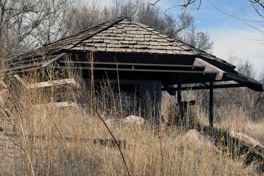
Above image of Fountain Creek Nature Center links to further images of the Hike
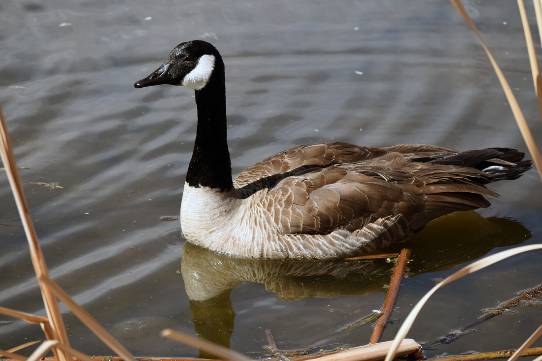
Canada Geese are frequent visitors of the marshes and ponds of Fountain Creek Regional Park
Cattail Marsh Wildlife Area
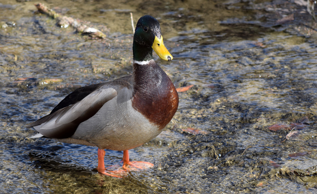
Mallards are one of many species of ducks to be observed at Fountain Creek Regional Park
Cattail Marsh Wildlife Area
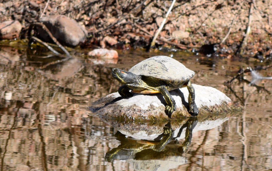
Western Painted Turtle sunbathing on a rock in Rice Pond
Covered Lookout built into the berm above South Rice Pond
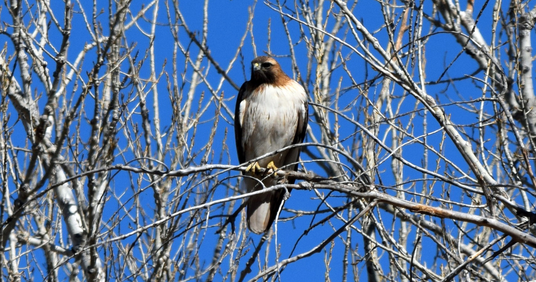
An assortment of Birds of Prey stalk Fountain Creek Regional Park
|
|
Driving Directions:
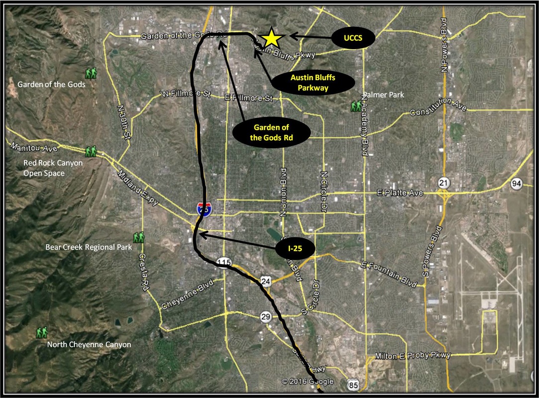
Fountain Creek Regional Park is located approximately 18 miles from UCCS. To get there from UCCS, turn right onto Austin Bluffs Pkwy. Stay on Austin Bluffs Pkwy as it turns into Garden of the Gods Rd. From Garden of the Gods Rd, turn left, merging onto I-25 headed south. Stay on I-25 for 14.2 miles and then take Exit 132A for Mesa Ridge Pkwy. Merge right onto Magrath Ave. Stay on Magrath Ave as it turns into Mesa Ridge Pkwy and 0.6 miles later, take the US-87 exit. Turn right onto US-87 and 0.3 miles later turn right onto Willow Springs Rd. Follow Willow Springs Rd for about a mile as it leads into Fountain Creek Regional Park Driving Directions to Fountain Creek Regional Park using Google Maps is linked here. |
Clear Springs Ranch Regional Park
|
Distance: Approximately 6 miles total
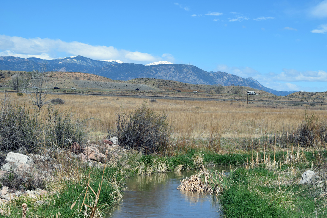
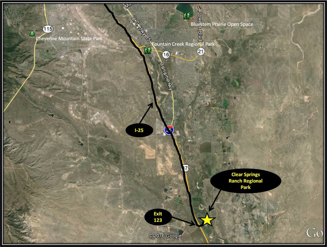
The 940 acre Clear Springs Ranch Regional Park is situated along Fountain Creek, just south of Fountain, in southern El Paso County. Clear Springs Ranch is a beautiful mix of farmland and cottonwood groves, a plentiful home, or way station to an abundant array of wildlife. The primary trail venturing through Clear Springs Ranch is the Colorado Front Range Trail. The very-level Front Range Trail mostly skirts the boundaries between Fountain Creek's riparian environs & adjacent agricultural fields, sometimes journeying through what Wendell Berry called the Margins. Walks in the park can feel familial to Germany's volksmarches, set in the country-side, often a mix of farmland and wild, but never far from the sights & sounds of humanity. The park's serenity can certainly fade the roar of the nearby interstate to an innocuous level. The hike described here begins from Clear Springs Ranch Regional Park's parking and picnic area, located directly off of I-25 at Exit 123. The hike follows the Front Range Trail headed north for approximately three miles before turning around and mostly retracing the route back to the start point. Beginning from the the picnic area, the trail quickly comes to an intersection. The left turn cuts through an open field occasionally interrupted by large cottonwoods. Turn right into the forested area and toward Fountain Creek. Near Fountain Creek, the dirt path comes to an intersection with a large sign annotating the Front Range Trail and distances to the next key landmarks. Turn left headed in the direction of the Fish Passage, notated by the sign as being three miles away. The hike described here stops a quarter mile short of the Fish Passage at an intersection. That intersection is also marked by a sign closely resembling the sign mentioned above. Shortly after turning left onto the Front Range Trail, a side-trail leads down to Fountain Creek. Having enjoyed the view of the creek, turn right back onto Front Range Trail as it follows the border between an open field and forest, coming to an intersection with the soft-surface Ray Nixon Road. The left turn returns to the picnic area and is the trail initially not taken at the start of the hike. From here, turn right onto the path & not the road, passing through bramble & cottonwoods, coming to a sign warning of flood damage. Not far past the sign is the only stream crossing of the hike. On most occasions this crossing can be done without getting boots wet, but dependent on the amount of recent rain or recent melt, the crossing might be quite dangerous, as witnessed by the signs on the trail and the nearby remains of a washed-out bridge. After crossing the stream, the Front Range Trail winds through woodland, passing by an informative sign on spotting owl nests, and arriving at another intersection. Turning right leads to a view of Fountain Creek's flood plain and the likely mad cackle of a nearby Belted Kingfisher, whose nest may be close by. After returning to the Front Range Trail from the short diversion, turn right passing by a farmer's field. and a sign requesting respect for private property by sticking to the designated path. Another intersection with Ray Nixon Road is quickly reached. This time turn right, joining the road. From here, Front Range Trail follows Ray Nixon Road for most of the remainder of the hike. The route passes by an old sod house and another view of Fountain Creek, before turning right, away from the road and initially through a dense sand patch. The path then briefly skirts the boundary between an agricultural field and the verdant wilds growing along Fountain Creek, before cutting through the bramble and veering back to the road. Once again turn right following Ray Nixon Road. A Front Range Trail Sign notes the right turn where the trail splits away once more from Ray Nixon Rd, passing through an open fence line, and coming to an intersection of two irrigation channels. The trail then parallels the channel pretty closely, quickly arriving at a concrete bridge and another intersection. A sign marks the intersection, as well as points out the distances of further key landmarks. The Fish Passage is notated as being just a quarter mile away, diverging from the Front Range Trail. This is the turnaround point for the hike described above. The way back is basically the way you came, except upon reaching the intersection after the stream crossing, instead of turning left, stay straight continuing through the open field and back to the park's picnic and parking area. The distance for the hike is described as approximately six miles total, but just be aware that approximation is very much a rough estimate based solely on the trail signs. With the exception of Fountain Creek Regional Park, Front Range Trail through Clear Springs Ranch may be the most level hike in the region. The trail itself is well-marked with the white Front Range Trail Sign and informative signs on the park's ecology. At times, the trail's surface is more sand than dirt, the kind of sand boots like to sink down into. Otherwise, given the flatness of the trail and ease of navigation, this hike is rated as easy. Just remember, the trails out on the plains get hotter quicker with the coming of summer. Horseback Riders and bicyclists are also welcome at Clear Springs Ranch. Further Information on the regional park is linked below. Further Online Resources: El Paso County, Co: Clear Springs Ranch Regional Park Clear Springs Ranch Regional Park Map pdf Colorado Springs Utilities: Clear Spring Ranch Colorado Birding Trail: Clear Springs Ranch Possibly Helpful Map of Hike |
Above image links to further images of the Park
Wild Turkeys & esp. their tracks can be observed from the Front Range Trail
View of Fountain Creek
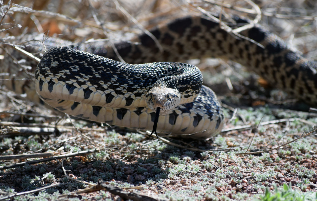
Gopher Snake interrupted from sunbathing along the Front Range Trail
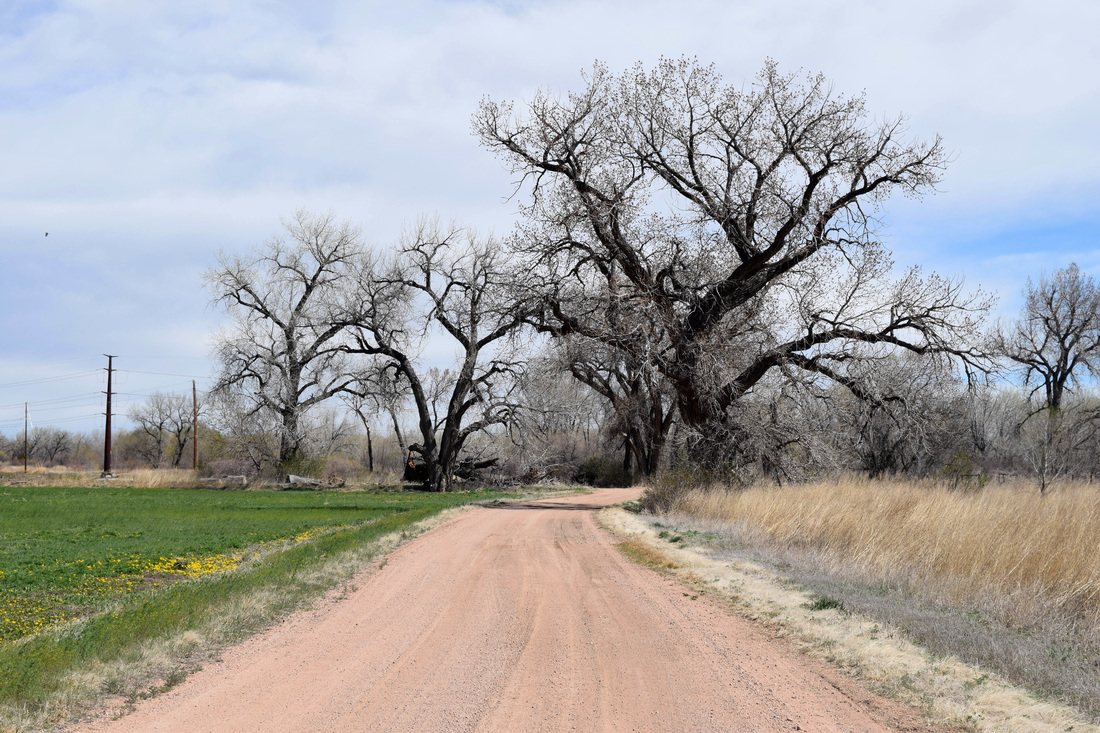
The Front Range Trail is a part of Ray Nixon Road for significant portions of the hike
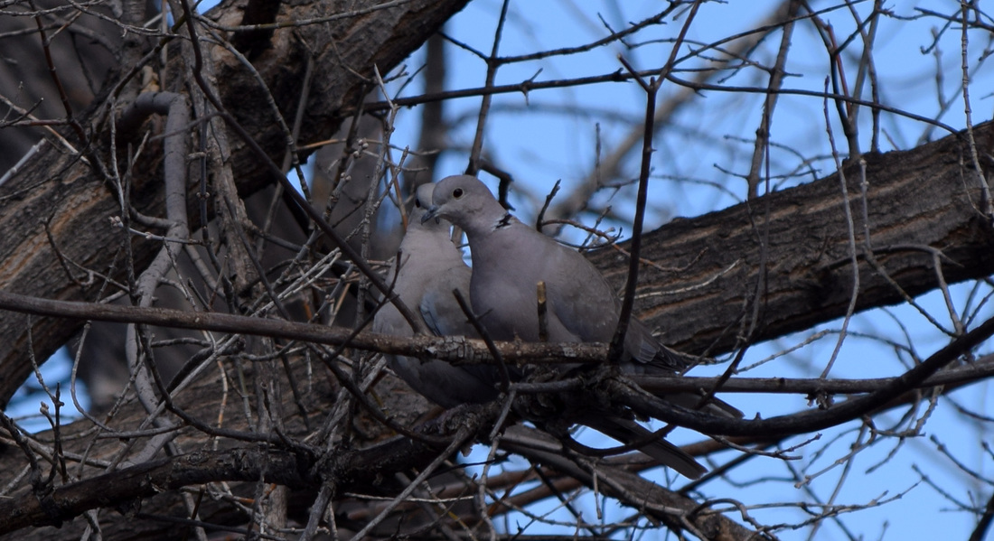
Eurasian Collared Doves resting in a Cottonwood near Front Range Trail
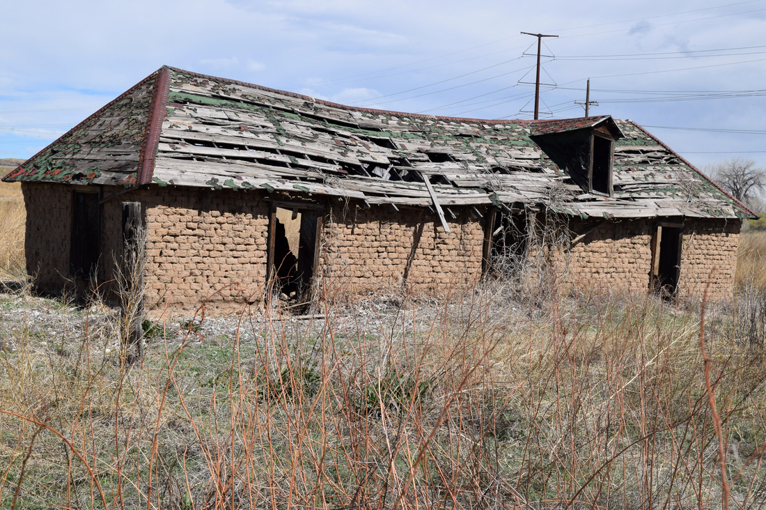
While on Wellfield Road, Front Range Trail passes by an Old Sod House
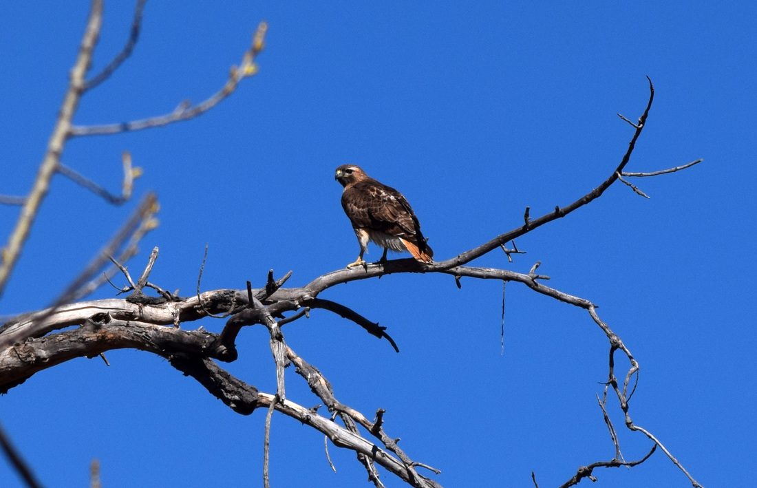
A Red-Tailed Hawk off in the distance monitoring the fields of Clear Springs Ranch
View of Pikes Peak from Front Range Trail
|

|
Driving Directions:
Clear Springs Ranch Regional Park is located approximately 25 miles from the UCCS's main campus. To get there from UCCS, turn right onto Austin Bluffs Pkwy and stay on Austin Bluffs Pkwy as it turns into Garden of the Gods Rd. From Garden of the Gods Rd turn left, merging onto I-25 headed south. Stay on I-25 for roughly 22.6 miles and then take Exit 123. From Exit 123 turn left passing under the one lane bridge & crossing two railroad tracks. From the railroad tracks follow the signs as the soft surface road initially curves left and then right, following a narrow road between two agricultural fields. Then turn left into the park's large parking area, designed also for horse trailers. Toilets are located near the parking and picnic area. Driving directions to Clear Springs Ranch Regional Park using Google Maps is linked here. |
Bluestem Prairie Open Space
|
Distance: 4.2 miles total, 2.1 miles one-way
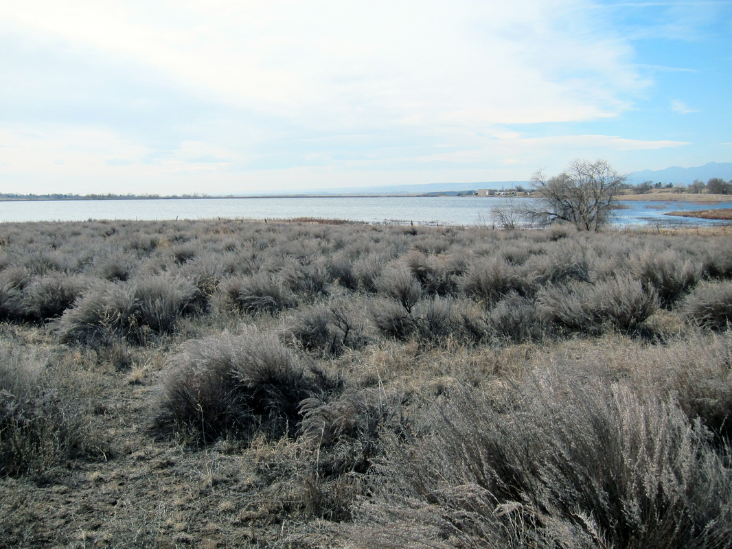
Once a part of the expansive Banning-Lewis Ranch, Bluestem Prairie Open Space is situated amongst the rolling prairies southeast of Colorado Springs, bordering Big Johnson Reservoir. Despite the proximity of human development, Blue Stem is alive with wildlife. Black-tailed prairie dogs have made much of the open space into a sprawling community. The prairie environ is home to several ground nesting birds, including the burrowing owl and scaled quail. Nearby Big Johnson Reservoir is a popular migratory layover for many species of waterfowl and other water birds. Bald eagles, red-tailed hawks, and other raptors patrol the skies above. Pronghorn antelope, coyote, fox, and rattlesnakes also take great interest in the open space. Bluestem Prairie's single trail skirts a barb-wired fence following Big Johnson's shore from a distance for 2.1 miles through rabbit bush, prairie grasses, yucca, and the occasional prickly pear cacti before coming to a dead-end. The trail itself is well-worn and easy to navigate,. Though unmarked, four informative signs along the way describe the open space's ecology and history. There is almost no uphill along the path. In order to protect the diverse wildlife at Bluestem, dogs and bikes are prohibited. As a there and back again hike, the distance walked is 4.2 miles total, or 2.1 miles one-way. The difficulty of this hike is easy with the caveat the trail is sporadically pocked with holes, aka prairie dog entrances. Further Online Resources: Bluestem Prairie Open Space Colorado Birding Trail: Big Johnson Reservoir/Blue Stem Open Space Colorado Country Birding: Big Johnson Reservoir The Colorado Hiker: Bluestem Prairie |
Above image links to further images of hike
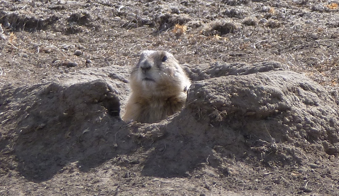
Black-Tailed Prairie Dog
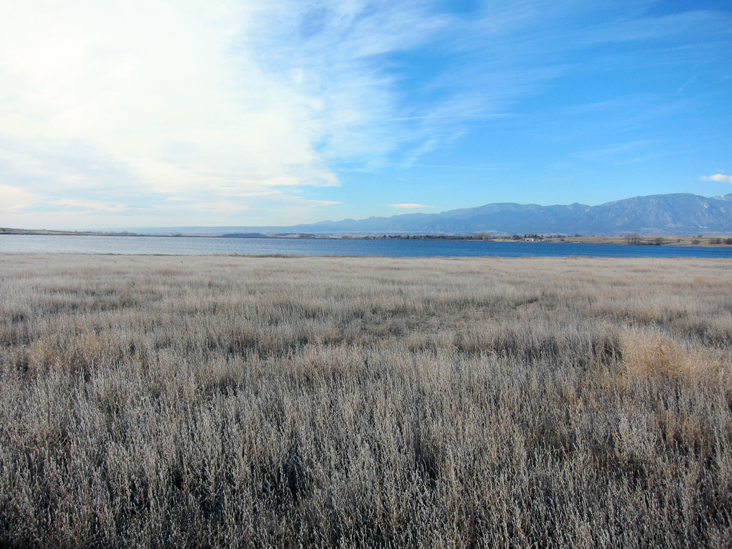
View from Bluestem Prairie Open Space
|
|
Driving Directions:
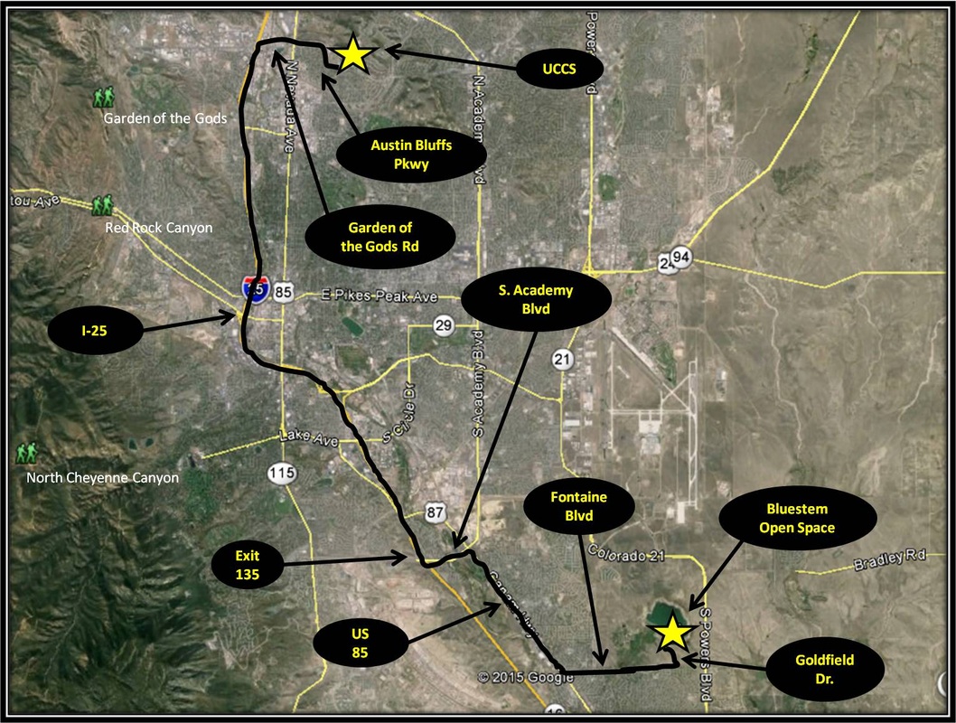
From, UCCS, turn right onto Austin Bluffs Parkway. From Austin Bluffs Pkwy continue onto Garden of the Gods Rd. From Garden of the Gods Rd turn left merging onto I-25. Stay on I-25 for approximately 10 miles before taking exit 135. Turn left onto South Academy and after about a mile turn right, exiting Academy taking the US-85 exit to Fountain. Turn right onto US-85 for 2.6 miles and then turn left onto Fontaine Blvd. Stay on Fontaine Blvd for 2.1 miles and turn left onto Goldfield Dr. Parking for Bluestem Prairie Open Space will be on the right about a half-mile down Goldfield Dr. Driving directions using Google Maps is linked here. |
