Waterton Canyon
|
Distance: 6.2 miles total, 3.1 miles one-way
Starting from its northern terminal near Denver, the Colorado Trail follows the South Platte River through Waterton Canyon for approximately 6.2 miles and then continues on for another 480 miles to Durango. The hike described here follows the Colorado Trail through Waterton Canyon for just 3.1 miles to the Mountain Lion Rest Area, making for a nice and easy 6.2 mile day-hike over ridiculously level terrain on a well-maintained soft-surface road. From the main parking lot, the trail crosses Waterton Rd, and quickly comes to the Mule Deer Rest Area. The Colorado Trail traverses civilization's outskirts for another half-mile before entering the canyon, passing by the Blue Heron Rest Area. The next rest area is named Black Bear and is reached roughly two miles from the start. Mountain Lion Rest Area is located a mile from Black Bear and is the turn around for this hike. The rest areas have sheltered picnic tables and vaulted toilets. Besides hiking, Waterton Canyon is also wildly popular for bicycling, fishing, running, and photography. The canyon is a winter home to a large herd of big horn sheep that are commonly observed during the cooler parts of the year by visitors to the trail. Please treat the big horns as the wild animals they are and with great care; specifically by following the many posted signs on how to properly encounter the area's wildlife without them needing to be put down afterward. The big horns and other wildlife are the principle reasons why dogs are not allowed on the trail. Besides the wildlife, the canyon is ripe with spectacular views. The views include power-lines paralleling the South Platte River and other build-up related to Denver's infrastructure. The area is managed by Denver Water. It is not uncommon for them to shut the trail down Monday through Saturday to complete a project. Be sure to check the Waterton Canyon website linked below on the trail's availability. Otherwise, Waterton Canyon is generally open daily half an hour before sun-up until half an hour after sunset. The total distance for the hike described here is 6.2 miles, 3.1 miles one-way. Navigation is straightforward with the route well-marked by signs, including mileage markers. There is no noticeable uphill or downhill to the trail and there are plenty of places to rest. Given these reasons, this hike is rated as easy. Further Online Resources: Denver Water: Waterton Canyon Waterton Canyon Map PDF The Colorado Trail Homepage |
Above Image links to further Images of the Hike
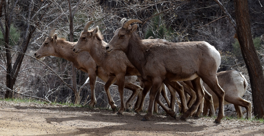
Big Horn Sheep inhabit Waterton Canyon
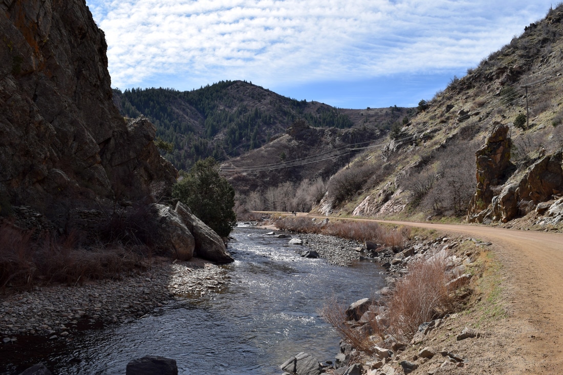
The Colorado Trail parallels the Platte through Waterton Canyon and does not require crossing
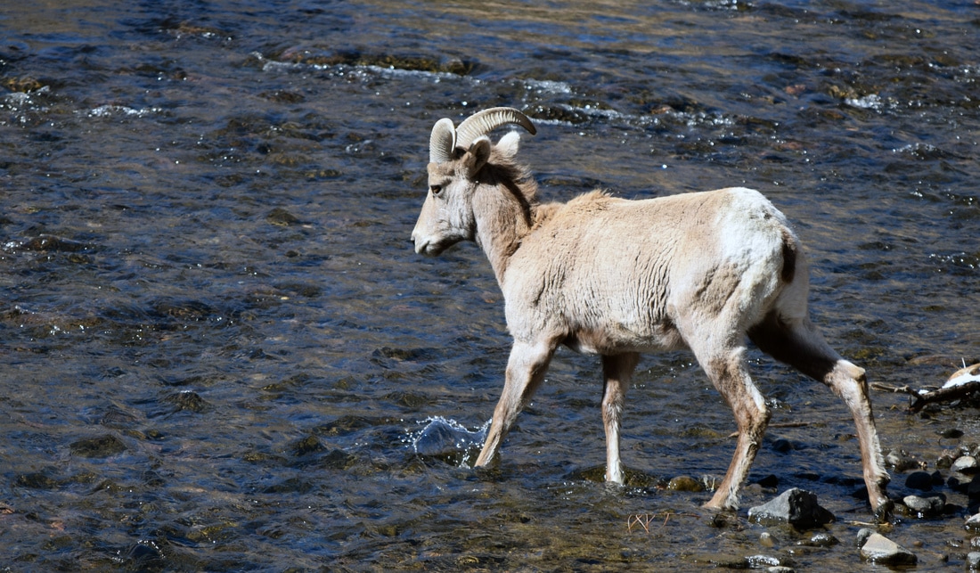
Big Horn crossing the river
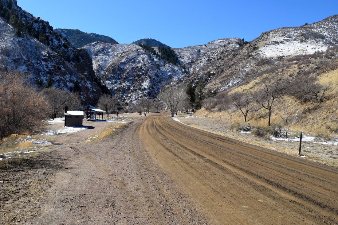
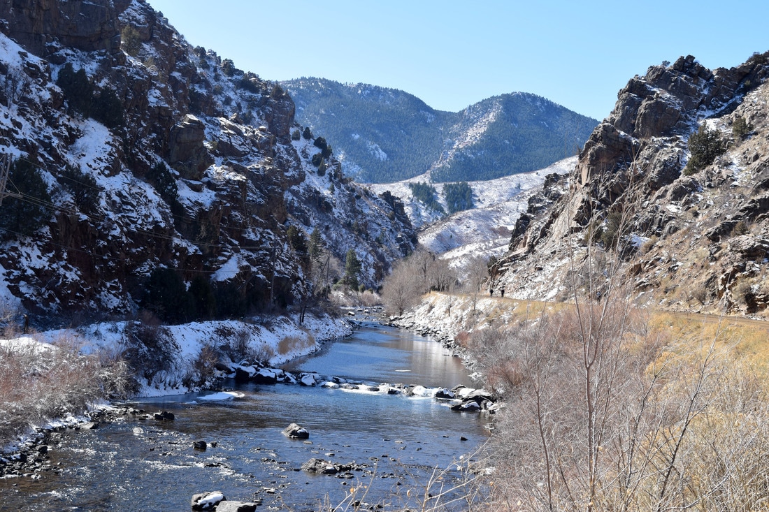
Mountain Lion Rest Area is the turn around point for this particular hike, but the trail continues on for a few more miles through Waterton Canyon
|
|
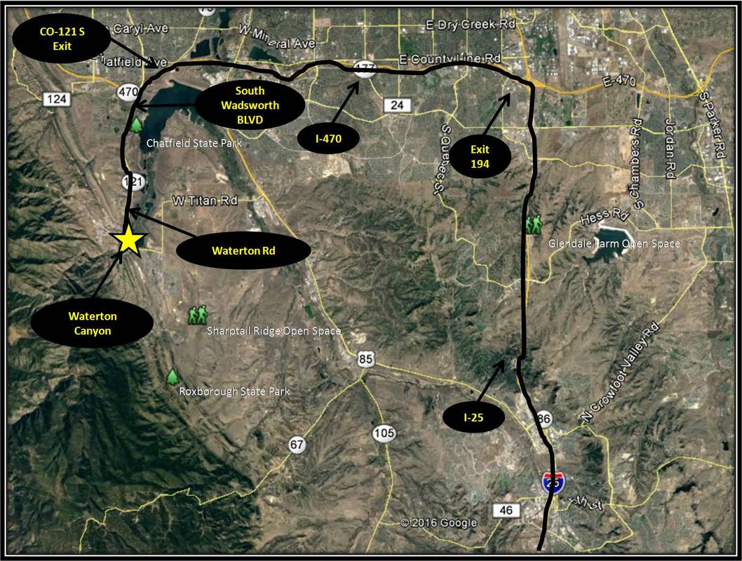
Driving Directions:
The starting point for this hike is located approximately 65 miles from the UCCS Campus. To get there, turn right onto Austin Bluffs PKWY. From the Austin Bluffs PKWY turn right onto Nevada Ave and from Nevada Ave merge onto I-25 headed north toward Denver. Stay on I-25 for approximately 58.6 miles. Take Exit 194 merging onto I-470 heading west. Stay on I-470 for approximately 12.3 miles and then take the exit for CO-121 S / South Wadsworth BLVD. From the exit ramp turn left onto South Wadsworth BLVD. After traveling about 4.4 miles on South Wadsworth BLVD turn left onto Waterton Rd. The parking area will be on the left a third of a mile down Waterton Rd from the turn from South Wadsworth BLVD. There is ample parking, but Waterton Canyon can be very popular. Vault toilets are located near the parking area and along the trail. Driving directions to Waterton Canyon's start point using Google Maps is linked here. |
