Black Forest Section 16
|
Distance: 4.2 miles
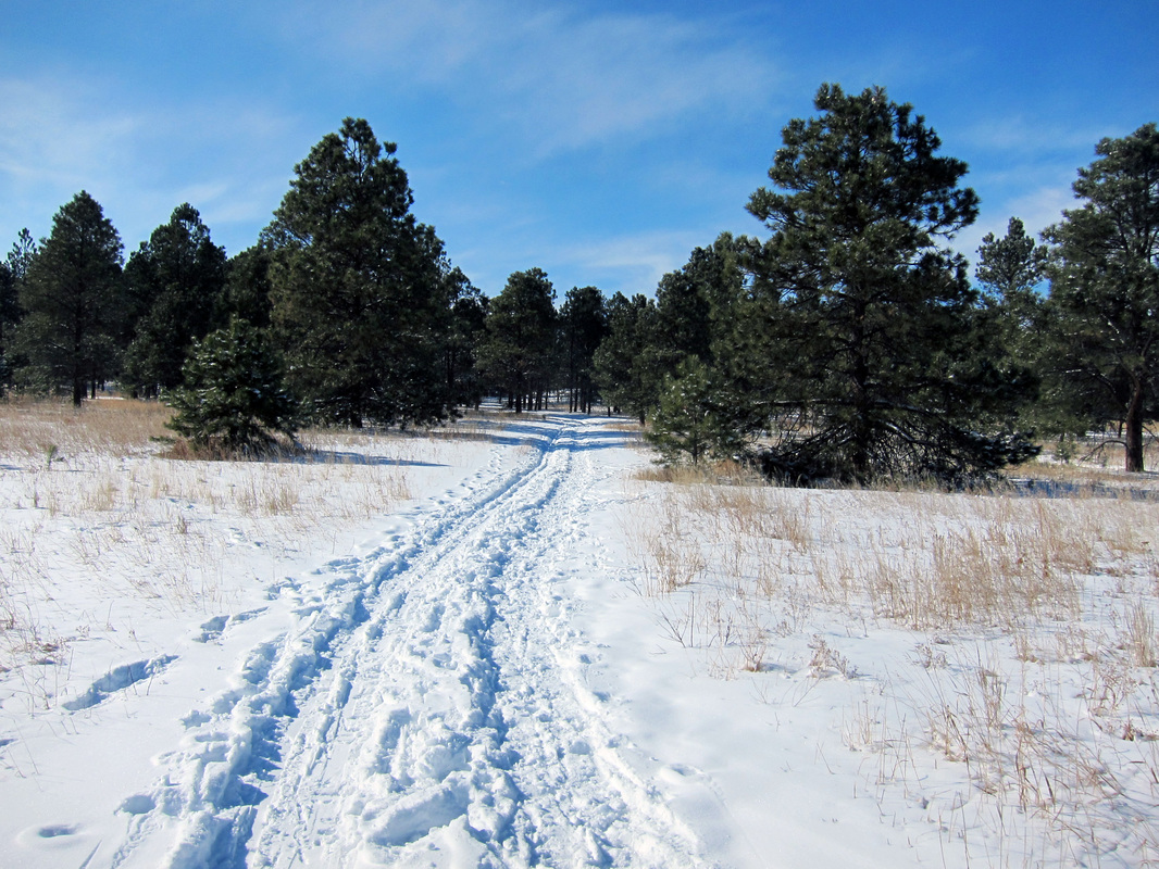
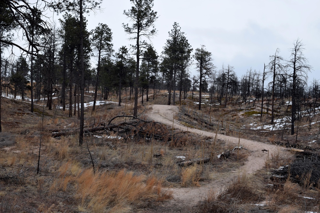
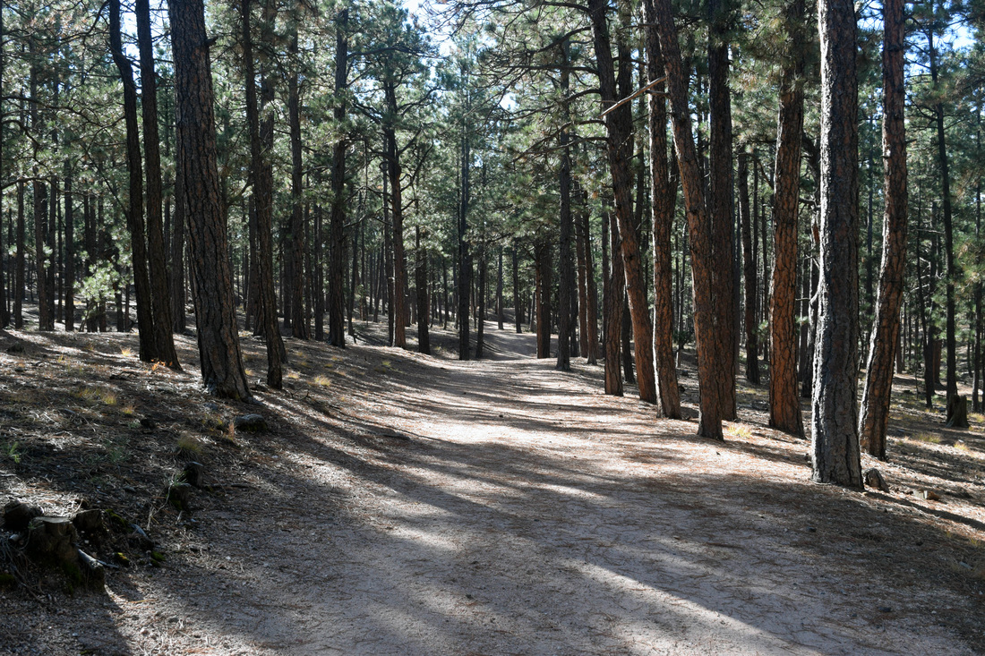
The 4.2 mile loop trail paralleling the perimeter of the 640 acre Black Forest Section 16 Open Space is a mostly level hike through ponderosa pine forest, with a handful of steep and brief inclines interspersed along the route. The forest on a couple of occasions gives way to open grassland where prairie wildflowers bloom in warmer months. The invasive mullein is most certainly among the most prolific species growing within the open space. Dependent on the cloud cover, views of Pikes Peak open up above the trees between the 9th and 10th trail entry signs. There are eleven points of entry onto the trail. Each are marked by sign, most are points of entry from nearby residential areas. The 1st and 11th points of entry are entry points for the loop hike's main parking area, while the 8th and 9th points of entry are located where the trail crosses by the School of the Woods' parking area. Black Forest Section 16 suffered less damage from the Black Forest Fire of 2013 than much of the area surrounding the park. Still, the destructive forces of the immense fire is visible along the path. The trail can be hard to discern near the School of the Woods, as the trail follows Vollmer Rd. During the Black Forest Fire, bulldozers cleared the forest to enhance the boundary created by Vollmer Rd. Otherwise, the trail is carved deep into the earth and is easy to navigate. In addition to the easy navigation, the path is mostly level for its 4.2 miles, making for a hike of easy difficulty level. Additionally, the trail is open to horse-back riding and biking. Further Links: Blackforesttrails.org: Black Forest Section 16 Cospringstrails.com: Black Forest Section 16 Elpasoco.com: Black Forest Section 16 TOSC: Black Forest Section 16 |
Above image links to further images of hike
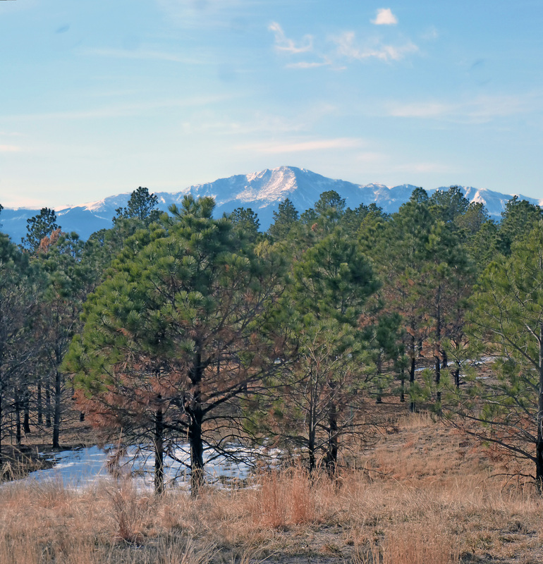
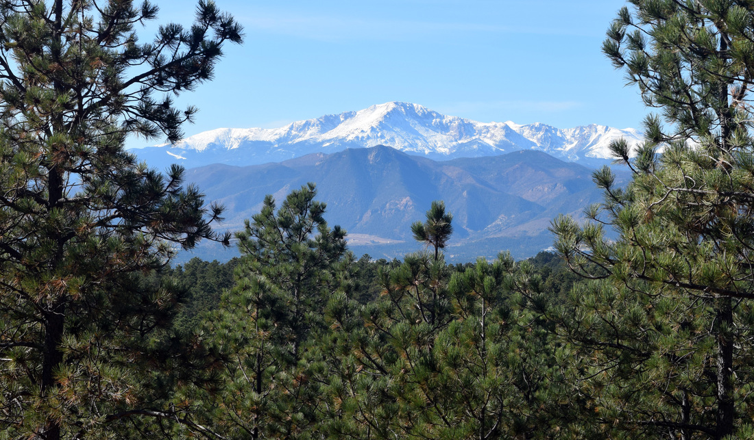
View of Pikes Peak from Black Forest Section 16
|
|
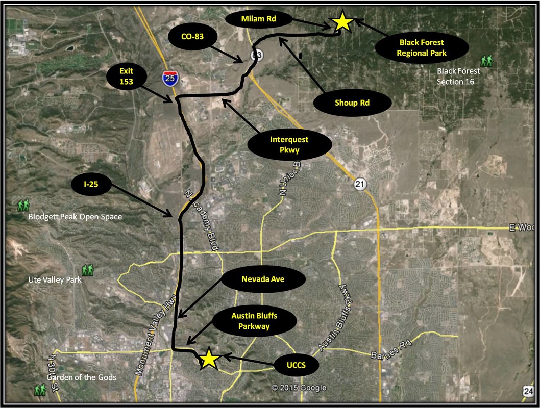
Driving Directions:
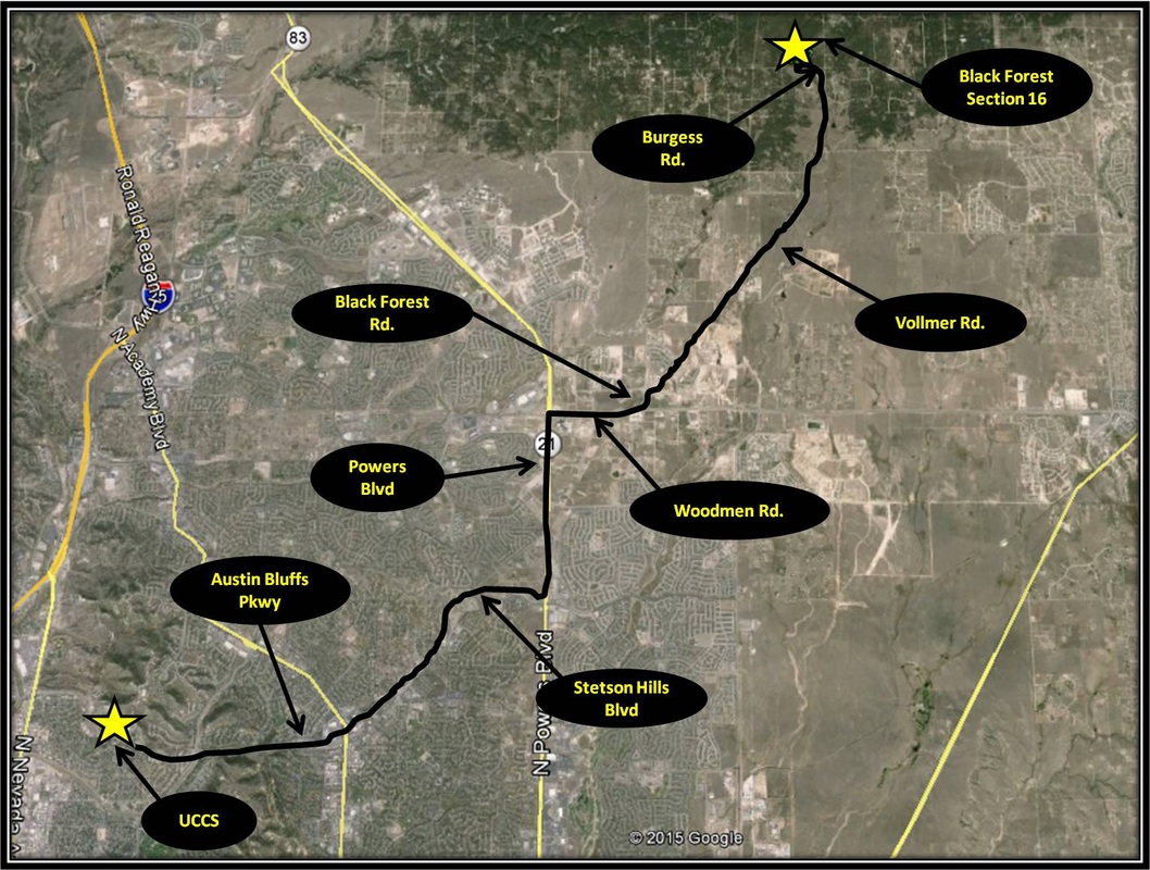
From, UCCS, turn left onto Austin Bluffs Parkway. Stay on Austin Bluffs Parkway for about 4.5 miles. Then turn right onto Stetson Hills Blvd and from Stetson Hills Blvd turn left onto Powers Blvd. From Powers Blvd, turn right merging onto Wodmen Rd headed east toward Falcon. From Woodmen Rd, turn left onto Black Forest Rd. Almost immediately after turning onto Black Forest Rd, turn right onto Vollmer Rd.. Stay on Vollmer Rd for about 4.5 miles and then turn left onto Burgess Rd. The parking area will be the immediate right after turning onto Burgess Rd, about 0.3 miles from the turn from Vollmer Rd. A sign for Section 16 marks the turn into the parking area. There is ample parking, including for horse trailers, but like most spots in Colorado the weekends can be very popular for getting outside. Driving directions to Black Forest Section 16 using Google Maps is linked here. |
Black Forest Regional Park
|
Distance: Varies, but not long
Like Fox Run and Black Forest Section 16, the 385 acre Black Forest Regional Park is located in the Black Forest, on the periphery of Colorado Springs in northeastern El Paso County in the midst of an immense ponderosa-pine forest. Black Forest Regional Park is described as the "Son of Fox Run Park" by Zoltan Molacsay in his perennial trail guide, Trails Guide: Denver to Pikes Peak because of the close similarities between the two. In addition to being located in the Black Forest, both parks have recreation and picnic facilities, along with multi-use trails that can be made into a short hike of easy level, likely under five miles. Unlike the two nearby parks mentioned above, Black Forest Regional Park's forest was greatly effected by the 2013 Black Forest Fire, with most of the damage done to the park's interior. Many of the park's trails venture through large swaths of charred, tree-trunk tombstones. The burned remains have been cut back from the trails to minimize the risk of being struck by a falling tree. For those seeking a pleasant, short hike, Black Forest Regional Park has three main trails with directional arrows marking their course. Each trail is a loop and are differentiated by the colors white, orange, and yellow. The white trail has trailheads located at the park's main entrance, as well as at the large parking area set aside for horse-trailers. I recommend starting from the horse-trailer parking area to increase the length of the short, three to four mile hike incorporating the three loops as described by the Black Forest Trails Association linked below. The White, Orange, and Yellow Trails all link up together near a wooden, inclement-weather shack. The Orange Trail is pretty straightforward as far as navigation goes but the trail does come to an intersection with the Cathedral Pines' Pikes Peak Loop near a memorial bench, before bending back to the inclement-weather shelter. The Pikes Peak Loop is a 4.8 mile trail that wraps around the Cathedral Pines Community and is a mix of publicly and privately-owned land. The Yellow Trail is accessible by both the Orange and White Trail and crosses Milam Rd, near intersections with both trails. The park's trails can be hard to differentiate and the sandy, acidic soil allows for the quick creation of social trails, so navigation will certainly at moments be intuitive. That intuition might be aided by traveling the trails widdershins from the horse-trailer parking area. .The three main trails are marked with signs on trees. There are also signs marking a cross-country ski route. In addition to foot traffic, bicycling and horse-back riding are welcome at Black Forest Regional Park. Further Information on the park is linked below. Further Links: El Paso County, Co: Black Forest Regional Park Black Forest Trails Association: Black Forest Regional Park Black Forest Regional Park Master Plan 2011 |
Above image links to further images of the Park
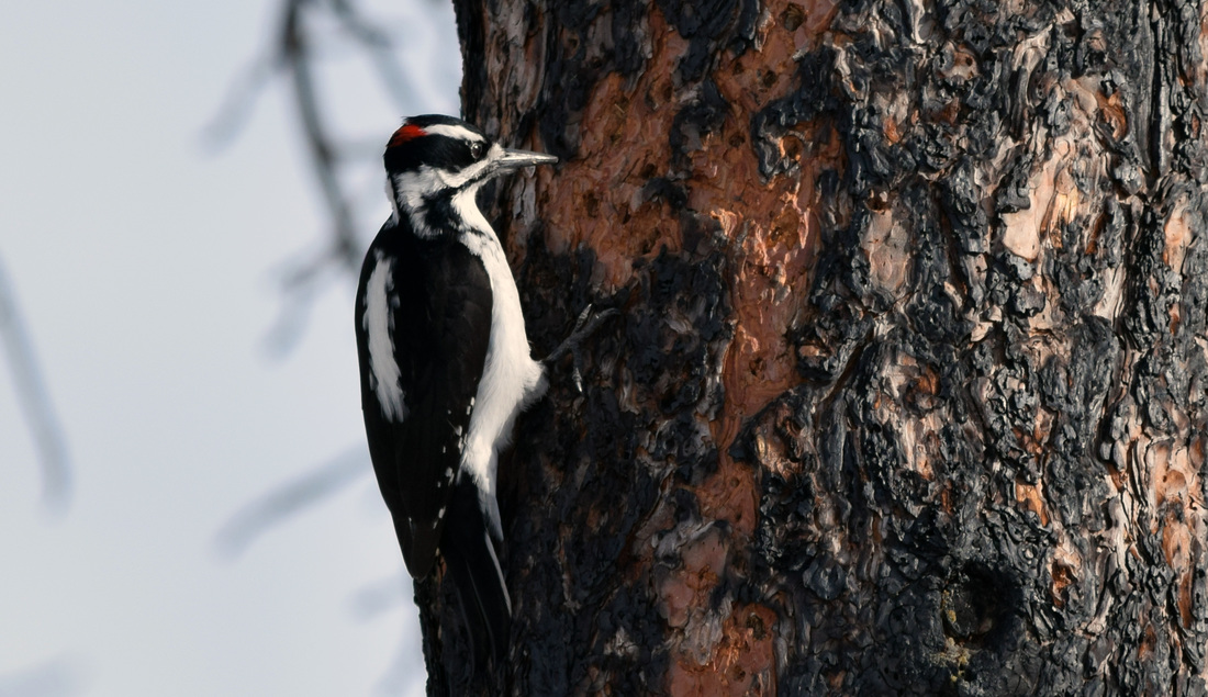
Hairy Woodpecker seeking food on a dead Pondersa
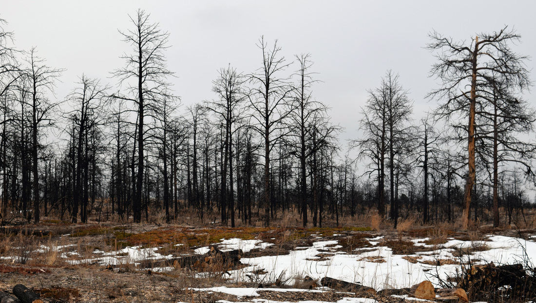
Black Forest Regional Park was badly burned from the 2013 Black Forest Fire
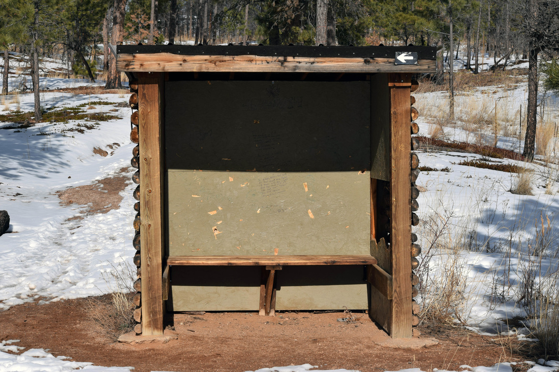
Inclement Weather Shelter located at nexus of the White, Orange, & Yellow Trails
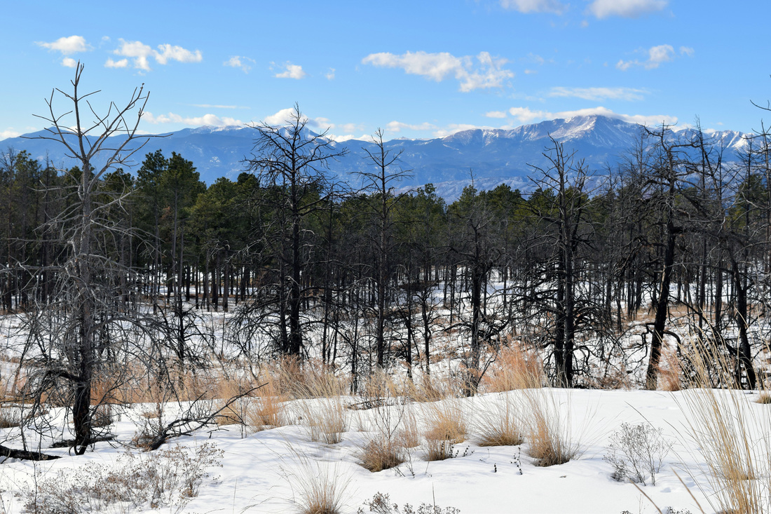
View of Pikes Peak from the White Trail
|
|
Driving Directions:
Black Forest Regional Park is located approximately 13 miles from UCCS. To get there from UCCS, turn right onto Austin Bluffs Pkwy and then turn right onto Nevada Ave. From Nevada Ave merge onto I-25 headed north. Stay on I-25 for approximately 5.5 miles and then take Exit 153. From Exit 153, merge right onto Interquest Pkwy and stay on Interquest Pkwy as it turns into Co-83. Then turn right onto Shoup Rd from CO-83. Stay on Shoup Rd for about 2.2 miles and then turn left onto Milam Rd. Almost immediately after turning left onto Milam Rd, turn right into the large parking area. The main entrance to the park is located a little further up on the right. The large parking area before the main entrance is also for horse-trailer parking. Vault toilets and parking are located at the main entrance, but for those looking to walk the park's trail system, I recommend beginning from the horse-trailer parking area. Driving directions to Black Forest Regional Park using Google maps is linked here. |
Fox Run Regional Park
|
Distance: Varies, but approximately 4 - 5 miles of trails
The 417 acre Fox Run Regional Park is located in the Black Forest on the eastern outskirts of Monument. The park has approximately four to five miles of hiking trails that wander beneath the shade of a dense ponderosa pine forest. The canopy does open to a vista of Pikes Peak near the park's ponds, otherwise any hike along the park's trails will be through forest. All of the park's trails are rated as easy, but Fox Run's western portion is more hilly than its northern region. Beginning from the trailhead located off of Roller Coaster Rd, the trails can make for a nice three to 3.5 mile loop following Fox Run's boundary. I recommend cutting back into the interior when approaching the northwestern corner of the park to avoid where the boundary trail follows the fence-line of a residential area very closely. Trails are not well-identified but they are marked well. Diamond-shaped, reflective blazes have been placed on trees to mark the trail and most major intersections have signs with park maps. There are also many informative signs located along the park's trails. These signs describe the ecology of the ponderosa pine forest. In addition to foot traffic, bicycling and horse-back riding are also welcome on Fox Run's trails. The southwestern portion of Fox Run is where the park has been built up, to include: two beautifully landscaped ponds, a wedding gazebo, picnic areas, playgrounds, pavilions and a volleyball court. Additionally, Fox Run Regional Park is dog-friendly, having an off-leash area, as well as another area set aside for small dogs. Further information on Fox Run is linked below. Further Links: El Paso County Parks: Fox Run Regional Park Fox Run Regional Park Map pdf Black Forest Trails Association: Fox Run Regional Park |
Above images links to further images of Fox Run Regional Park
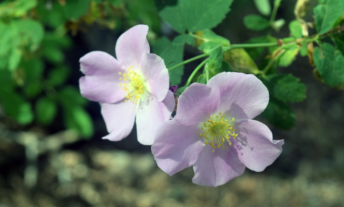
Wild Roses bloom in the acidic soils of the Black Forest at Fox Run Regional Park
View from Fallen Timbers Overlook
|
|
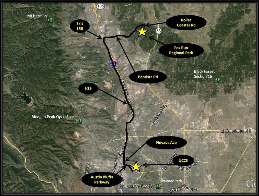
Driving Directions:
From UCCS, turn right onto Austin Bluffs Pkwy and from Austin Bluffs Pkwy, turn right onto Nevada Ave. From Nevada Ave, merge onto I-25 headed north toward the community of Monument. Stay on I-25 for about 10 miles and then take Exit 158 for Baptiste Rd. Turn right onto Baptiste Rd and stay on Baptiste Rd for 3.9 miles. At the stop sign turn right onto Roller Coaster Rd. Parking for the trailhead will be on the right 0.2 miles later. There is plenty of parking located at the trailhead off of Roller Coaster Rd. Vault toilets are located at the trailhead, as well as a few picnic tables. Driving Directions using Google Maps is linked here. |
