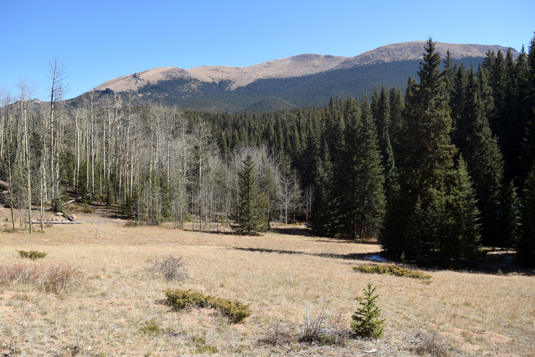
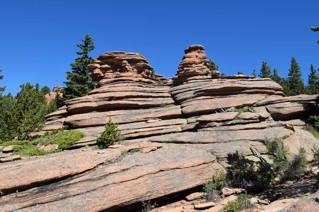
The Crags
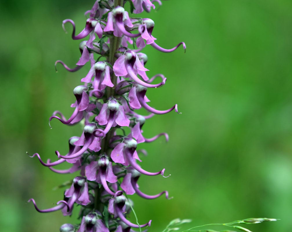
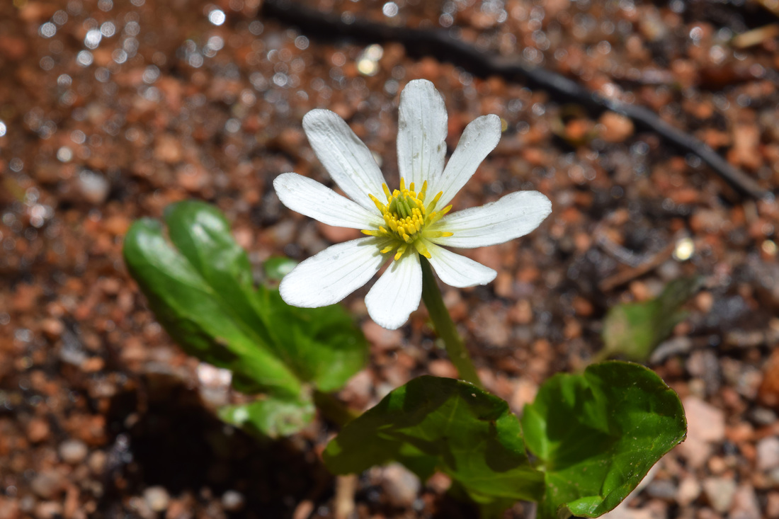
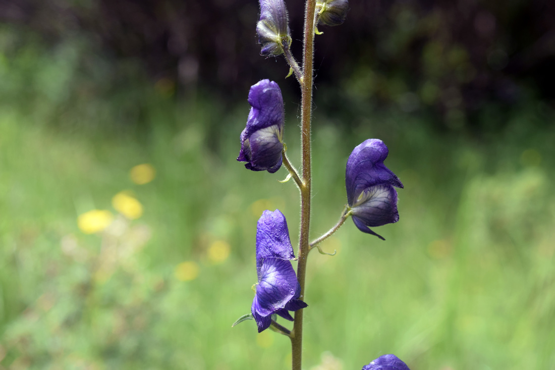 Monkshood blooms in the meadows close to the Crags Trail
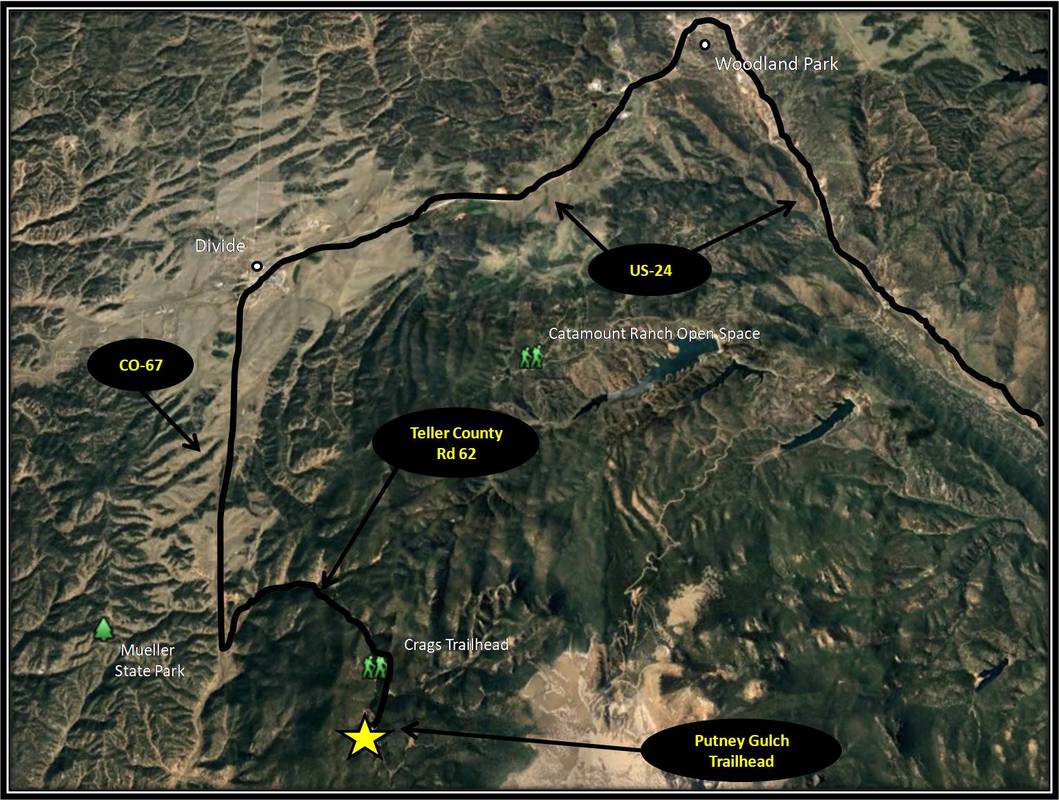
The trails described in this section are located within the mountainous topography of Pikes Peak's western slope in Pike National Forest, between Victor and US-24. Some of these trails rank among the area's best-loved hikes, in particular the Crags Trail and Pancake Rocks.
From the Crags Trailhead, the Devils Playground Trail leads to the summit of Pikes Peak, one of Colorado's 14ers. The Ring the Peak trail also ventures through this area having just passed through the North Slope Recreation Area.
Most of the trails, but not all of them, begin from different points along Teller County Road 62, including Raspberry Mountain Trail, Puntney Gulch Trail, the Devils Playground Trail and the Crags Trail.
The Crags Campground is also located off of Teller County Rd 62, just a little further up from the Crags and Devils Playground Trailhead. The national forest campground has 17 campsites that can accommodate up to the size of a small trailer or small RV. There are no sewage and electrical hookups. Crags Campground is first come - first serve and there is a fee to use the camp site. It is also possible to camp for free along Teller County Rd 62 as it ventures through national forest.
Descriptions for the Crags Trail, Putney Gulch Trail to Anne Marie Falls and Horsethief Park Trail to Pancake Rocks and Horsethief Falls are located below. Driving directions are found below each trail description.
Further Online Resources:
Pike National Forest: Crags Campground
Colorado Springs Gazette: Rough it for Free in the Hills by R. Scott Rappold
The Crags Trail
|
Distance: Approximately 5 miles total
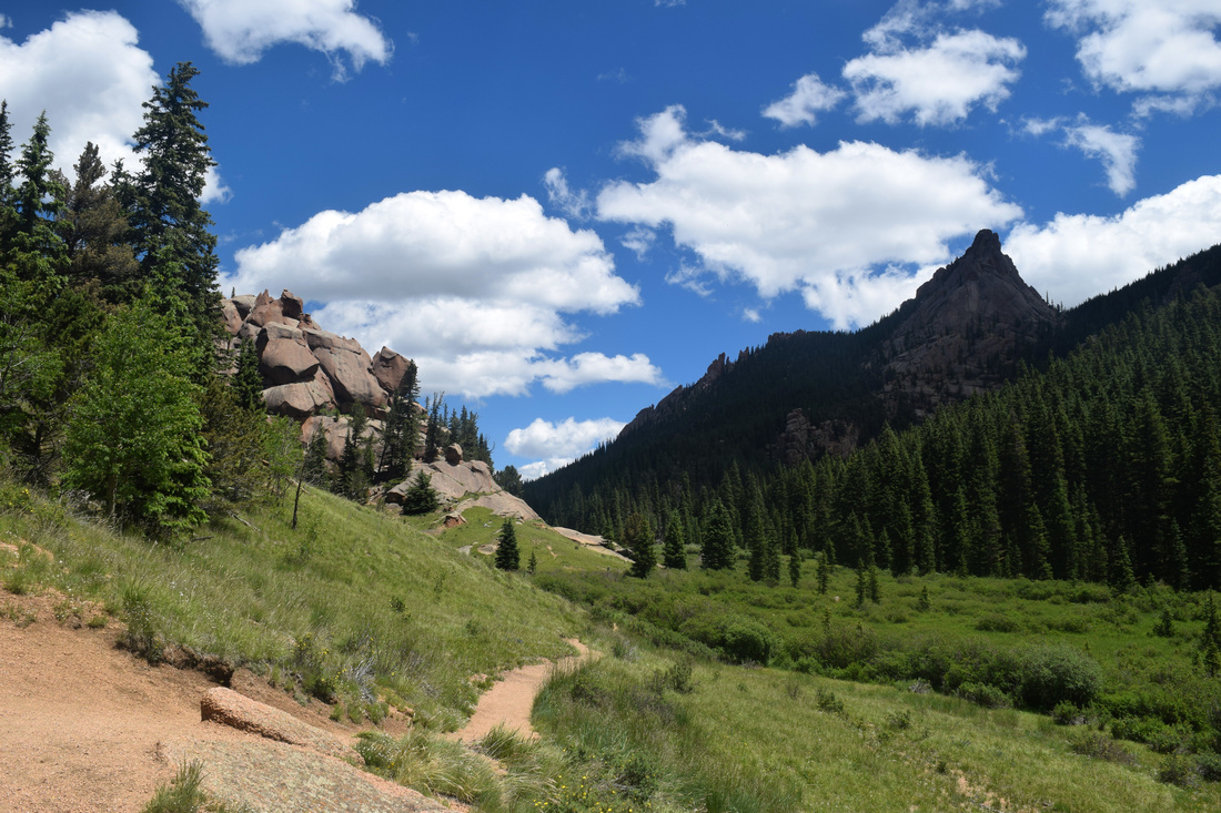
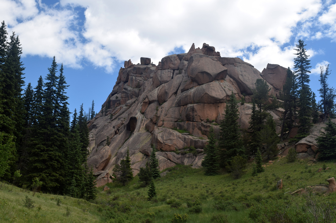
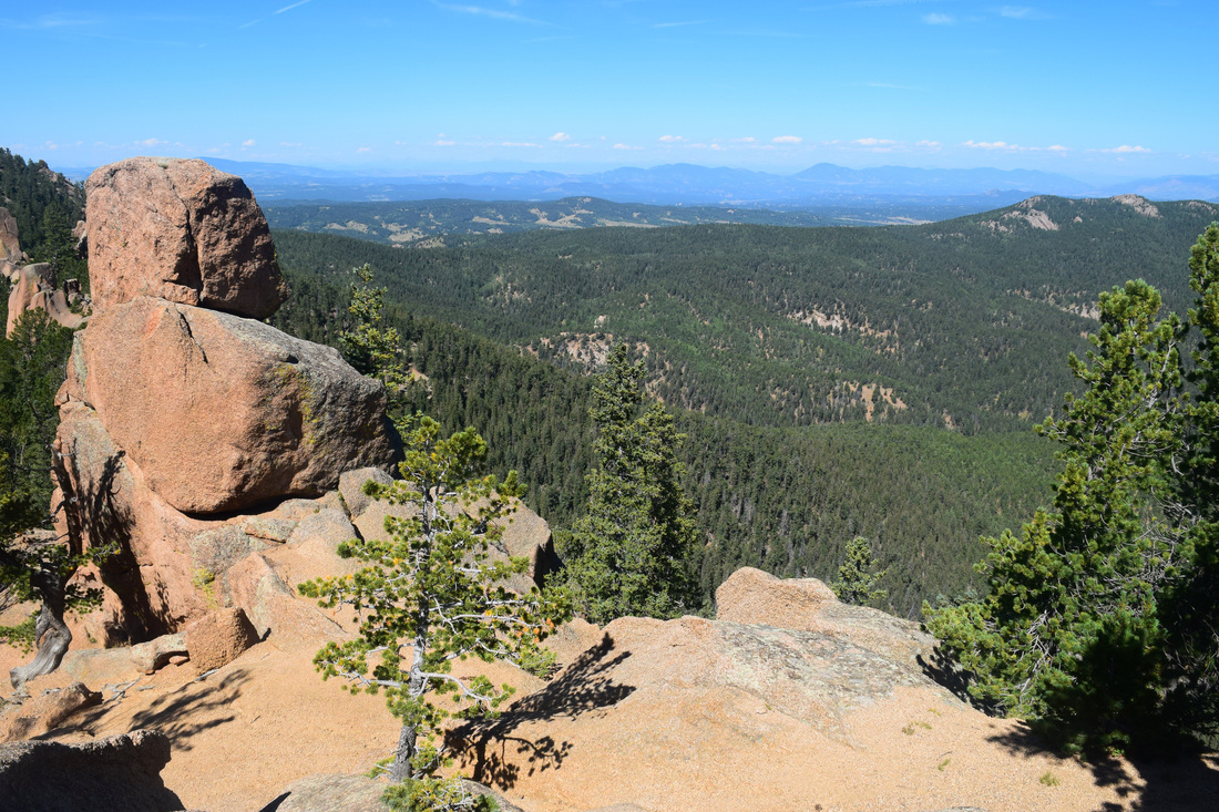
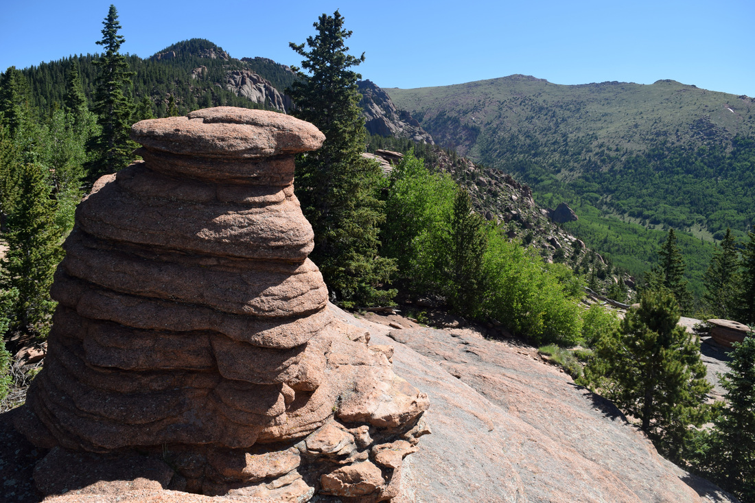
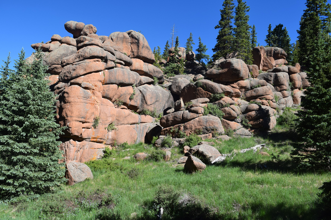
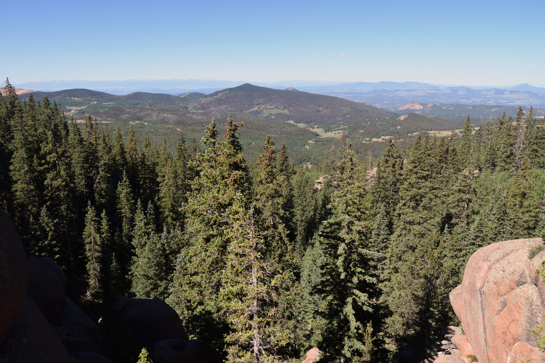
With abundant summer wildflowers and epic views from its 10,800 ft summit, the Crags is among the region's most popular hikes. The striking terrain easily lives up to its reputation and can not be recommended highly enough. This there and back again hike starts near the vault toilet, crossing Four-Mile Creek by bridge, then switch-backing up the densely-forested hillside, climbing above Crags Campground. The uphill is sudden but brief as the trail levels out and then begins to casually descend back toward the creek. Nearing the creek, the path forks, with the Devils Playground Trail veering right and crossing the creek by narrow wooden bridge. The Devils Playground Trail leads to Pikes Peak's summit and is numerically identified by the Forest Service as #753, but a sign at the intersection identifies the trail also as #664A. Turn right, continuing along the Crags Trail, numerically identified by the Forestry Service as #664. From here the route follows the creek through a gorgeous valley surrounded by jagged peaks and monoliths made of Pikes Peak granite. Through the valley, spruce and other conifers intersect open meadows ablaze with Shrubby Cinquefoil, Prairie Smoke, Elephant Head, Monkshood, and many other wildflowers. Under a dense evergreen canopy, the trail begins to climb the mountainside, coming to a saddle. In the saddle, the trail sharply curves left, steeply climbing out of the forest to the Crags' summit at 10,800 ft. After enjoying the incredible perspectives, the way back is the way you came, about 2.5 miles back to the Crag Trail's start point. As a there and back again hike, the total distance hiked is approximately five miles total. Distance is based on information detailed in the trail guide Best Hikes Near Colorado Springs written by Stewart M. Green. Reliable online resources differ on the distance, including the Pike National Forest website which describes the hike as 2.1 miles one-way, or 4.2 miles total. The Crags Trail is mostly easy to follow; although the path can be easy to lose during the last, steep climb up to the summit. The way up is also slick from eroded loose gravel. Except at the start and the climb up to the summit, most of the hike is as close to level as one could imagine considering the mountainous terrain. Given these factors, the Crags Trail is rated as moderate. Further information on the hike, including driving directions, are linked and described below. Further Online Resources: Pike National Forest (fs.usda.gov): Crags Trail #664 Visit Colorado Springs: The Crags Trail On Walkabout On: The Crags Trail, Colorado by Dobbs |
Above image links to further images of the Hike
Along the Crags Trail
View from near the Crags summit
View from the Crags
|

|
Driving Directions:
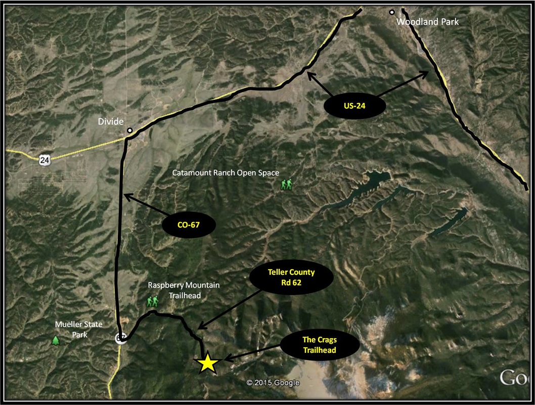
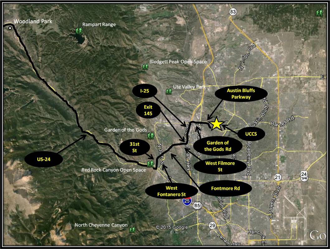
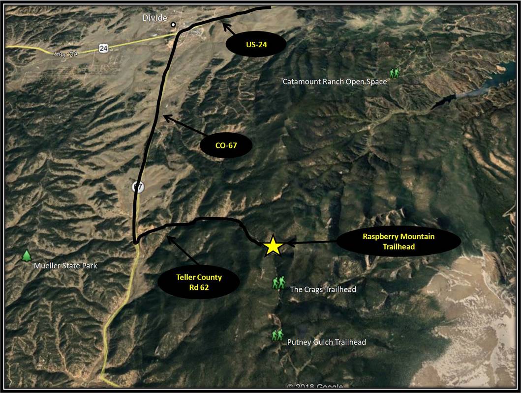
From UCCS, turn right onto Austin Bluffs Pkwy and stay on Austin Bluffs Pkwy as it turn into Garden of the Gods Rd. From Garden of the Gods Rd, turn left onto I-25 headed south. Shortly after merging onto I-25, take Exit 145 for West Filmore St. Turn right onto West Filmore St and stay on it as it turns into Fontmore Rd and then West Fontanero St. From West Fontanero St, turn left onto 31st St and from 31st St, turn right onto US-24. Stay on US-24 for about 22.3 miles, passing through the town of Woodland Park. In Divide, turn left onto CO-67. Stay on CO-67 for about 4.3 miles and then turn left onto Teller County Rd 62. A Crags Campground sign marks the left turn from CO-67. Stay on Teller County Rd 62 for about 3.2 miles, passing through the Rocky Mountain Mennonite Camp and coming to the Crags Trailhead not long after.. Teller County Rd 62 is an often-used, narrow dirt road that is bumpy but usually manageable for most cars. Parking will be on the right behind a fence. There is a lot of space for parking, but the Crags is very popular and it is not uncommon to find oneself looking for a spot to pull-off nearby. Vault toilets are located near the trailhead and the parking area. Driving directions to the Crags Trail's start point using Google Maps is linked here. |
Raspberry Mountain (Ring the Peak)
|
Distance: Approximately 4.8 miles total, 2.4 miles one-way
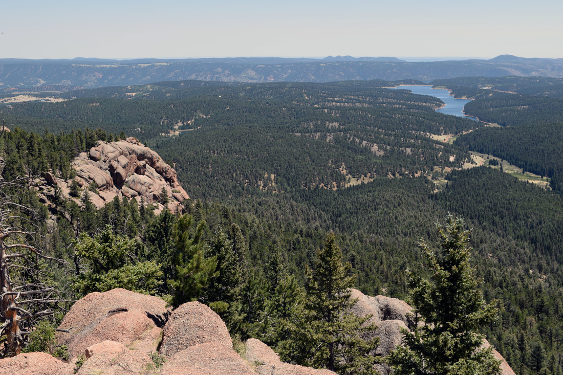
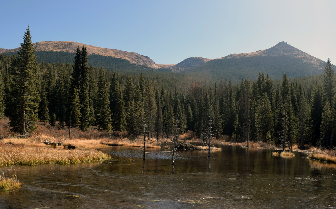
The hike to Raspberry Mountain described here begins from County Road 62 at the Raspberry Mountain Trailhead for the Ring the Peak Trail. The Raspberry Mountain Trailhead is located near the Crags Campground. From the Raspberry Mountain Trailhead, the trail crosses over a bridge before steadily switch-backing up the hillside. The trail then descends and climbs a couple of times before coming to a fork in the trail. Turn right. Red Ring the Peak trail signs mark the right turn. Not far past the right turn, the forest gives way temporarily to a valley, with the trail closely skirting the side of a hill. The trail cuts back into forest before reaching the turn-off to Raspberry Mountain. The turn is well-,marked by a trail sign. From here the way gets steep. At the top of a ridge, the trail comes to a fork. A sign marks turn right. From here the trail descends down into a saddle before steeply climbing to Raspberry Mountain's 10, 605 ft pinnacle. Be aware the trail can be easy to lose on the way up to the top of Raspberry Mountain and on the way back down. Also, there is some likely climbing / rock scrambling at the top of Raspberry Mountain, but nothing too difficult. Once you've enjoyed the incredible panorama offered by Raspberry Mountain, the way back is the way you came making for an approximate hike of 4.8 miles total. Distance is based information found on the Friends of the Peak website. Alltrails.com and Colorado Springs Trails and Hiking describe the hike as being 4.6 miles total. The hike to Raspberry Mountain is pretty well-marked; although the outline of the trail does fade in and out along the last jaunt to the top. The Ring the Peak portion of the hike is very reasonable in how it approaches inclines, but the trail leading up to Raspberry Mountain can be ruthlessly steep in a couple of spots. Given these factors, this hike is rated as moderately-easy. Further Online Resources: Alltrails.com: Raspberry Mountain via Ring the Peak Trail COSpringstrails.com: Raspberry Mountain Friends of the Peak: Raspberry Mountain |
Above image links to further images of the Hike
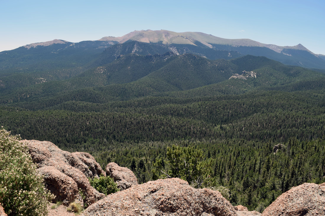
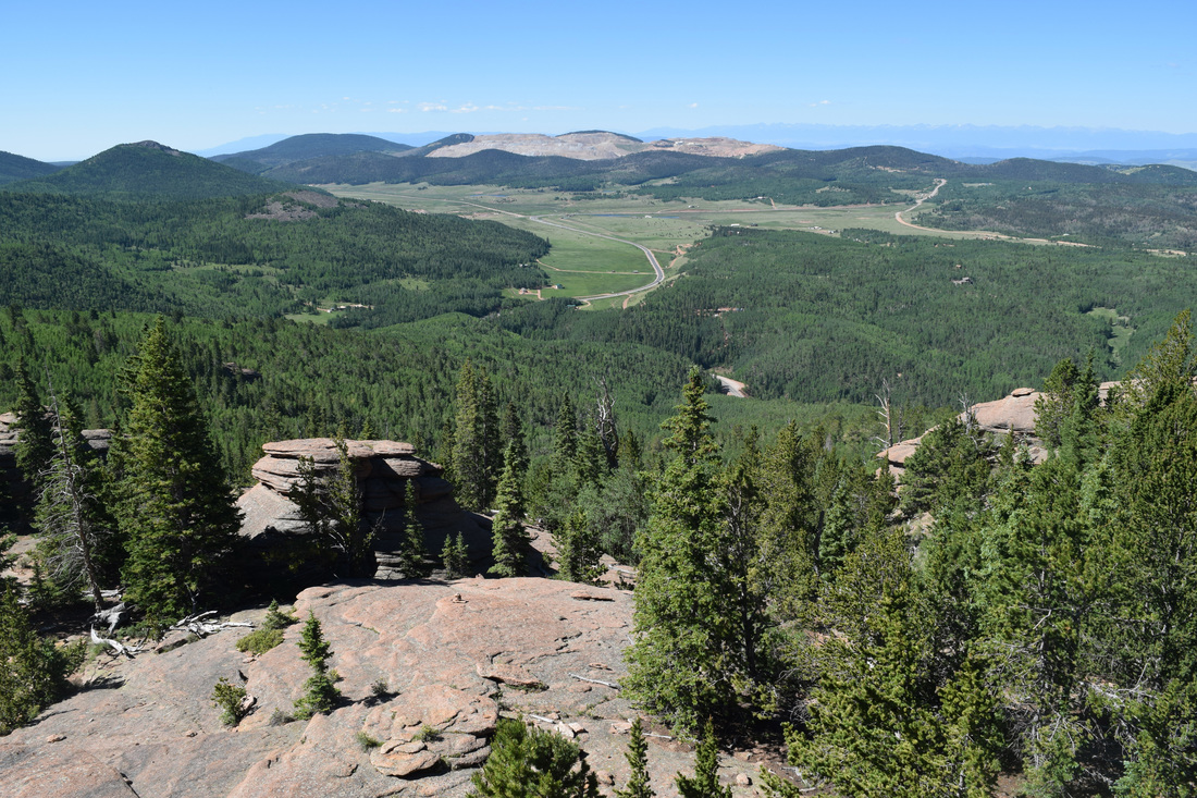
View of Pikes Peak from Raspberry Mountain
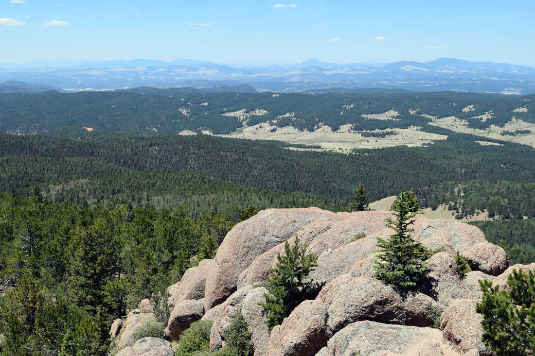
View from Raspberry Mountain
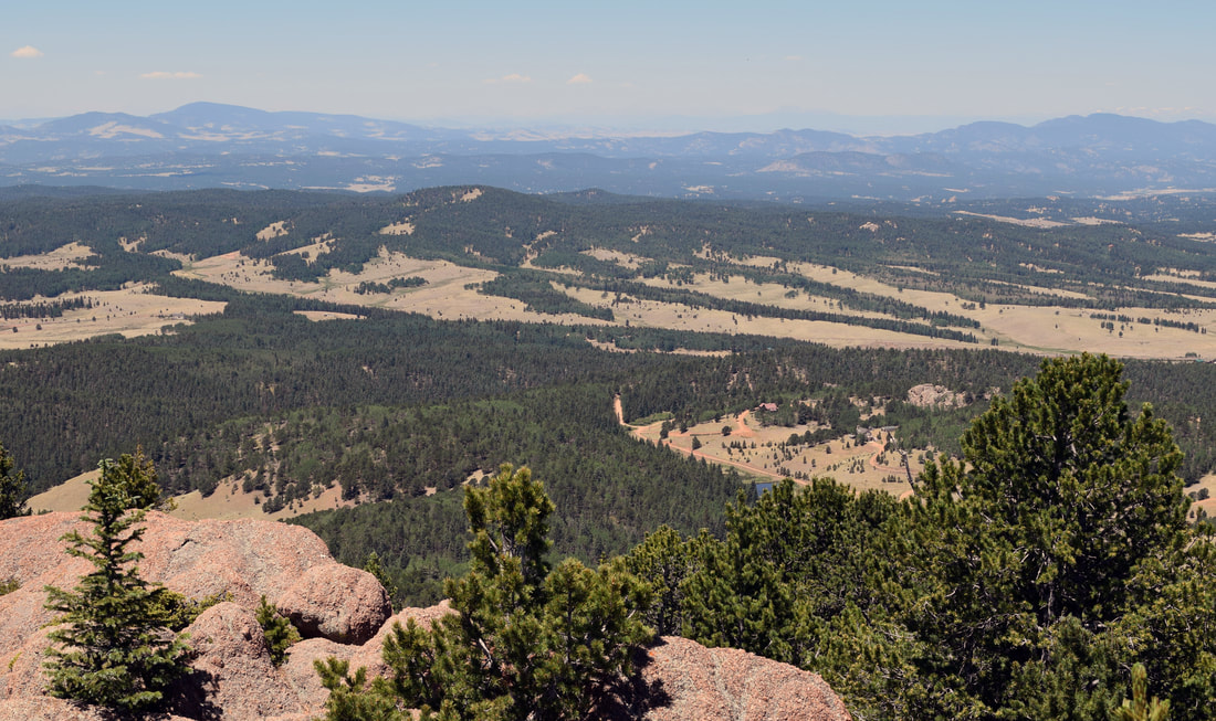
View from Raspberry Mountain
|
|
Driving Directions:
From UCCS, turn right onto Austin Bluffs Pkwy and stay on Austin Bluffs Pkwy as it turn into Garden of the Gods Rd. From Garden of the Gods Rd, turn left onto I-25 headed south. Shortly after merging onto I-25, take Exit 145 for West Filmore St. Turn right onto West Filmore St and stay on it as it turns into Fontmore Rd and then West Fontanero St. From West Fontanero St, turn left onto 31st St and from 31st St, turn right onto US-24. Stay on US-24 for about 22.3 miles, passing through the town of Woodland Park. In Divide, turn left onto CO-67. Stay on CO-67 for about 4.3 miles and then turn left onto Teller County Rd 62. Follow Teller County Road 62 for about 2.5 miles. The Raspberry Mountain Trailhead will be on the left. There is a reasonable amount of parking space, but the area can fill up quick on a summer weekend. There are no toilets located at the trailhead, but vault toilets are located nearby at the Crags Campground. Driving directions to Raspberry Mountain Trailhead using Google Maps is linked here. |
Putney Gulch Trail to Anne Marie Falls (Ring the Peak)
|
Distance: Approximately 5 miles total, 2.5 miles one-way
The Crags Trail and the trail leading to Raspberry Mountain are two very popular local hiking destinations. Their parking areas fill up quick and are the source of much of County Road 62's traffic and for good reason. The two are beautiful hikes, but their is another beautiful hike beginning from County Road 62. The hike along Putney Gulch Trail is equally as beautiful as the other two hikes, journeying through dank forest and verdant mountain parks, offering outstanding views of Pikes Peak and Sentinel Point, passing by a seasonal waterfall known as Anne Marie, before heading on to Horse Thief Park. The hike described here is a there and back again hike beginning from the Putney Gulch Trailhead and ending at Anne Marie Falls, about the half way point to Horse Thief Park. The distance to the falls is approximately 2.5 miles making for a total of about 5 miles. The trail begins from a park, climbing into forest, switch-backing up to the ridge before winding down into Putney Gulch. Beaver Ponds can be seen in the distance before the trail makes a sharp left, crossing a stream twice and heading back into the shadows of a dense canopy. The trail crosses another stream. Like the other two stream crossings, this one can likely be accomplished without getting your boots wet. Not long after the third stream crossing, the trail will come to another sharp curve marked by 'Ring the Peak' trail signs and a Forestry Service Sign labeled '704'. Behind the '704' Forestry Trail Sign is an old logging road. Follow this old logging road a short distance to reach the base of Anne Marie Falls. After enjoying the falls, the way back is the way you came. Navigation is pretty straightforward, just keep an eye out for Forestry Service Trail Sign '704' after the third stream crossing. The hike is approximately 2.5 miles one-way, or 5 miles total. Distance is based on information read on Alltrails.com and my Mother's hiking group. There is three stream crossing to the waterfall. They all can be accomplished without getting your boots wet, with maybe the exception of the first one. Given these factors this hike is rated as Moderate. Further Online Resources: Friends of Pikes Peak: Putney Gulch Trail Alltrails.com: Putney Gulch to Anne Marie Falls The Colorado Springs Gazette: Putney Gulch to Horse Thief Park |
Above image links to further images of the Hike
Elephanthead Lousewort blooms along Putney Gulch Trail
Beaver Pond in Putney Gulch with Pikes Peak and Sentinel Point in the Background
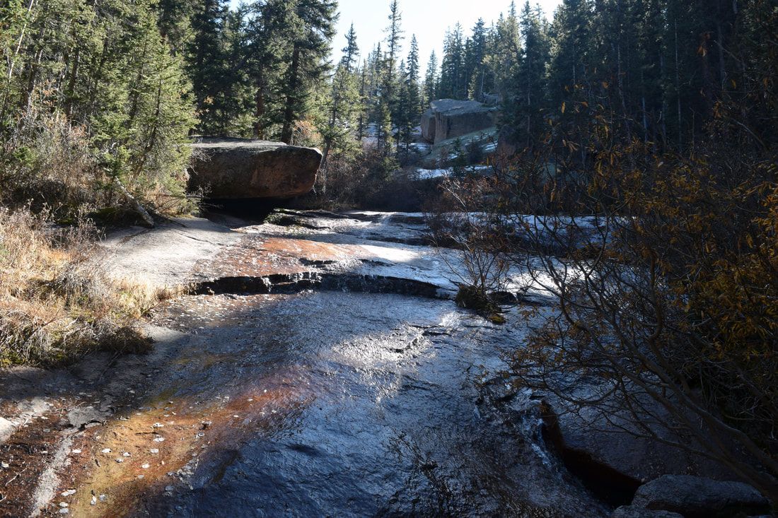
Anne Marie Falls is dependent on the Melt or Recent Rains
|

|
Driving Directions:
From UCCS, turn right onto Austin Bluffs Pkwy and stay on Austin Bluffs Pkwy as it turn into Garden of the Gods Rd. From Garden of the Gods Rd, turn left onto I-25 headed south. Shortly after merging onto I-25, take Exit 145 for West Filmore St. Turn right onto West Filmore St and stay on it as it turns into Fontmore Rd and then West Fontanero St. From West Fontanero St, turn left onto 31st St and from 31st St, turn right onto US-24. Stay on US-24 for about 22.3 miles, passing through the town of Woodland Park. In Divide, turn left onto CO-67. Stay on CO-67 for about 4.3 miles and then turn left onto Teller County Rd 62. A Crags Campground sign marks the left turn from CO-67. Stay on Teller County Rd 62 for about 3.7 miles, passing through the Rocky Mountain Mennonite Camp, the Raspberry Mountain Trailhead and the Crags Campground before coming to a dead end, the parking area for the trailhead for Putney Gulch.. Vault toilets are located at the Crags Trailhead. No latrines are located at the Putney Gulch Trailhead. Driving directions to Putney Gulch Trailhead using Google Maps is linked here. |
HorseThief Park Trail to Pancake Rocks and Horsethief Falls (Ring the Peak)
|
Distance: Approximately 7 miles total
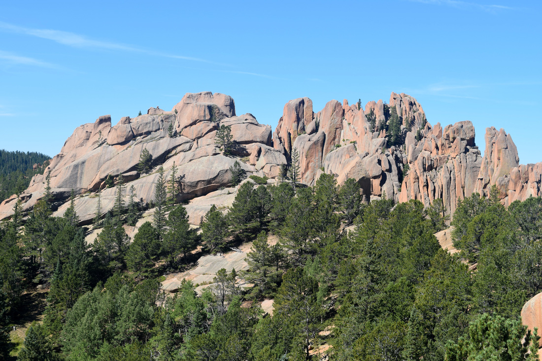
To get to Pancake Rocks from the pull-off parking area located on Highway 67, initially follow Horsethief Park Trail, numerically identified by the Forest Service as trail #704. At first the trail climbs a couple of switchbacks, before steadily ascending toward Horsethief Park under a dense forest canopy. Near Horsethief Park, the trail comes to an intersection marked by a Ring the Peak trail sign. To get to Pancake Rocks continue straight. The left turn leads to the Putney Gulch trailhead and the Crags Campground. From here on, the Ring the Peak Trail adjoins the route to Pancake Rocks. Past the intersection, Horsethief Park Trail parallels the stream through meadow and forest for a short distance before coming to another intersection marked by two signs. As indicated by the rather large wooden sign, turning right, headed up the mountainside leads to Pancake Rocks and continuing straight leads to Horsethief Falls. In his description, Stewart M. Green saves the short hike to Horsethief Falls for after returning from Pancake Rocks. Just be advised, most the cars in the parking lot belong to hikers whose destination is most likely the falls and those seeking a more private experience with the falls are more likely to find that privacy earlier in the day. To get to Pancake Rocks, turn right onto the trail alphanumerically identified as #704a. From here the route ventures up a northern facing slope through dense coniferous forest, eventually switch-backing five times before reaching the ridge. Besides being unforgiving in its uphill, this portion of the hike takes longer than most areas for the snow to melt away. As the trail spits out from the forest's shadow atop the ridge, social-trails cut away to a boulder garden with tree-top views of distant southern ranges. After returning from exploring the boulders, the path passes by a Ring the Peak sign before dipping and climbing to a nearby boulder outcropping offering beautiful, southern panoramic views. Having enjoyed the views, the trail briefly descends into a draw and climbs once again through dense forest. After cresting another ridge, the trail descends into the Pancake Rock formations. The formations are named for their resemblance to stacked pancakes. The Pancake Rock formations also possess many excellent vantages of the surrounding mountainous terrain, which are particularly pleasing when the aspen leaves have turned to gold. As mostly a there and back again hike, the way back is the way you came. Once back at the intersection with the trail leading to Horsethief Falls, turn right headed to the falls located approximately 0.3 miles away according to Stewart M. Green's trail description. The trail sign has it listed as 0.5 miles away. The way is mostly level with one small stream crossing on the way to the falls and maybe another upon reaching the falls. After enjoying the falls, retrace the route back to the intersection with Pancake Rocks and continue straight headed back down to the trailhead and main parking area. The hike to Pancake Rocks is listed as being 3.2 miles one-way, or 6.4 miles round trip. Adding the small trek to Horsethief Falls increases the hike by 0.6 miles, making for a total of seven miles. Distance is based on Stewart Green's excellent trail guide, Best Hikes Near Colorado Springs. Most of the 3.2 miles to Pancake Rocks is uphill and some of this uphill can be mean steep. The way to Pancake Rocks is better marked with signs than many other trails in the region. Given these factors, the hike to Pancake Rocks is rated as moderate. Make sure to check the area's conditions; as a late spring - early summer hike to Pancake Rocks might require winter considerations, like yak tracks. Further information on the hike and driving directions are provided below. Further Online Resources: Pike National Forest: Horsethief Park Trail # 704 Examiner.com: Hiking to Horsethief Falls and Pancake Rocks by Steven Krull Hiking in the Rockies: Horsethief Falls Trail by Josh Friesema |
Above image links to further images of the Hike
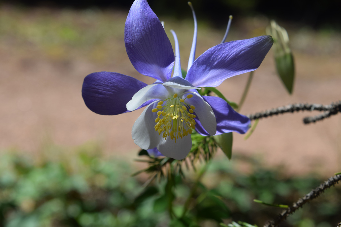
Columbine blooming along Horsethief Park Trail
A vantage from Pancake Rocks
Pancake Rock Formations
Marsh Marigold along the way to Horsethief Falls
Along the way to Pancake Rocks
View along the way to Pancake Rocks
|


|
Driving Directions:
The start point for the hike to Pancake Rocks is located just 37.5 miles away from the UCCS campus. To get there, turn right onto Austin Bluffs Pkwy and stay on Austin Bluffs Pkwy as it turn into Garden of the Gods Rd. From Garden of the Gods Rd, turn left onto I-25 headed south. Shortly after merging onto I-25, take Exit 145 for West Filmore St. Turn right onto West Filmore St and stay on it as it turns into Fontmore Rd and then West Fontanero St. From West Fontanero St, turn left onto 31st St and from 31st St, turn right onto US-24. Stay on US-24 for about 22.3 miles, passing through the town of Woodland Park. In Divide, turn left onto CO-67. Stay on CO-67 for about 9.3 miles. Parking for the trailhead will be on the left and right side of Highway 67 immediately after passing a tunnel. There is a moderate amount of parking, but spots fill up quick during summer. There are no toilets located at the trailhead and parking area. Driving Directions to Pancake Rock's start point using Google Maps is linked here. |
