Paint Mines Interpretive Park
|
Distance: Approximately 3.7 miles total
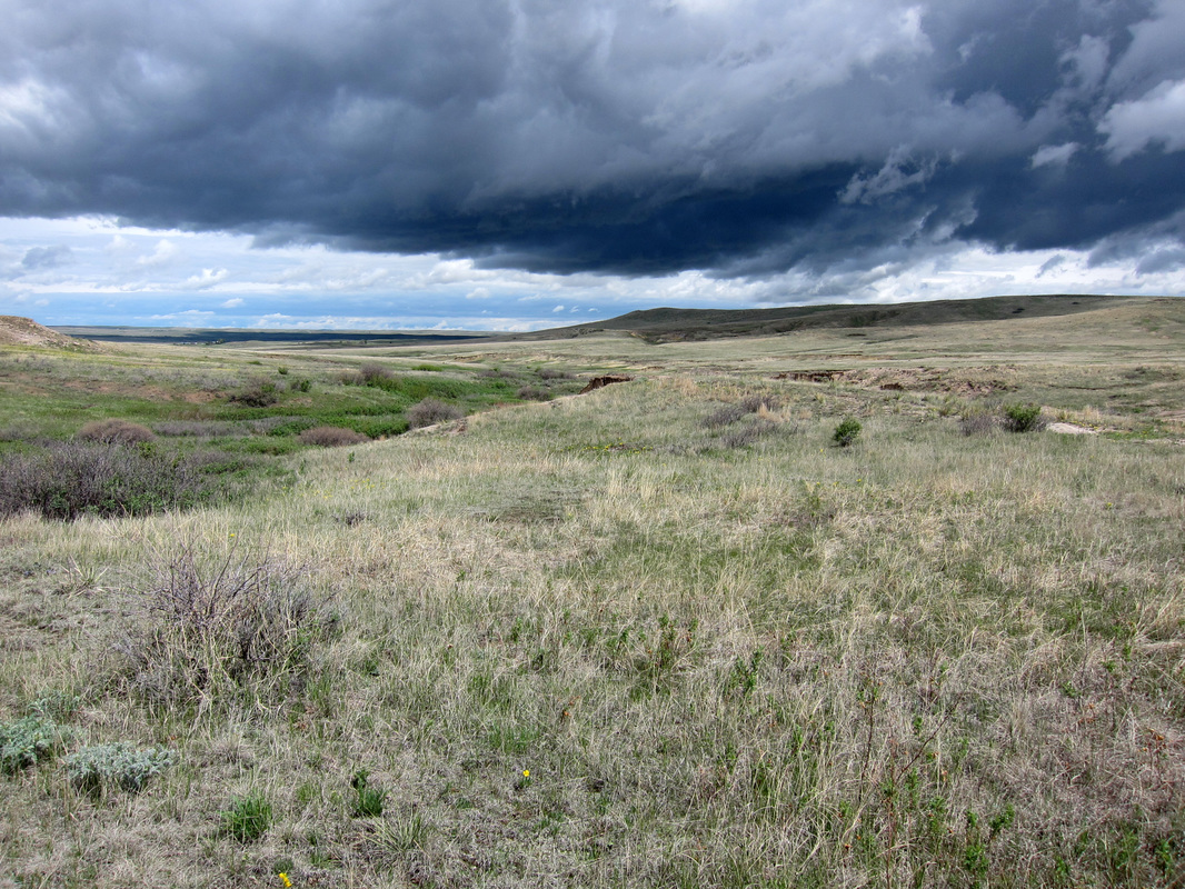
The 750 acre Paint Mines Interpretive Park is located on the outskirts of Calhan, CO in El Paso County. Much of the park consists of beautiful, sloping grasslands. Species like Golden Banner, Foothills Mertensia, and various milkvetches grow in force along the park's trails, creating a pleasing, spring display of yellows, purples, whites, and blues. Black-eared Jackrabbits, Pronghorn Antelope and Mule Deer are among the frequent wildlife visitors to the park., including many birds, like the Western Meadowlark and Swainson's Hawk. The grassland's beauty is reason enough to hike the park's trails; however the prairie ecology is far from the only reason to experience the Paint Mines. The park is home to badlands of astonishing design and hue. Sculpted by erosion, the striking and vivid landscape known as the Paint Mines is among Colorado's most unique terrains, with only a few other locations possessing similar qualities to be found within the state's boundaries. Paint Mines Interpretive Park has about 4 miles of hiking trails. These trails can be combined to make an approximate 3.7 mile figure-eight loop hike starting from the park's main parking area. Not far past the trailhead, the path comes to an intersection. The right turn is the quick way to the formations. Stay straight headed downhill at a slight incline. The Paint Mines Trail will cut sharply right following a dry stream bed, after passing by a sign describing the park's ecology. The trail rut can get confused through the gulley, so trail signs are interspersed to ease navigation. The trail passes by another sign describing the prehistory of human activity dating back an estimated 9,000 years ago. The vibrant, exposed clay has been attracting the creativity of artisans for a very long time.. About 1.1 miles from the hike's beginning, the trail comes to another intersection. Continuing straight leads to the nearby Paint Mine formations. The right turn heads back to the main parking area. Turn left, as the path briefly curves up a hill and then levels out as the route veers left, passing by an exposed gulley. Just past the gulley, the trail sharply cuts up and over the gulley, headed up toward a metal bench with pretty views of the plains. About 1.2 miles from the last intersection, the trail comes to another fork. A trail sign notates, the way straight leads to the park's other parking area. Turn right following the trail another 0.6 miles before coming to another intersection of trails. A sign where the trails intersect notates the fragility of the nearby Paint Mine's uncanny ecology and the extra care requested of each visitor in exploring the area's beauty by staying on designated trails, leaving no trace, and taking nothing but experience and maybe a photo or two. From this intersection, turn right into the surreal heart of the park. A sign on the Paint Mines' geology has been placed near the turn. Having explored the area and returned to the last intersection, continue straight, through the gulley. Capillaries trail off to further perspectives of the barrens before shortly reaching the intersection originally crossed about 2.2 miles earlier. Head left, as the path briefly switchbacks at a fairly steep ascent, cresting near another metal bench with a pretty view of the plains. Past the bench, the trail descends down to the first intersection. At this intersection, turn left toward the nearby parking area and the end of the hike. This hike is approximately 3.7 miles total. This figure is based on adding up the distances on the park map and on the trail guide Best Easy Day Hikes: Colorado Springs by Stewart M. Green and Tracy Salcado-Choure. There is some uphill to consider, but not much. Most of the uphill is reasonable with the steepest climb coming near the end of the hike, after visiting the park's painted badlands. The trails are well-marked with a variety of different signs making navigation pretty straightforward, even when the trail rut can be confused by run-off paths. Given the distance, navigation, and uphill, the hike described here is rated as easy. Dogs, other pets, bicycles, and horseback riding are not permitted at the Paint Mines to help preserve the park's unique ecology. Further Online Resources: El Paso County, CO: Paint Mines Interpretive Park Paint Mines Interpretive Park Map PDF HistoryColorado.org: Calhan Paint Mines Awayfromthegrind.com: Paint Mines Interpretive Park by Roselyn Ludwig |
Above image links to further images of hike
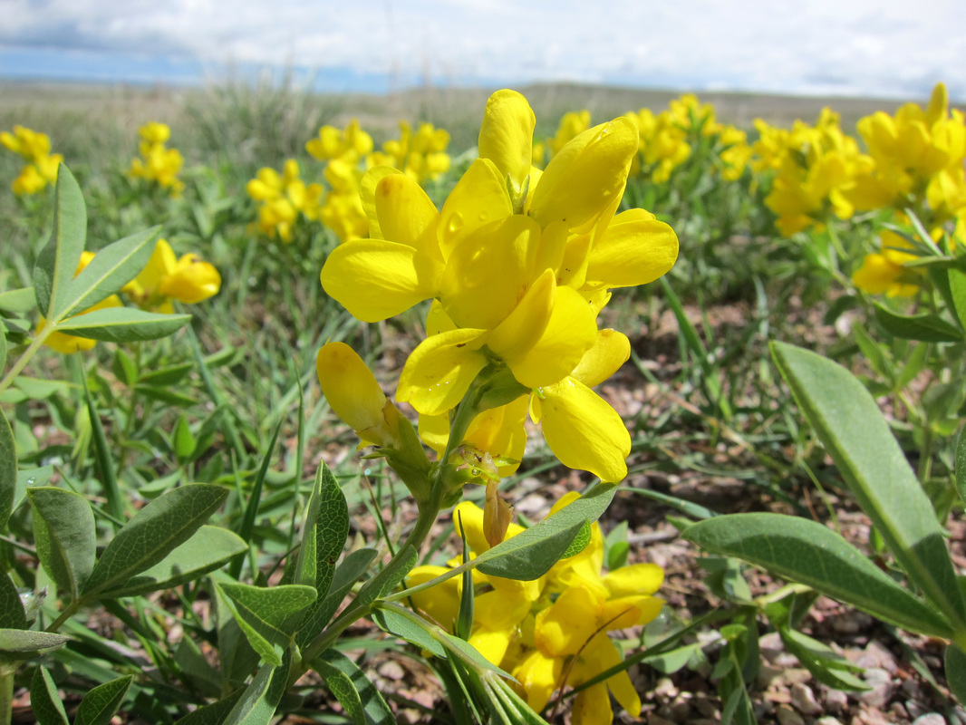
Golden Banner is a sea of yellow during spring at the Paint Mines
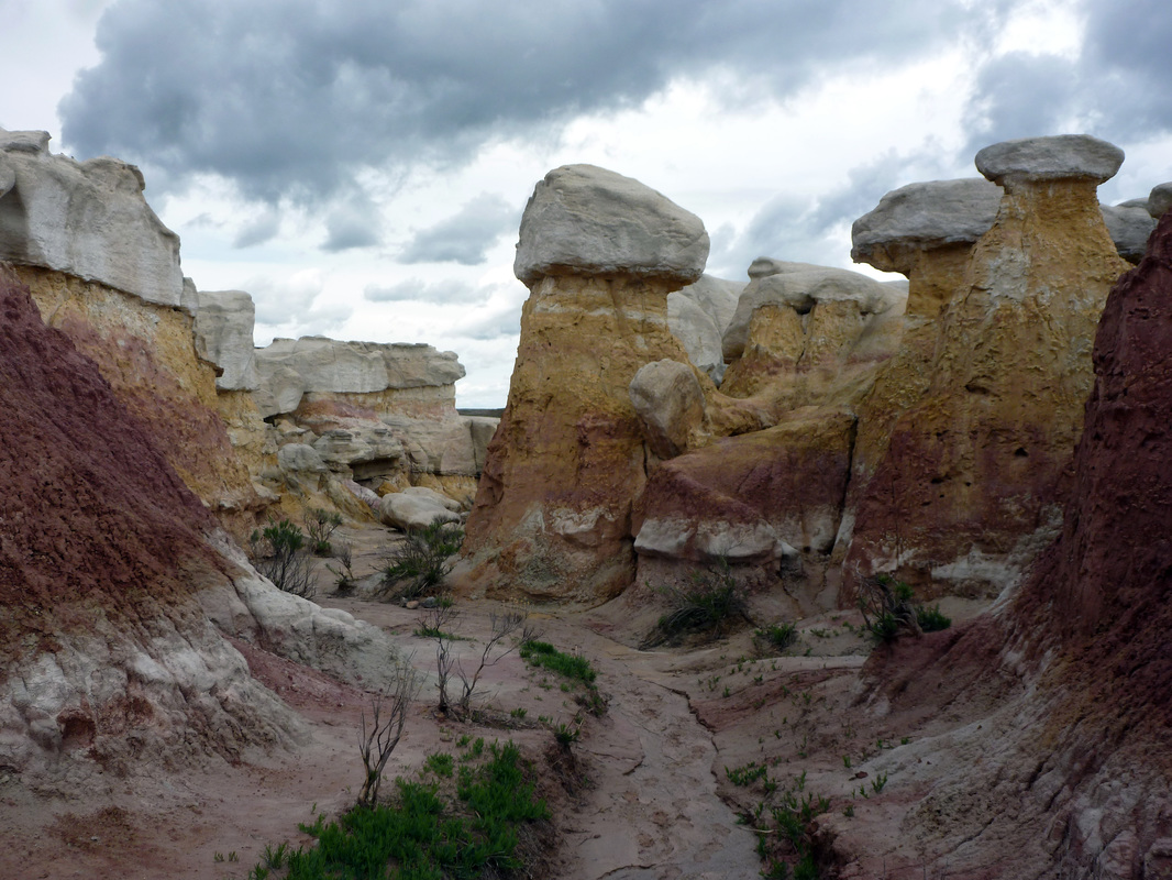
The uncanny environ of the Paint Mines
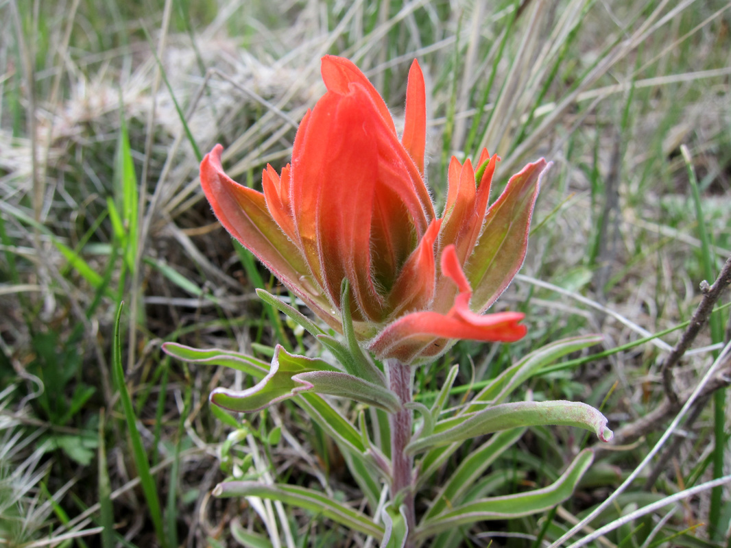
Foothills Paintbrush blooms along Paint Mines Trail
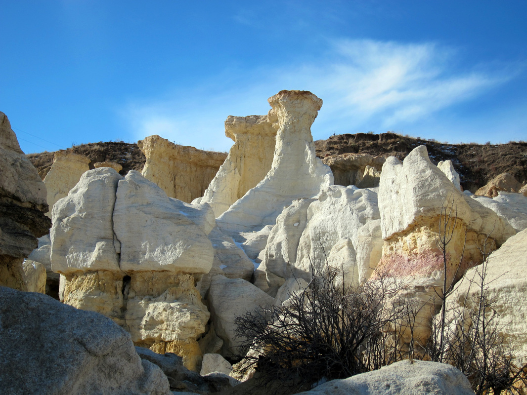
Hoodoos & spires found within the Paint Mines
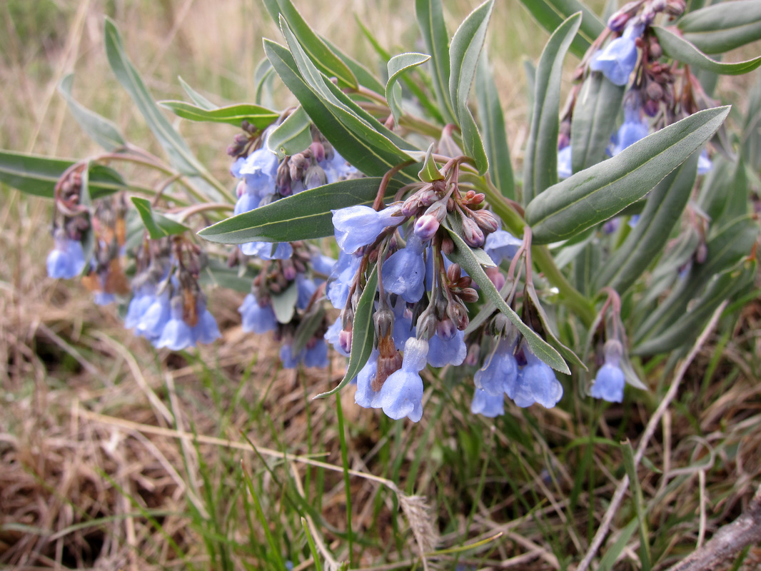
Foothills Mertensia blooms along Paint Mines Trail
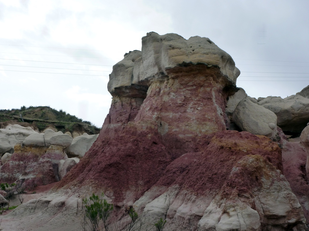
One of many striking formations found at the Paint Mines
|
|
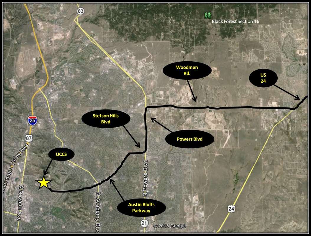
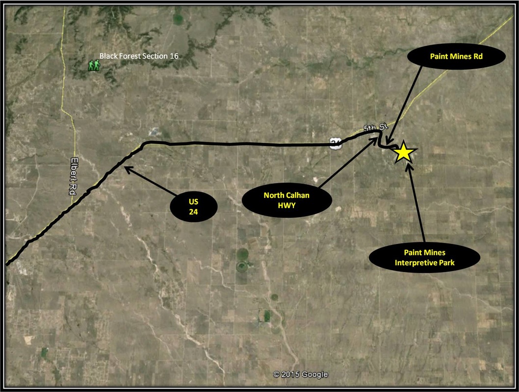
Driving Directions:
From UCCS, turn left onto Austin Bluffs Parkway. From Austin Bluffs Parkway, turn right onto Stetson Hills Blvd. Turn left onto Powers Blvd from Stetson Hills Blvd. From Powers Blvd, turn right onto Woodmen Rd. Follow Woodmen Rd into Falcon, turning left onto US-24. Stay on US-24 for about 25 miles. Just after passing through Calhan, turn right onto Yoder St. Yoder St becomes North Calhan Highway'. After 0.4 miles, turn left onto Paint Mines Rd. Follow Paint Mines Rd for 1.4 miles and turn left into the Paint Mines' main parking area. Another parking area for the park is located 0.6 miles further up Paint Mine Rd past the main parking area. The main parking area is moderately sized and has a vault toilet. Driving directions to Paint Mines Interpretive Park using Google Maps is linked here. |
