Spruce Mountain Open Space
|
Distance: Approximately 5.1 miles total
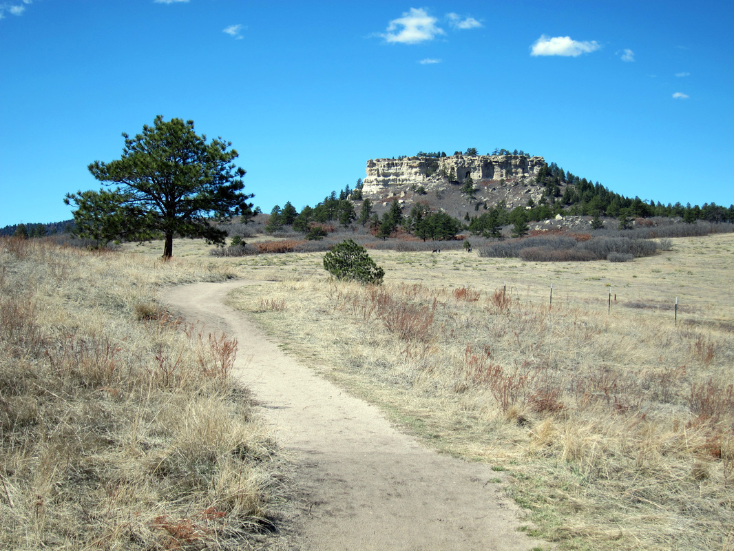
Between Castle Rock and Monument, on the eastern flank of Rampart Range, stark and striking silhouettes of disperse buttes with names like Raspberry, Rattlesnake and Eagle Mountain disrupt the serene continuity of rolling, pastoral grasslands. Far-off views of this stunning terrain can be experienced from a number of rocky perches atop Spruce Mountain. Spruce Mountain, also a butte, is a Douglas County Open Space located adjacent the Greenland Open Space, near the community of Palmer Lake. The approximate 5.1 mile, figure-eight loop hike described here is a slight variation of the 5.5 mile Mountain Top Loop notated by the open space's trail signs. The difference in distance is based on taking the Oak Shortcut Trail on the way back to the hike's start point, instead of retracing the last 0.6 miles. Close to the hike's start point, the trail comes to an intersection with Spruce Meadow Trail. Continue straight headed through a thicket of gambel oak, then ascending at a slight incline through open grassland toward Eagle Mountain. At a little less than a half-mile, another intersection is reached. Turn left, away from the Eagle Pass Trail Cut-Off, headed through mixed forest of pine and shrubs. For 0.3 miles, the trail switchbacks up the hillside, reaching a sign marking where the path intersects with the Oak Shortcut Trail. Turn right continuing up the hillside, at first through open shrubland and then under evergreen forest. The trail switches-back, eventually climbing onto Spruce Mountain's top., near the Greenland Overlook. Past this initial rocky outcropping, the path ventures back through forest, passing by the beautiful view of Eagle Mountain from Paddock Point. A nearby plaque commemorates dedicated forester and Spruce Mountain admirer, Warren Paddock, whom the lookout is named for.. Another intersection is reached after having traveled about a mile from the intersection with the Oak Shortcut. From here, the trail loops around Spruce Mountain's mostly flat hilltop, predominantly through forest. Turn right onto the loop, briefly headed downhill, eventually coming to an intersection with a Service Road. The Service Road descends sharply toward Eagle Pass Trail. Steer left, continuing along the Mountain Top Loop toward the craggy overlook known as Windy Point. On the way, social trails cut away to awesome vistas from the butte's edges. Past WIndy Point, other social trails lead to picnic sites and nearby outlooks.. After 2.3 miles, the loop comes back to its beginning. From here turn right retracing the route back down to the trailhead. When the intersection with Oak Shortcut Trail is reached again, turn right onto the shortcut. After descending a short distance, Oak Shortcut Trail comes to an intersection with Spruce Meadow Trail, near a couple of picnic tables. Veer left down the hill and then turn right at the next intersection, headed back to the nearby parking area and end of this hike. Navigation for this hike is straightforward, with signs and often maps located at trail intersections. There are minimal steep inclines to be huffed-up. The trail's switchbacks make even the climb up to the Spruce Mountain's top very reasonable. Given these factors and the 5.1 miles total distance hiked, this trail is rated as moderate. The distance is based on adding up the mileage presented on the Spruce Mountain & Meadow Open Space Map linked below. In the trail guide Best Easy Day Hikes: Colorado Springs, the authors describe the same hike as being 5.3 miles. Additionally, cycling and horse-back riding are also welcome activities at Spruce Mountain Open Space. Further Online Resources: Douglas County: Spruce Mountain Open Space & Trail Douglas County: Spruce Mountain and Spruce Meadow Open Space Trail Map Cospringstrails.com: Spruce Mountain Open Space Fun Colorado Hikes: Spruce Mountain Open Space Trail by Mary Norton Colorado Lifestyle: Spruce Mountain Loop by sylvia murphy |
Above image links to further images
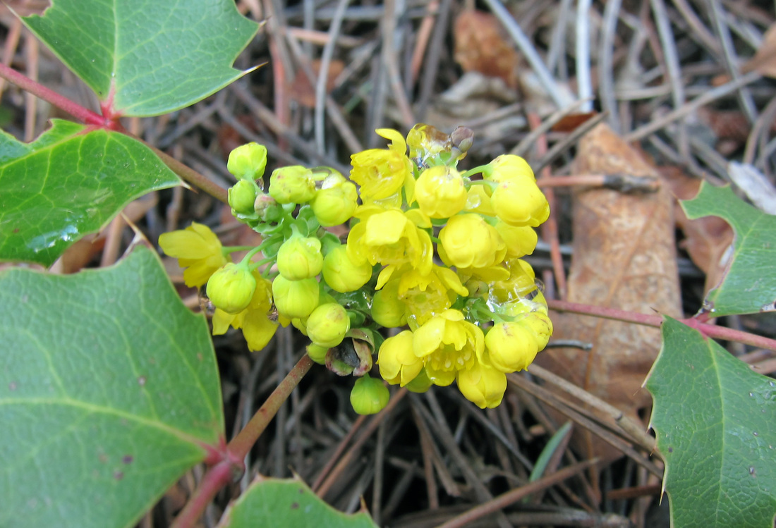
Oregon Grape is a prolific, spring bloomer on Spruce Mountain
View of Eagle Mountain from Paddock Point
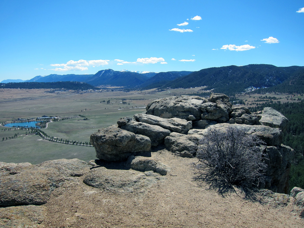
View from Windy Point along Spruce Mountain Open Space Trail
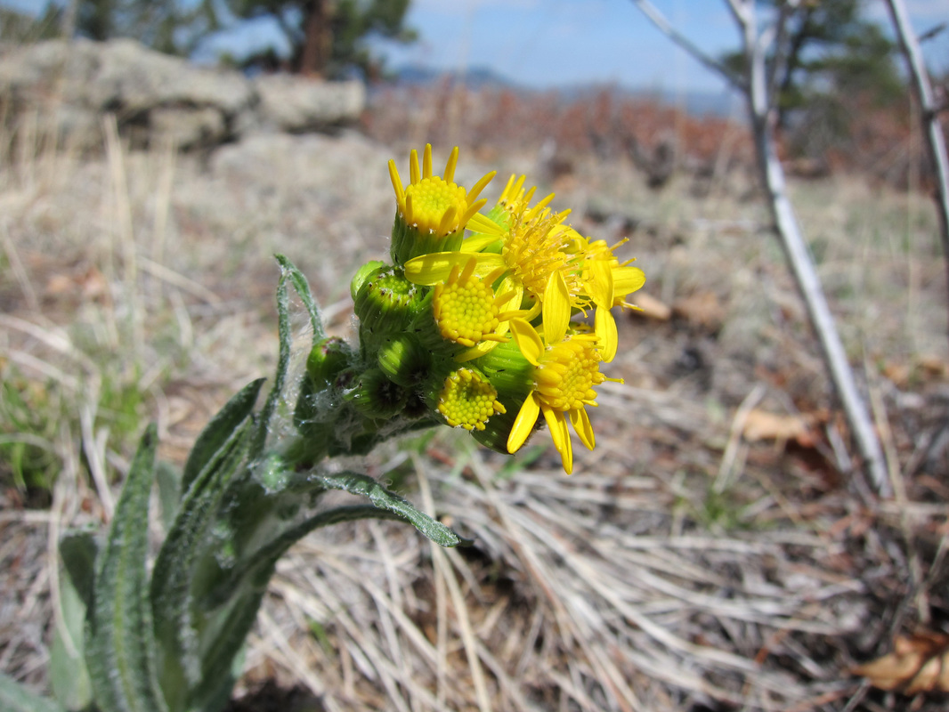
Spring wildflower blooms along the Mountain Top Loop
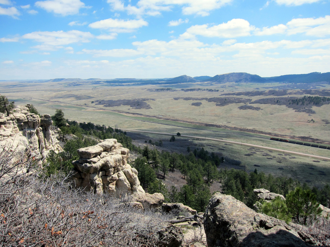
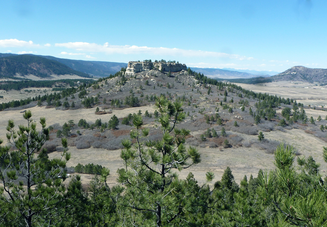
View from Mountain Top Loop
|
|
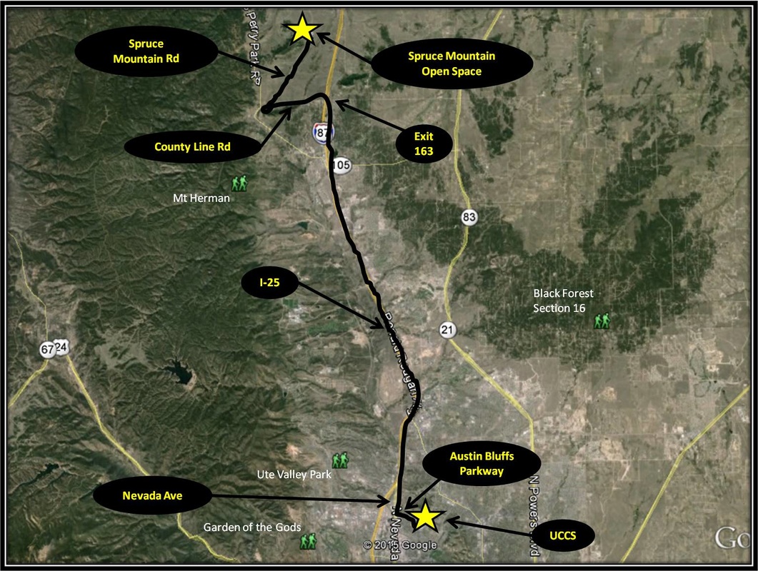
Driving Directions:
From UCCS, turn right onto Austin Bluffs Parkway. From Austin Bluffs Parkway, turn right onto Nevada Ave. and merge onto I-25, headed north. Stay on I-25 for 15.4 miles, then take exit 163 for County Line Rd. Turn left onto County Line Rd from the exit ramp. After 2.6 miles, turn right onto Spruce Mountain Rd. Stay on Spruce Mountain Rd for 3. 5 miles. Parking for the Spruce Mountain Open Space Trailhead will be on the left. While parking is ample, Spruce Mountain and Meadow are popular trails, esp on weekends when the weather is right. Driving directions to Spruce Mountain using Google Maps is linked here. |
