Aiken Canyon Nature Preserve
|
Distance: Approximately 5.3 miles total
In 1991, the Nature Conservancy leased from the state what has become 1,620 acres 16 miles south of Colorado Springs near Ft Carson's Turkey Creek Ranch, creating a preserve and naming it for Charles Aiken, a 19th century ornithologist who lived in Turkey Creek Canyon. The beautiful terrain is in a transition zone between the mountains and plains and is a corridor for wildlife venturing from the Beaver Creek Wilderness to the remote and wild training grounds of Ft Carson. Zoltan Molocsay wrote in his excellent work, Trails Guide: Denver to Pikes Peak, Aiken Canyon Preserve is a landscape sometimes taken for granted by those who live on the Front Range because of its familiarity. Regardless, a hike in Aiken Canyon cannot be recommended highly enough, esp in spring. The preserve protects a manifold terrain consisting of rolling grassland broken up by patches of gambel oak, three-leaf sumac, and mountain mahogany. Boulder Raspberry and chokecherry joins the other shrubs when under the shade of ponderosa pine, near an often-thirsty stream bed. The gambel oak dominate the slope's of Aiken Canyons mountains, while old-growth white fir and ponderosa pine tower in the shade of a narrow, craggy canyon. In spring, an awesome array of wildflowers bloom amid the preserve's many micro-ecosystems. In the meadows, Rufous Hummingbirds buzz overhead like fighter pilots. Many other bird species can also be observed at Aiken Canyon. Charles Aiken, himself identified more than 75 species. The hike described here incorporates AIken Canyon, Overlook, and Canyon Trails to make for an approximate 5.3 mile hike total. The keyhole-loop Aiken Canyon Trail begins from behind the large informative sign, near the preserve's adobe field station. After initially heading through grassland, the trail briefly follows a wash before cutting left back into grassland. The trail crosses an often dry stream-bed a few more times, journeying through meadow and mixed forest before coming to where Aiken Canyon Trail loops, about 0.7 miles from the hike's beginning Veer right headed through a patch of shrubs, crossing a seasonal stream, and passing through another sloping grassland. The trail then veers back under the shade of mixed forest passing by sandstone formations, often closely following the stream's wash, crossing its path a few times. About a mile after turning right onto the loop, the trail crosses through a meadow headed toward a gap in Aiken Canyon's nearby hilly terrain. Just as the trail begins to enter into more shrubland, an intersection is reached with a side-trail leading up through a nearby narrow canyon. The Canyon Trail is approximately 0.75 miles one-way, climaxing near the remains of an old homestead still standing when the Nature Conservancy leased the land, and subsequently demolished the structure out of safety concerns, leaving mostly tin roof rusting. Canyon Trail can be tougher to discern than the Aiken canyon Trail, esp at a few of the stream crossings. The stream is mostly seasonal and does not often involve getting boots soaked. After returning along the Canyon Trail, turn right back onto the loop. From here, the way switchbacks up through mixed forest, quickly arriving at an intersection with another side-trail, this one leading up to a nearby overlook of the eastern plains and in particular the rolling hills of Fort Carson's training grounds. After returning down the short Overlook Trail, turn left back onto the loop. From here the trail winds for roughly 0.8 miles back to the loop's beginning. At first, the way descends through mixed forest and meadows, passing under the shadows of heavier forest before crossing a wash out onto open grassland. Another deep wash is crossed before arriving at the loop's beginning. From here, turn right retracing the route back to the hike's beginning approximately 0.7 miles away.. Aiken Canyon Trail is well-maintained and marked with signs at key locations, including at intersections with the other pathways. There are also many informative wooden signs on Aiken Canyon's ecology along the trail's first 0.7 miles. Some of the signs are hard to read do to being weathered and sun-baked. The Canyon Trail can be difficult to pick back up on a few of its stream crossings and mostly fizzles out near the slim remains of a past homestead, making a turnaround point feel more like a guess. Even on the Overlook and Canyon trails, the uphill is quite reasonable. Given this, the approximate 5.3 miles, and the mostly straightforward navigation, this hike is rated as moderate. AIken Canyon Nature Preserve is open to the public on Saturday, Sunday, and Monday during daylight hours. The Field Station is open on Saturdays and Sundays. The bathrooms are located within the field station. In order to help preserve the area's unique ecology and wildlife habitat, bicycling and horseback riding are not permitted at Aiken Canyon. Neither are pets. Further information on Aiken Canyon is linked below. Further Online Resources: The Nature Conservancy: Aiken Canyon Preserve Colorado Springs Hiking: Aiken Canyon Nature Preserve Examiner.com: Hiking in Colorado Springs: Aiken Canyon Preserve |
Above image links to further images of Hike
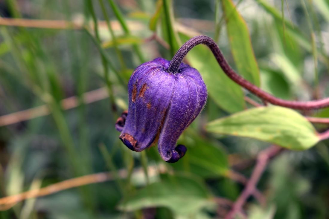
Sugarballs bloom along Aiken Canyon Trail
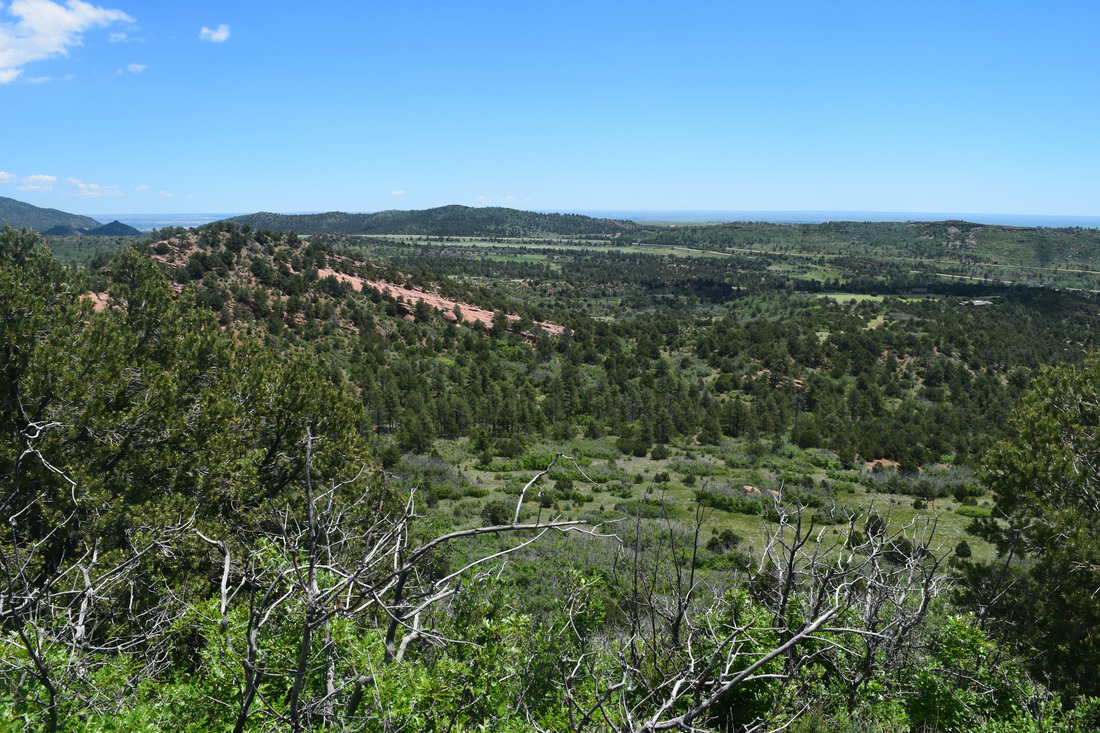
View from Aiken Canyon Overlook
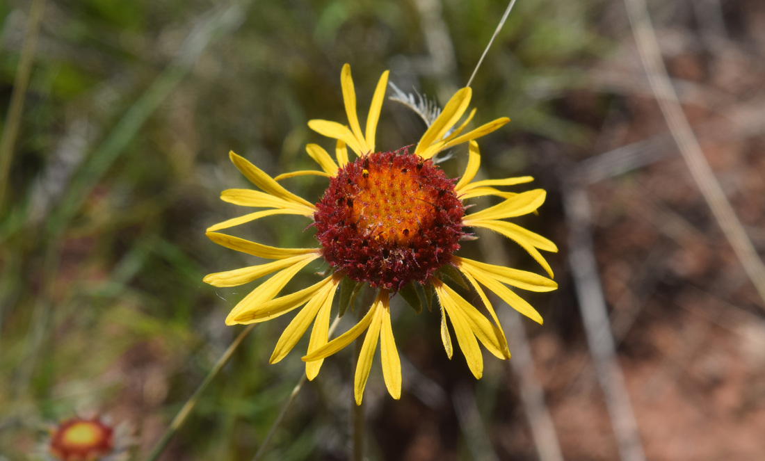
Blanketflower blooms along Aiken Canyon Trail
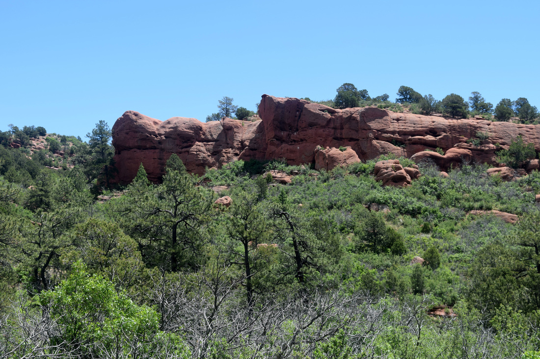
View from along Canyon Trail
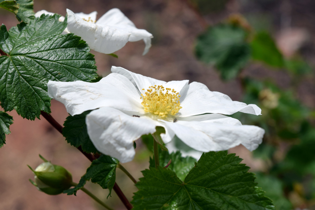
Boulder Raspberry along Aiken Canyon Trail
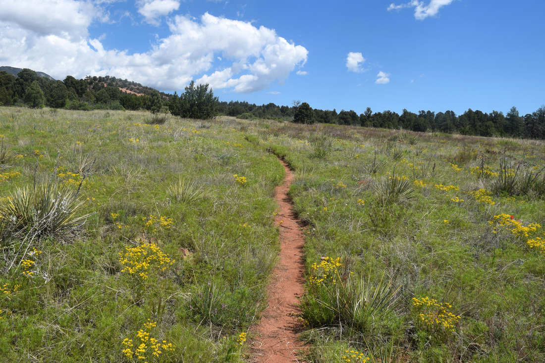
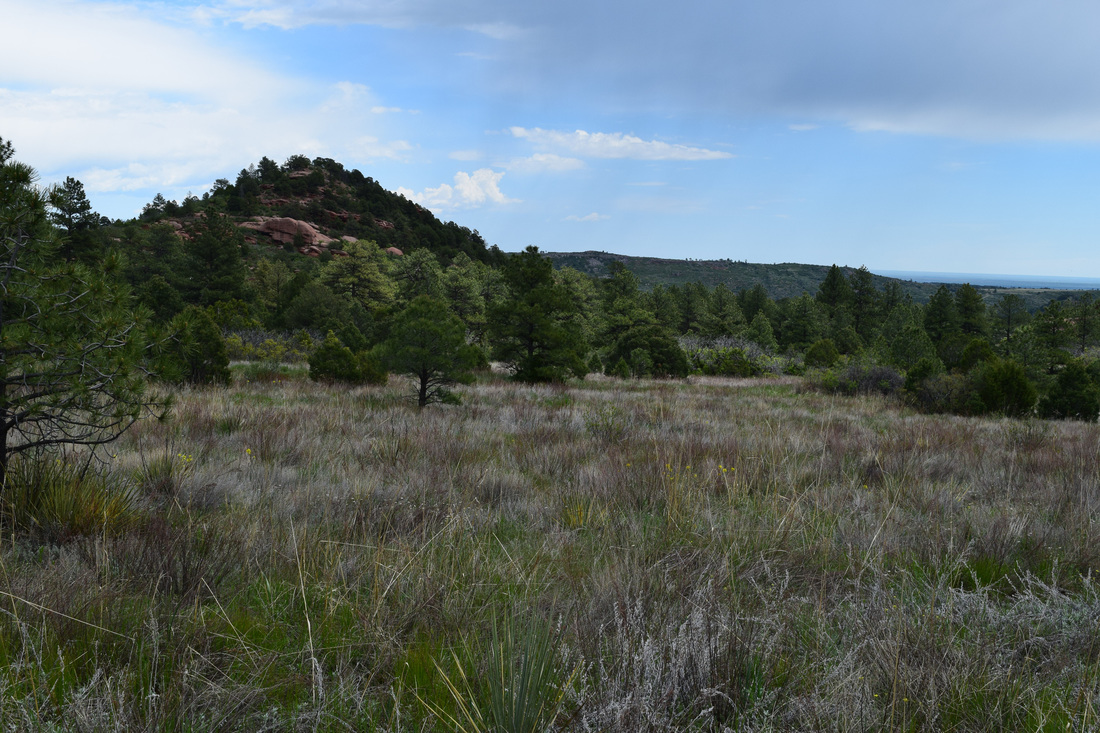
Along Aiken Canyon Trail
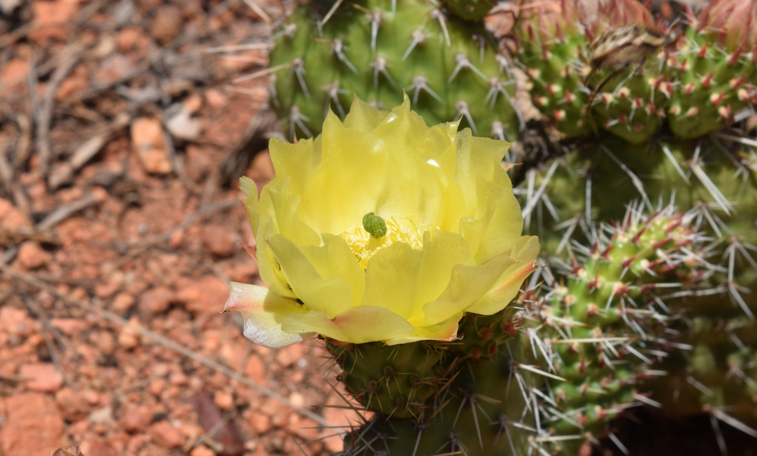
Prickly Pear Cactus blooms on the sun-baked hilltop along Aiken Canyon's Overlook Trail
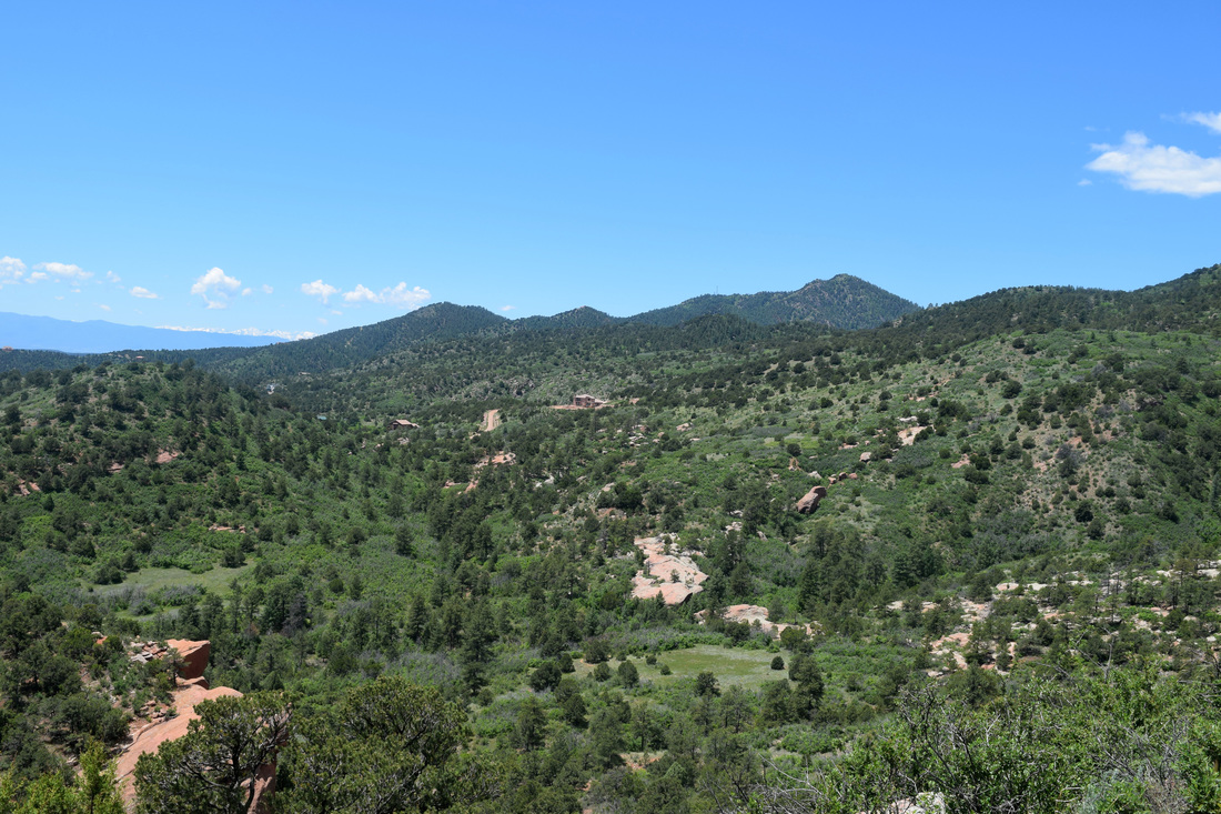
View south along trail headed up to the Overlook
|
|
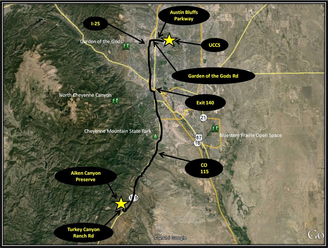
Driving Directions:
From the University of Colorado at Colorado Springs, turn right onto Austin Bluffs Pkwy. Stay on Austin Bluffs Pkwy as it turns into Garden of the Gods Rd. From Garden of the Gods Rd, turn left onto I-25. Take Exit 140 after traveling 5.7 miles on the interstate. From the exit ramp, keep left following the signs for Tejon St. Pass through Tejon St and turn right onto Nevada Ave, which is also CO-115. Stay on CO-115 for 14.2 miles before turning right onto Turkey Canyon Ranch Rd. Parking for AIken Canyon will be on the right. The parking area is moderately sized, but there most likely will be plenty of room. Bathrooms are located within the field station. The field station is open on Saturdays and Sundays, but not Mondays. Driving directions to Aiken Canyon Preserve using Google Maps is linked here. |
