Gold Camp & Old Stage
The hikes described in this section originate from Gold Camp and Old Stage Roads. These well-maintained soft-surface roads offer access to trails winding their way through aspen groves and ponderosa pine forest, leading to verdant mountain parks ripe with wildflowers and waterfalls and mountaintops with spectacular panoramas. Hikes described below are: High Drive to Mays Peak, Seven Bridges Trail to Jones Park, St Mary's Falls Trail, Gray Back Peak Trail, Mt Rosa from Frosty Park and Almagre Rd to Almagre Mountain.
|
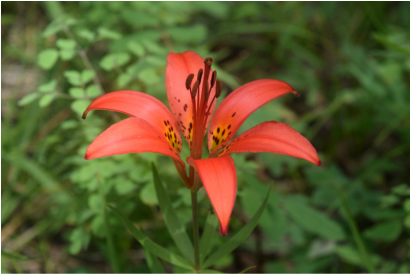
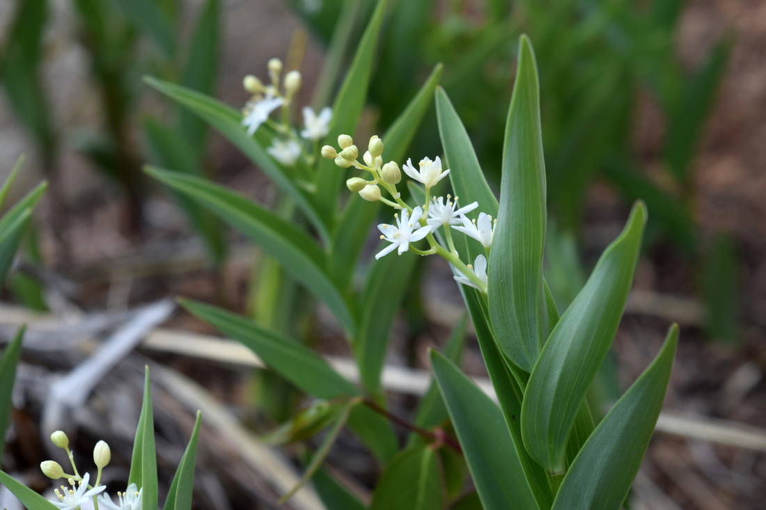
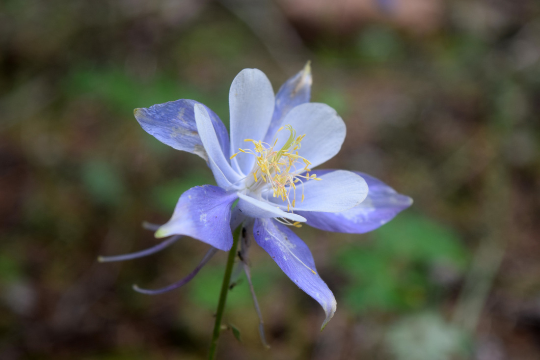
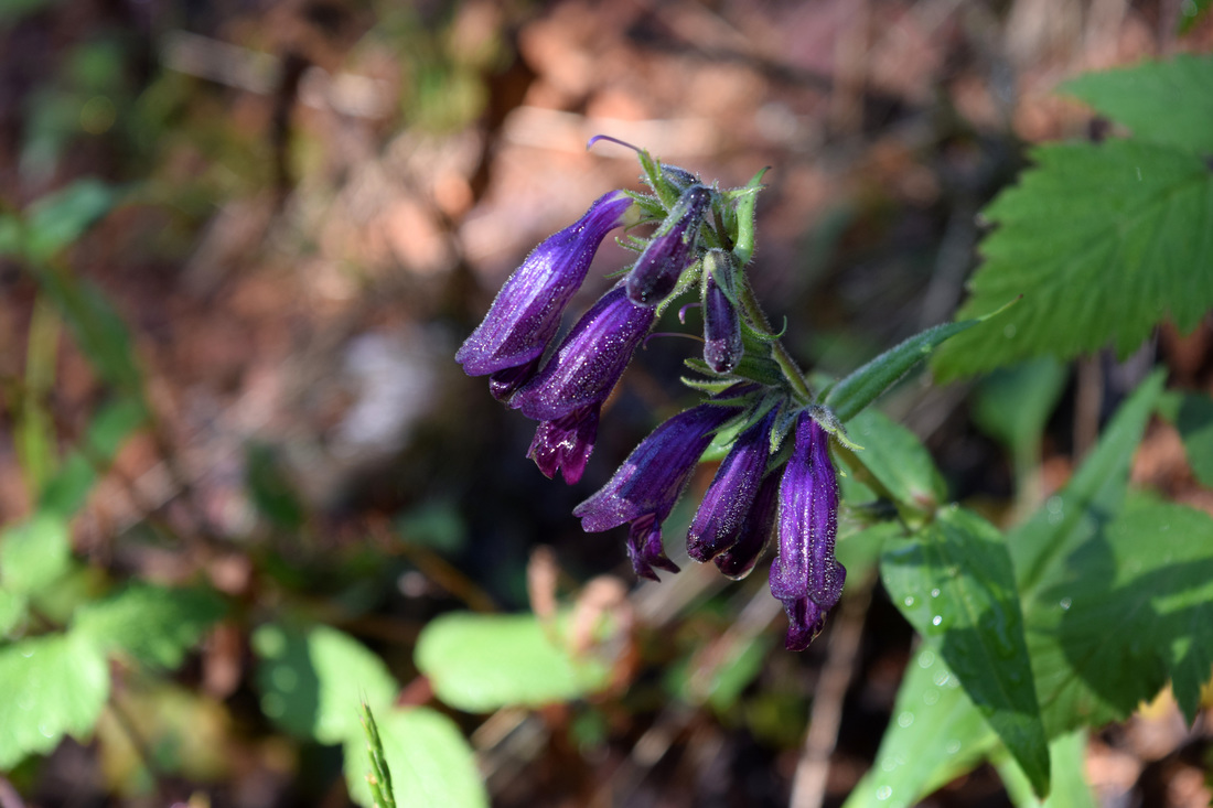
Above image links to further images of some of the area's wildflowers
|
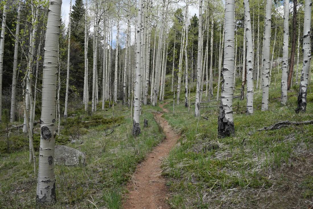
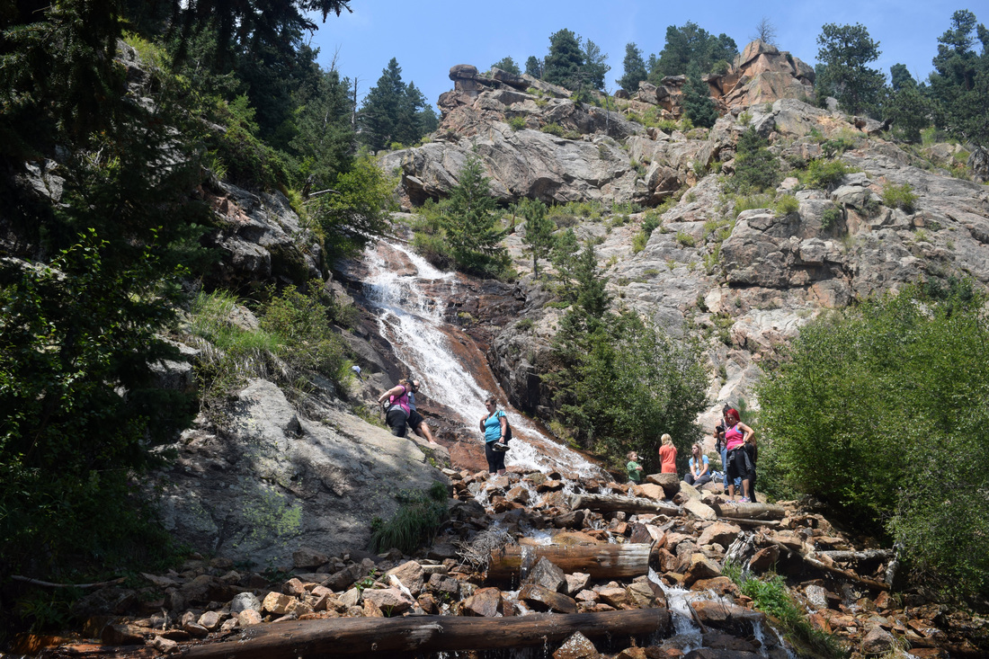
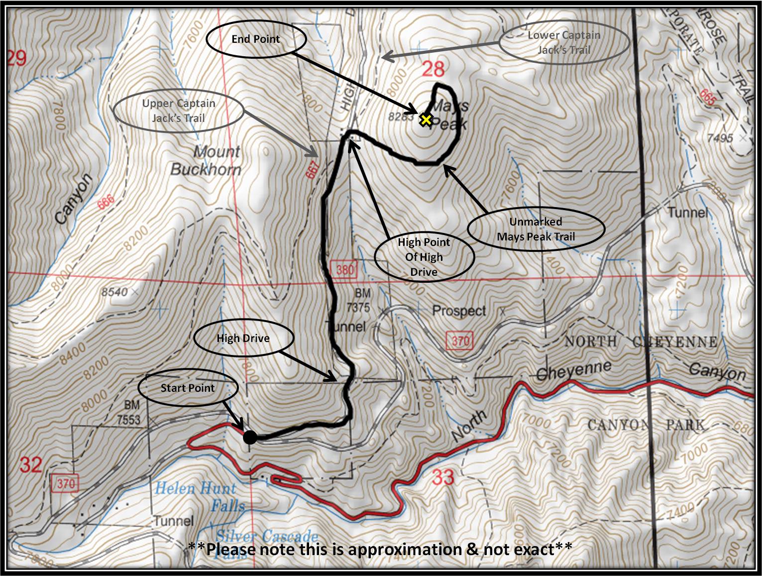
High Drive to Mays Peak
|
Distance: Approximately 3.2 miles total
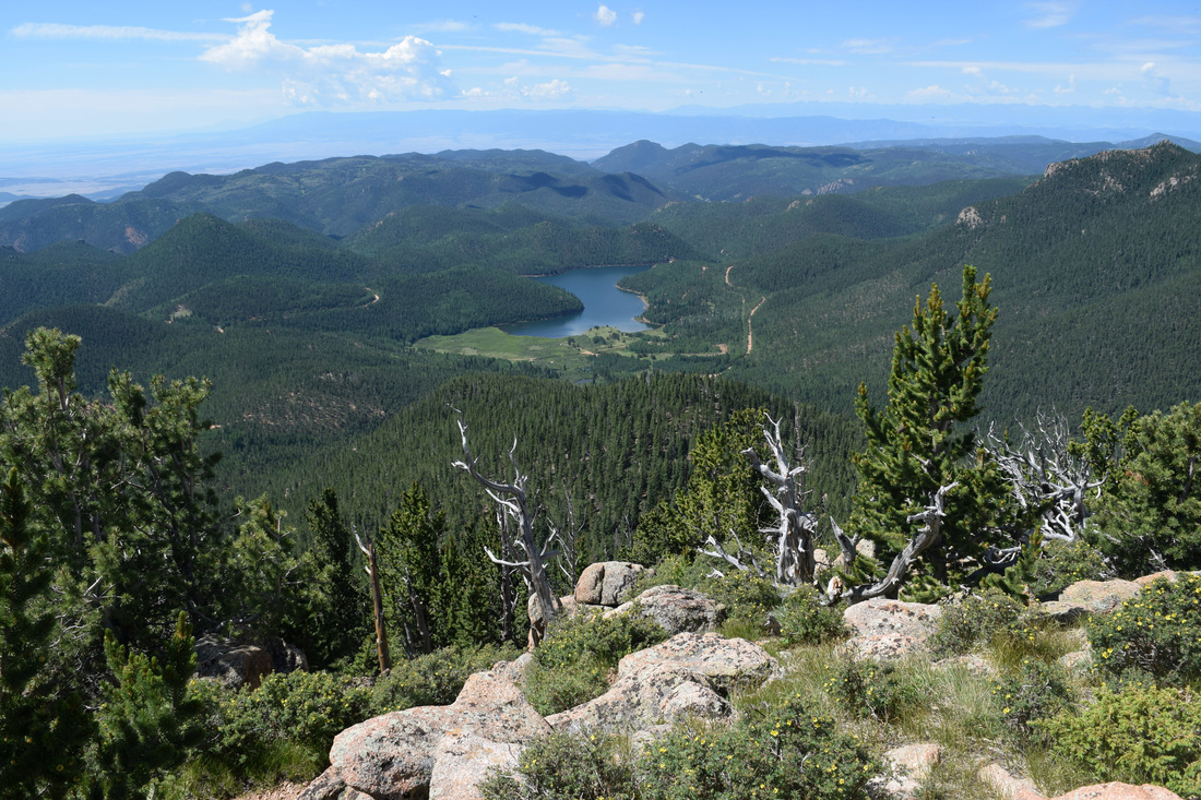
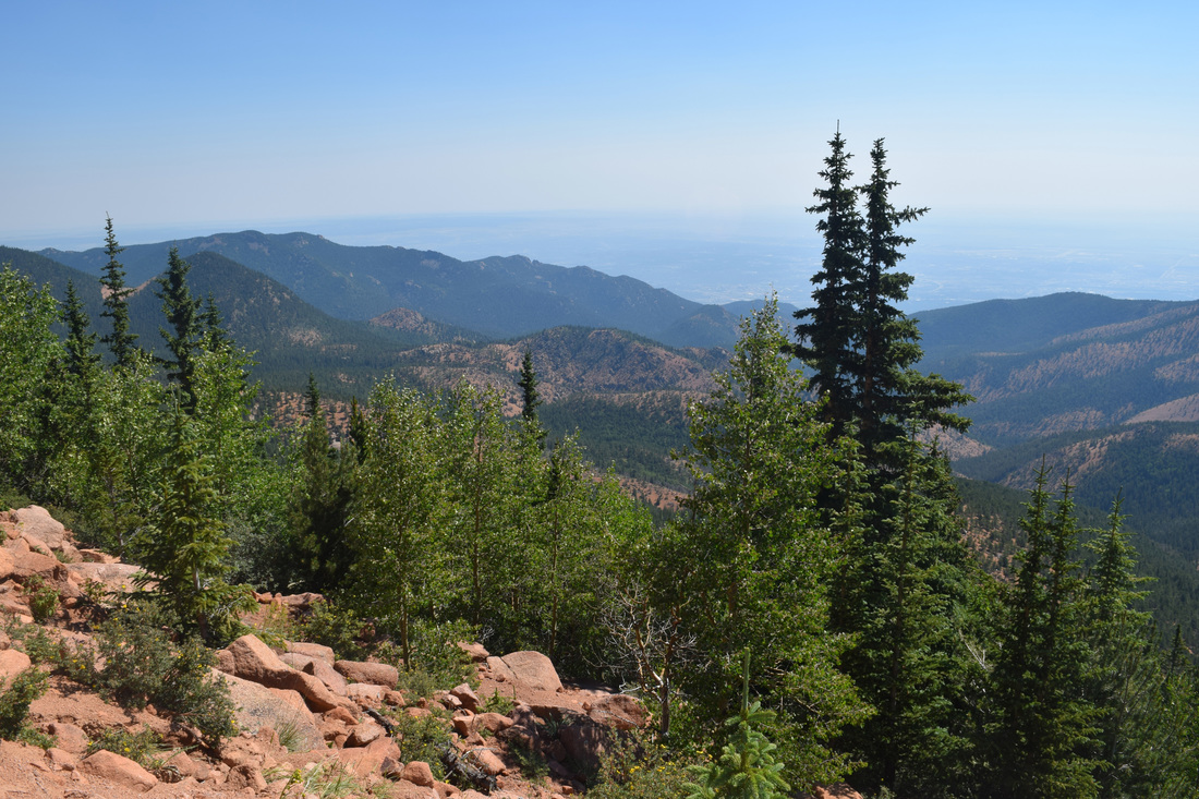
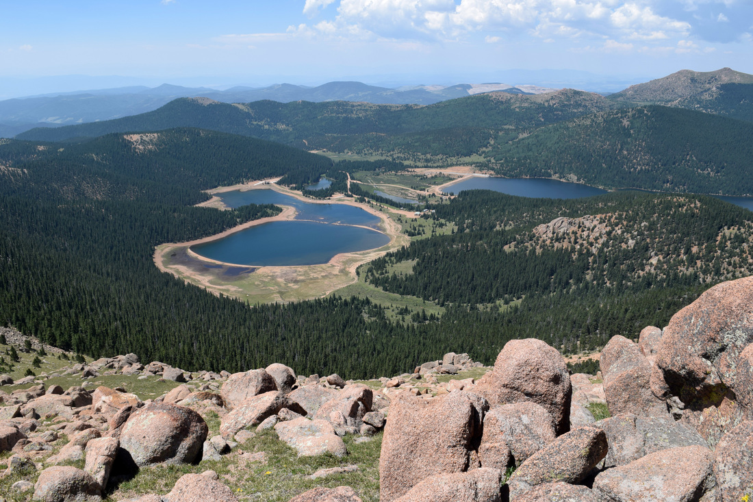
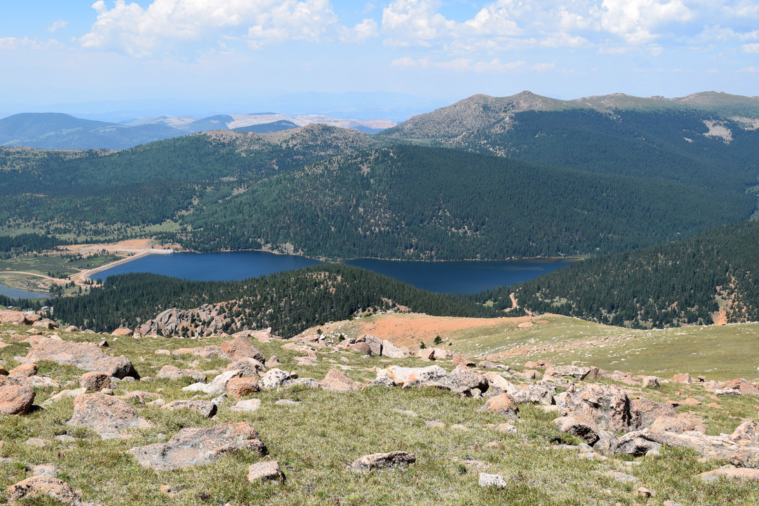
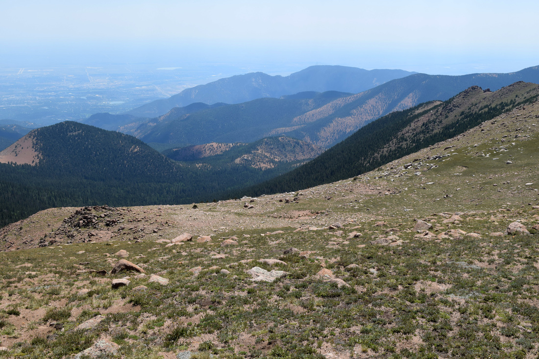
With spectacular perspectives of the park's mountainous terrain and the city below, Mays Peak (8,283 ft) is a fairly easy, there and back again hike beginning from the parking area at the intersection of High Drive and Gold Camp Road. From the parking area, travel up High Drive at a moderate incline for approximately a mile, reaching the high point of the century-plus old carriage road in a saddle between Buckhorn Mountain and Mays Peak.. A retaining wall on the left notates the road's highest point as 7,867 ft. Just past the retaining wall, Upper Captain Jack's Trail intersects with High Drive on the left and Lower Captain Jack's Trail (also known as Penrose Multi-Use Trail) intersects on the road's right, near the seasonal gate. These trails are marked with signs. The trail leading up to Mays Peak is not marked. As the high point of High Road is reached, there is a group of boulders on the right and just past these boulders is a wire fence. The unnamed, corkscrew-shaped trail leading to Mays Peak begins just behind the fence's right side, opposite of the side closer to Lower Captain Jack's Trail. The path initially looks like a wash, but the course's intention becomes apparent very quickly, generally following the mountain's contour counter-clockwise. Between coniferous forest and bramble oak, vistas of the mountainous interior open up, and as the trail continues to corkscrew, the perspectives change to Cheyenne Mountain, Colorado Springs, and the eastern plains. As the path's course curves west, headed back into the mountains, the trail ascends into thicker forest and onto a bit of a saddle. Just after passing by a nearby group of boulders on the trail's left side, the path crosses by what looks like a steep wash. Although the trail continues on, turn left heading up the very, steep wash, which bares hints of once being a trail of some kind. Following a short but steep climb through shaded forest, the path spits out onto Mays Peak's wind-shorn top, where the panoramic views are sparsely interrupted by tree cover. After enjoying the views, the way back is the way you came, approximately 1.6 miles back down to the start point, making for a hike of about 3.2 miles total. This distance is based on information detailed in a Happy Trails column written by Dave Phillips and published by the Colorado Springs Gazette, linked below. The way to Mays Peak is not marked, in particular the narrow trail winding around and the wash leading up to Mays Peak may be hard to spot. Most of the uphill is reasonable, but there are some steeper moments, esp. the last jaunt to reach the peak. Given these factors, this hike is rated as easy-to-moderate in difficulty level. In the links listed below is a possibly helpful map to aid in the general orientation of the hike's navigation. The map itself is not exact, just an approximation. Further Online Resources: Gazette.com: Happy Trails: Mays Peak by Dave Phillips Colorado Springs Trails & Hiking: Mays Peak A Possibly Helpful Map |
Above image links to further images of the Hike
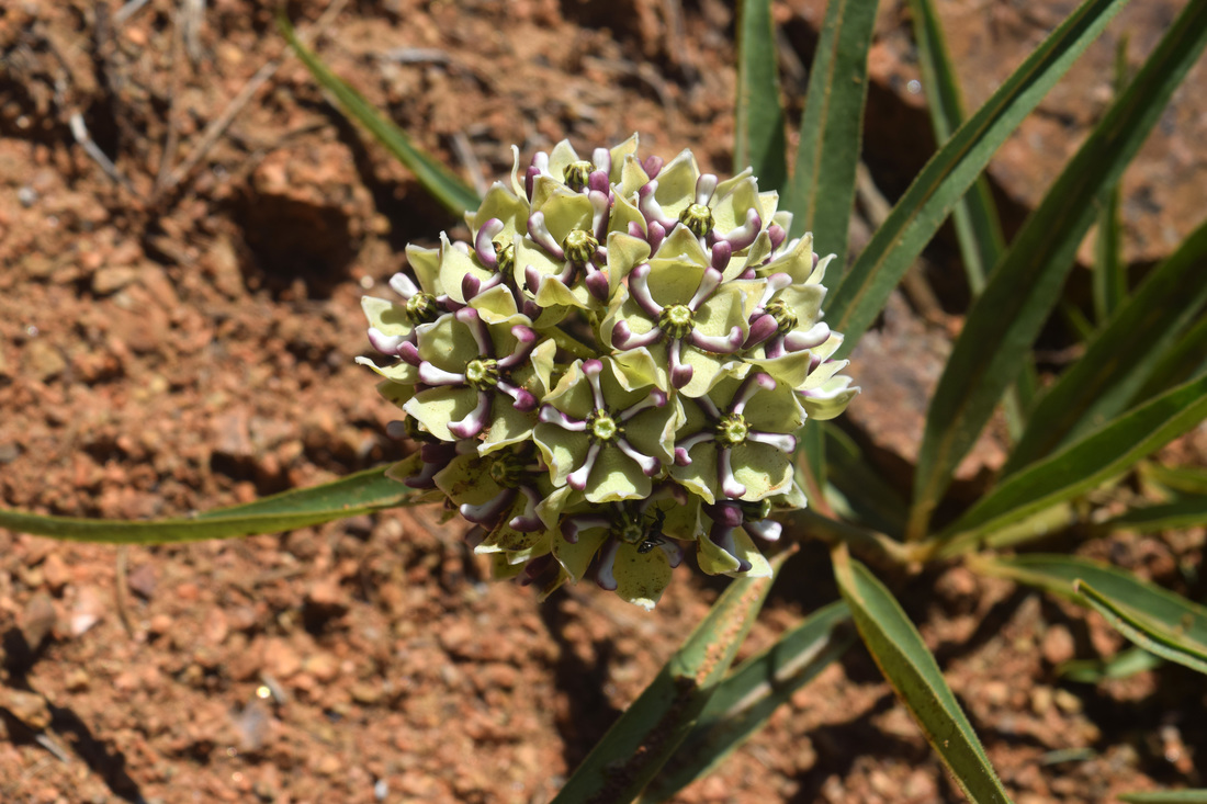
Spider Milkweed along High Drive
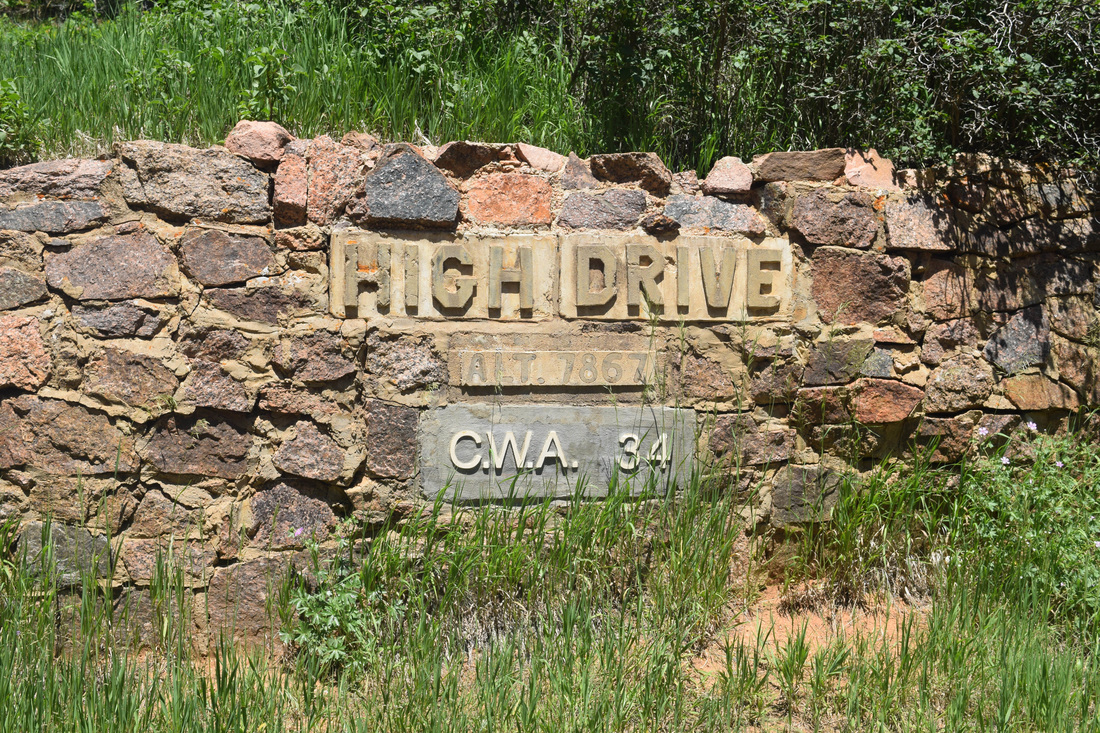
Retaining Wall marking the High Point of High Drive
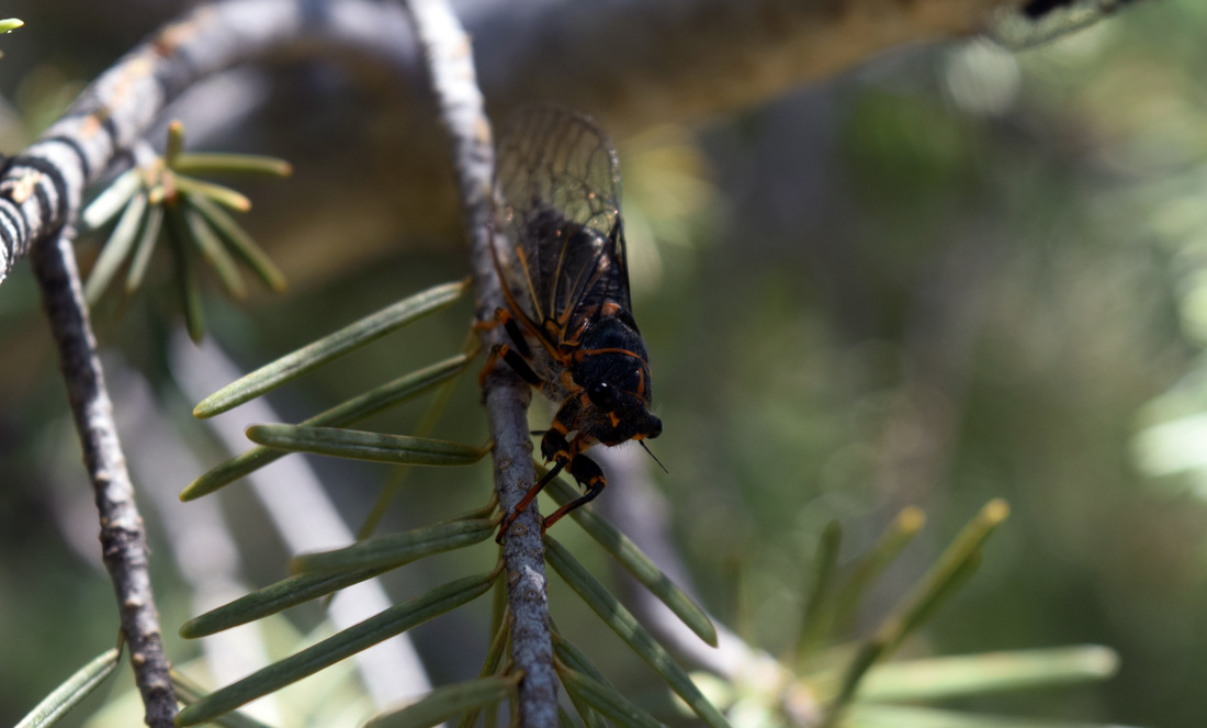
Cicada near Mays Peak Trail
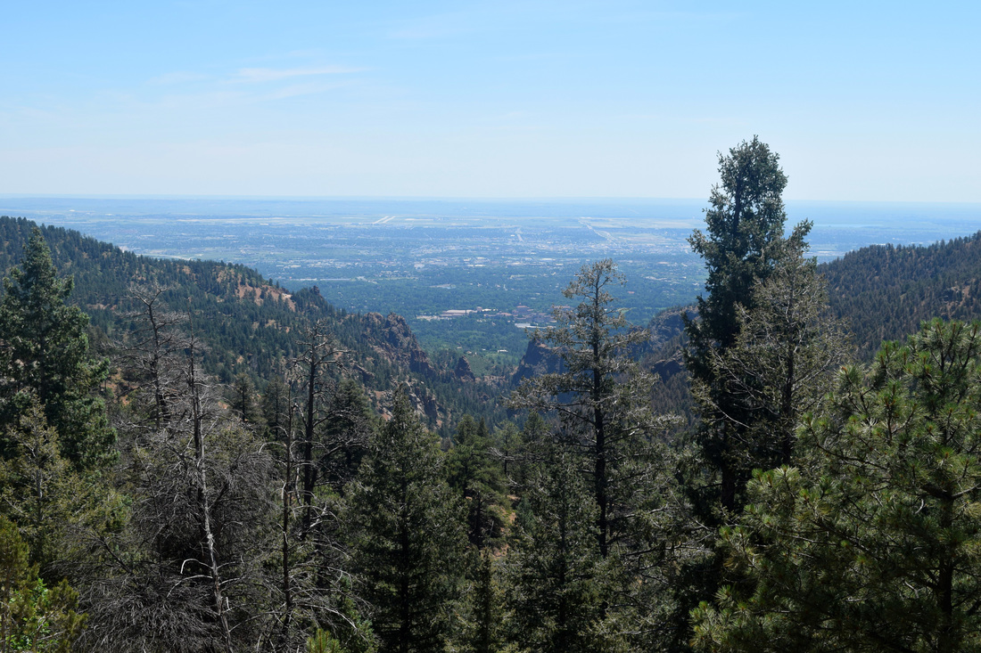
View from Mays Peak
|

|
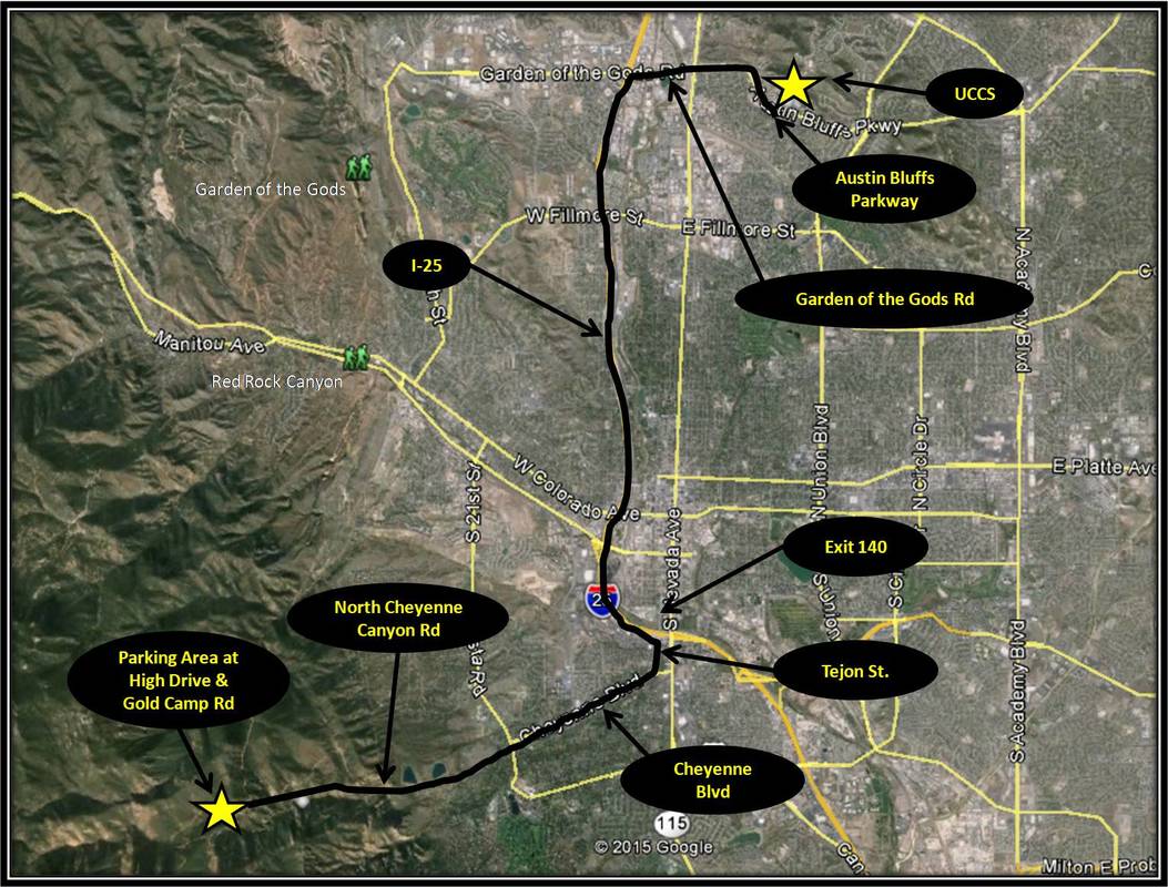
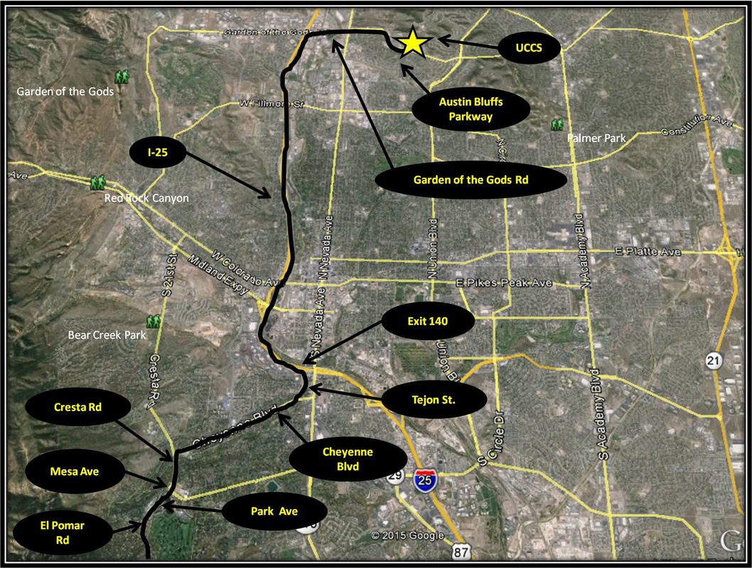
Driving Directions:
The start point for this hike is located approximately 13.5 from UCCS. To get to the parking area at the intersection of Gold Camp Rd and High Drive from UCCS, turn right onto Austin Bluffs Parkway. From Austin Bluffs Parkway, continue straight toward I-25 as Austin Bluffs becomes Garden of the Gods Rd. From Garden of the Gods Rd, turn left onto I-25 headed south to the exit for Tejon St, Exit 140. From the exit ramp, turn right onto Tejon St and from Tejon turn right onto Cheyenne Blvd. From Cheyenne Blvd, stay straight as the road becomes North Cheyenne Canyon Rd. From North Cheyenne Canyon Road, veer right into North Cheyenne Canon Park and follow the road up to the parking area where High Drive intersects with Gold Camp Rd. The parking area is sizable but fills up very quick on the weekends. The nearest toilets are located at Helen Hunt Falls. Driving directions using Google Maps is linked here. |
Seven Bridges Trail to Jones Park
|
,Distance: Approximately 6 miles total
The hike to Jones Park from Seven Bridges Trail begins from the parking area above North Cheyenne Canyon Park where Gold Camp Rd closes to vehicular traffic, at the intersection with High Dr. The route is initially level, traveling along the part of Gold Camp Road closed to vehicular traffic for 0.7 miles, coming to the intersection with the Seven Bridges Trail after passing over North Cheyenne Creek as it flows through culverts buried beneath the road. The intersection is marked with a trail sign labeled #622, which is the Forest Service's numerical identity for Seven Bridges Trail. From here the way is much more uphill following North Cheyenne Creek. As the trail's name implies, North Cheyenne Canyon Creek is crossed seven times by bridge. The seventh bridge is reached after hiking 1.6 miles from the parking area and makes for a good turnaround point for a shorter day hike. Once past the seventh bridge, the trail continues to follow the creek, but from a greater elevation, climbing further up onto an exposed and eroded hillside. Although easy to identify, the trail's path is slippery with sand and very fine gravel through this segment of the hike. The lack of vegetation creates some impressive views of the canyon from rocky vantage points. Eventually, the trail and the creek meet again, near where the trail splits. Either way is the correct choice for the hike described here. The path that crosses the creek, also crosses by an intersection with a trail leading to Deer Park and Rosemont Reservoir. Continue on Seven Bridges, crossing the creek once again without worry of getting boots wet and uniting with the trail that continued to parallel the creek without crossing it. In an aspen meadow, the trail comes to an unmarked intersection, with the right turn headed steeply up a trail that at first appears to be more of a run-off. This is Trail #622A and it links up with Pipeline Trail on top of the ridge. Seven Bridges Trail continues to follow the creek, coming to an intersection with Pipeline Trail after leaving the aspen meadow.. So either continuing to follow Seven Bridges or turning right headed up Trail #622A will work. Continuing straight along Seven Bridges Trail is a less steep climb. Either way, upon arriving at the intersection with Pipeline Trail, turn right. The Pipeline Trail is numerically identified as Trail #668 and is a part of the Ring the Peak Trail. After climbing onto the ridge, the trail descends down into another aspen meadow, crossing the eighth bridge of this walk. A few meters past the bridge, Pipeline Trail comes to an intersection with Trail #667, also known as Jones Park Tail. This aspen meadow and one-time home of gold prospectors is known as Jones Park, the turnaround point for this hike. As a there and back again hike, just retrace the approximate three miles back down to the start point. The hike to Jones Park taking Seven Bridges Trail is approximately six miles total. Distance is based on a Colorado Springs Gazette column linked below. Most of the trek to Jones Park is uphill, some of it is steep. Also, some of the trail's surface can be slick and rocky, esp. on the way down. The portions of the trail absent forest cover and proximity to the creek can be quite hot when the sun is shining, even in winter. Seven Bridges is a popular trail year-round and when it comes to parking, the early bird definitely gets the worm on the weekends and holidays. Given the fairly straightforward navigation, distance, and amount of uphill, this hike is rated as moderate on the difficulty scale. Bicyclists are also welcome on Seven Bridges Trail. A longer loop hike can be made by turning right onto Jones Park Trail (#667) from Pipeline Trail, which eventually leads to High Drive. From High Drive turn right and follow the road back down to the parking area. Further Online Resources: Out There Colorado (Colorado Springs Gazette): Seven Bridges to Jones Park Examiner.com: Hiking in Colorado Springs: Seven Bridges/North Cheyenne Canyon Creek Trail by Deb Stanley Hiking the Rockies: Seven Bridges Trail Pike National Forest: 7 Bridges Trail #622 |
Above image links to further images of the Hike
The first of Seven bridges over North Cheyenne Creek can be avoided by turning right from Gold Camp Rd on the unmarked trail located a little bit before passing over North Cheyenne Creek
False Solomon Seal blooming along Seven Bridges Trail
One of the Seven Bridges
Western Virgins Bower blooming along Seven Bridges Trail
After the Seventh Bridge, the trail traverses a highly eroded mountainside
Seven Bridges passes through an Aspen Meadow before intersecting with Pipeline Trail
|

|
Driving Directions:
The start point for this hike is located approximately 13.5 from UCCS. To get to the parking area at the intersection of Gold Camp Rd and High Drive from UCCS, turn right onto Austin Bluffs Parkway. From Austin Bluffs Parkway, continue straight toward I-25 as Austin Bluffs becomes Garden of the Gods Rd. From Garden of the Gods Rd, turn left onto I-25 headed south to the exit for Tejon St, Exit 140. From the exit ramp, turn right onto Tejon St and from Tejon turn right onto Cheyenne Blvd. From Cheyenne Blvd, stay straight as the road becomes North Cheyenne Canyon Rd. From North Cheyenne Canyon Road, veer right into North Cheyenne Canon Park and follow the road up to the parking area where High Drive intersects with Gold Camp Rd. The parking area is sizable but fills up very quick on the weekends. The nearest toilets are located at Helen Hunt Falls. Driving directions using Google Maps is linked here. |
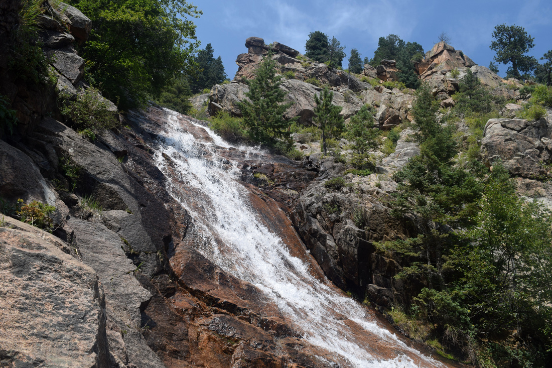
St Mary's Falls Trail
|
Distance: Approximately 6 miles total
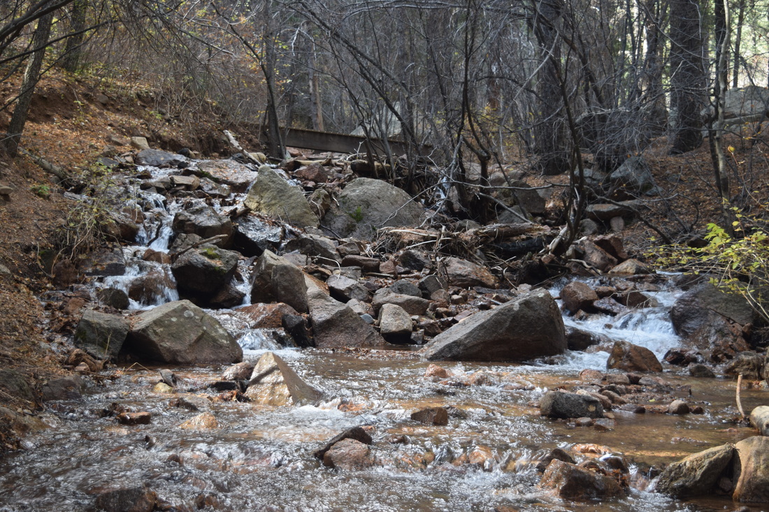
St Mary's Falls is among the region's most striking and popular waterfalls to visit, esp during winter and spring when the falls are either frozen or raging. Additionally, the distant perspectives looking away from the falls are almost as beautiful as the falls themselves. To get to St Mary's Falls, start from the parking area at the intersection of High Drive and Gold Camp Rd, passing by the gate preventing vehicular traffic from further traveling Gold Camp Rd. From the gate, hike Gold Camp Rd for about 1.2 miles, passing by Seven Bridges Trail (numerically identified as #622), coming to a collapsed tunnel. The tunnel's entrance is blocked by a formidable, black metal fence. The trail climbs around and over the blocked-off, collapsed tunnel. Excellent views of North Cheyenne Canyon open up as the trail skirts the hillside coming to a fork. At the fork, a sign notates the right turn leading to St Mary's Falls 1.6 miles away and Mt Rosa's prominent summit approximately five miles away. Turning left leads down to Gold Camp Rd past the failed tunnel. After turning right, St Mary's Falls Trail parallels Buffalo Creek, keeping the stream to the left of its course on the way to the falls. Social trails lead down to Buffalo Creek but at no time does the trail cross Buffalo Creek on the way to the falls. At first the trail follows Buffalo Creek closely through shaded forest consisting of aspen and pine. The trail then ascends up steps crafted from rocks and manufactured wood, rising out of the draw and into the sunlight.. Under a forest canopy once again, the path nears the creek and then veers hard right. A sign notates only 0.2 miles to St Marys Falls. Even with a switchback, the last 0.2 miles can be at moments very steep. About 500 ft from the Falls, the route splits again, with a hard right turn leading to Mt Rosa's summit approximately three miles away. A sign has been placed near this intersection as well. Continue straight, quickly arriving beneath the falls. From here the trail appears to cross Buffalo Creek and then climb to the falls' base, but this can be a rather dangerous proposition when the water is strongly flowing. Often obscured by vegetation during summer, the trail actually cuts right near the creek's bank, headed steeply but shortly up to the base of St Mary's Falls. The rocky path levels out near a memorial to a life ended too soon by a fall from nearby Stove Mountain. After enjoying St Mary's Falls, the way back is the way you came, approximately three miles back down to the parking area at the intersection of High Dr and Gold Camp Rd. As a there and back again hike, the total distance walked is approximately 6 miles. An Out There Colorado column written by Dave Phillips linked below has the distance at 5.8 miles. Stewart M. Green in his trail guide, Best Hikes Near Colorado Springs describes the distance as 6.4 miles. Navigation is pretty straightforward, with intersections marked by signs. This trail consists mostly of uphill on the way to the Falls, some of it steep. Given these factors, the hike to St Mary's Falls is rated as moderate. In addition to foot traffic, bicycling is also welcome on St Mary's Trail. The Forestry Service's numerical identifier for St Mary's Falls Trail is #624. Further Online Resources: Pike National Forest: St Mary's Falls Trail #624 Out There Colorado: St Mary's Falls by Dave Phillips Colorado Photo Hikes: Winter Hike to St Mary's Falls by Steffani Greenleaf |
Above image links to further images of the Hike
St Mary's Falls Trail parallels Buffalo Creek
View of Stove Mountain from St Mary's Falls Trail
St Mary's Falls is a popular destination
View from St Mary's Falls
St Mary's Falls
|
|
Driving Directions:
The start point for this hike is located approximately 13.5 from UCCS. To get to the parking area at the intersection of Gold Camp Rd and High Drive from UCCS, turn right onto Austin Bluffs Parkway. From Austin Bluffs Parkway, continue straight toward I-25 as Austin Bluffs becomes Garden of the Gods Rd. From Garden of the Gods Rd, turn left onto I-25 headed south to the exit for Tejon St, Exit 140. From the exit ramp, turn right onto Tejon St and from Tejon turn right onto Cheyenne Blvd. From Cheyenne Blvd, stay straight as the road becomes North Cheyenne Canyon Rd. From North Cheyenne Canyon Road, veer right into North Cheyenne Canon Park and follow the road up to the parking area where High Drive intersects with Gold Camp Rd. The parking area is sizable but fills up very quick on the weekends. The nearest toilets are located at Helen Hunt Falls. Driving directions using Google Maps is linked here. |
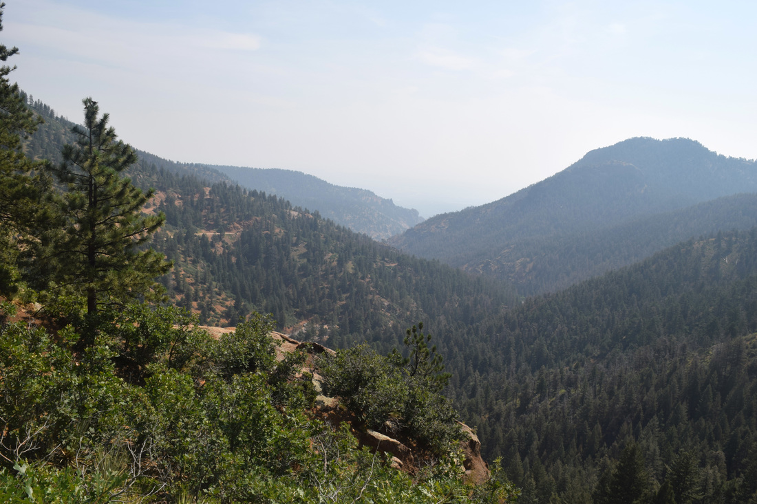
Mt Rosa from Gold Camp Road (Penrose-Rosemont Reservoir)
|
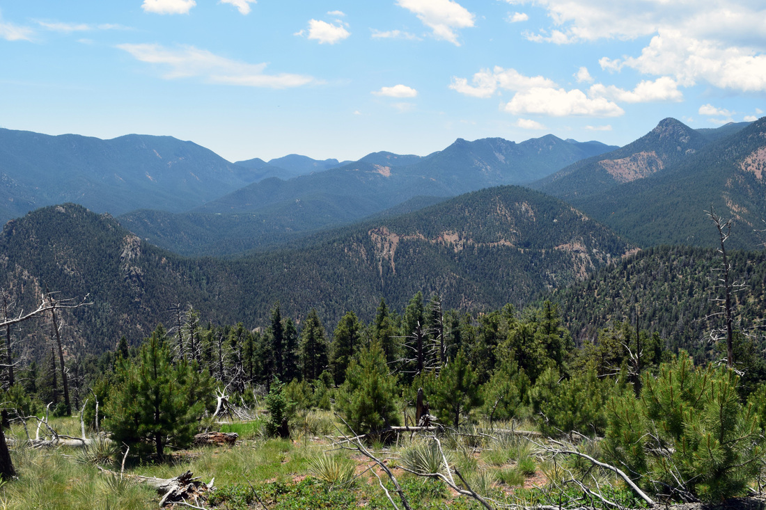
Distance: Approximately 7 miles total, 3.5 miles one-way
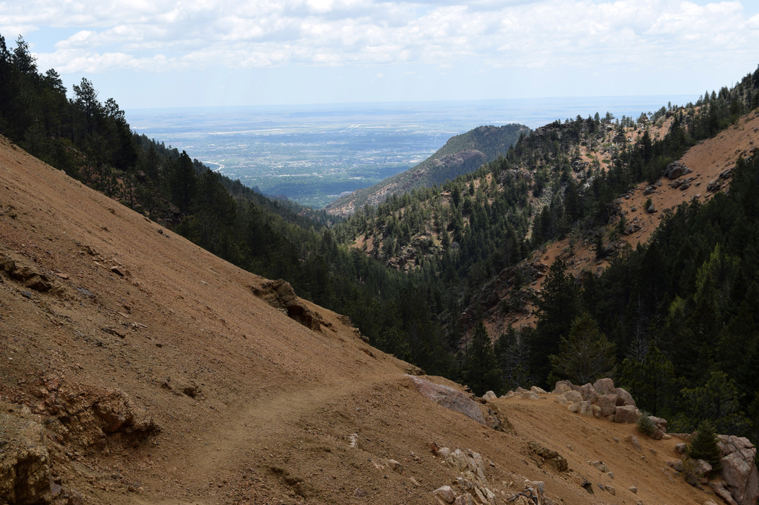
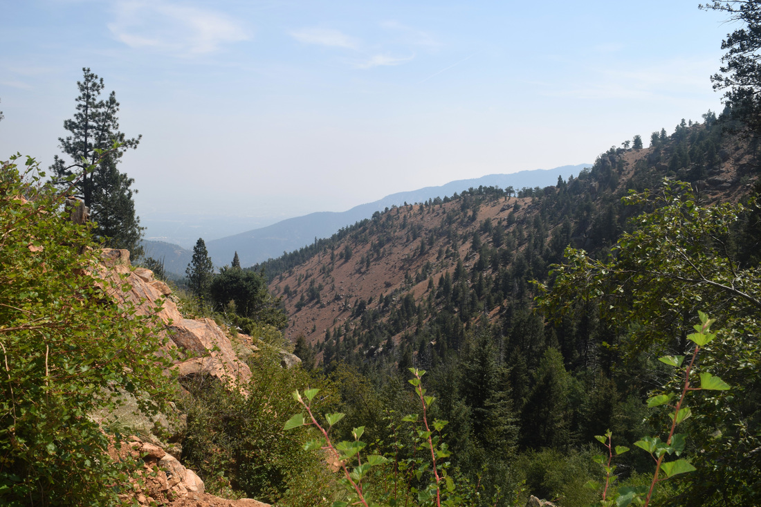
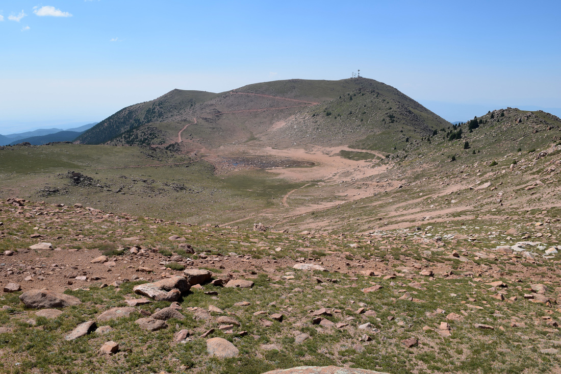
At 11,499 ft, Mt Rosa is one of the tallest and most prominent mountains in the Colorado Springs skyline. The conical peak is well-reputed for its incredible vantages of the surrounding terrain and is particularly known for its breathtaking views of Penrose-Rosemont Reservoir and when the time is right the fall foliage. Mt Rosa can be accessed by more than one way. The hike described here is a popular trek to Mt Rosa starting from the west of the mountain, but instead of beginning from Frosty Park; this hike description begins a mile and a half further down Forest Service Road 379 (FS 379) at its intersection with Gold Camp Rd. The reasoning behind this is FS 379 can be a lot rougher road than Gold Camp or Old Stage and dependent on one’s tolerance for the joyful noise created by rocks scraping against an undercarriage, a vehicle with 4WD and a higher clearance is recommended when driving to Frosty Park. From the intersection with Gold Camp Rd, begin hiking up FS 379, mostly through forest. The road has one creek crossing on the way to Frosty Park which likely can be rock-hopped without getting boots wet. There will also be several camping spots and ad lib firearm ranges along the way to and around Frosty Park's western border. After traveling about a mile and half, FS 379 comes to the wide open mountain meadow known as Frosty Park. A barbed-wire fence has been put up to help protect the meadow. Keep a close eye for a narrow gap in the fence near a bunch of fallen logs. If you find yourself reentering the forest and come to an intersection with Forester Trail and Nelson Camp Trail, then you have missed the right turn through the meadow. One can head back to find the road through the meadow or turn right onto Nelson Trail, numerically identified as #672. Near the fallen logs, turn right through the gap in the fence, cross over the berm and onto an old forestry road that cuts up through the meadow abounding with shrubby cinquefoil. With the coming of summer, Frosty Park can really come to life with a beautiful array of wildflowers like Monkshood, Sneezeweed and Shooting Stars. Just under a half-mile, the old forestry road arrives at an intersection with Nelson Trail, numerically identified as trail #672. Three signs mark the intersection; two are white ‘no motorized vehicles’ signs to warn dirt bikes and ATVs of the prohibition in taking the old forestry road headed down into Frosty Park instead of continuing along Nelson Trail. From the old forestry road turn right onto Nelson’s Trail. From here Nelson’s Trail ventures through dense, often-mixed forest, winding up the mountainside, at times steeply so. After about a mile, Nelson’s Trail climbs onto a ridge mostly barren of vegetation, except for sparsely populated pines. This is where the trail leading to Mt Rosa’s peak cuts away from Nelson’s Trail. A trail sign labeled ‘672’ marks the split. Fallen branches and toppled rocks may also mark the right turn leading up to Mt Rosa. After turning right at the sign, the trail follows the ridge for about 0.7 miles, climbing up to Mt Rosa. Stacked rocks known as cairns have been constructed to mark the way. Portions of the ridge continue to be pretty sparse of vegetation, allowing for some pretty good vistas before reaching Rosa’s pinnacle. After enjoying the views, the way back is the way you came, about 3.5 miles back down to Gold Camp Rd. As a there and back again hike, the total distance walked is approximately 7 miles. Distance is based on the great trail map of the Gold Camp Area designed by Pocket Pals Trail Maps, a local company that produces many maps on the areas nearby hikes and Colorado’s 14ers. Navigation is pretty straightforward, but both the turn through Frosty Park and later to Mt Rosa has the potential to be missed. The turn to Mt Rosa is marked but by a Nelson’s Trail sign. Given the distance, ease of navigation, and amount of uphill, this hike is rated as moderate. Driving Directions to the hike’s start point and links to further information are provided below. Further Online Resources: csindy.com: Hiking Along Old Stage Road by Bob Falcone Colorado Springs Gazette: Mount Rosa Out There Colorado: Top 10 Fall Treks in Colorado by Dena Rosenberry Pocket Pal Trail Maps |
Above image links to further images of the Hike
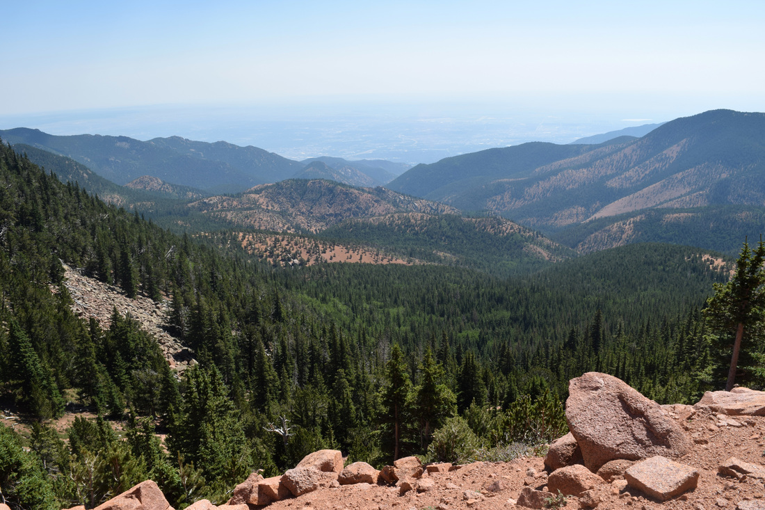
View of Penrose-Rosemont Reservoir from Mt Rosa
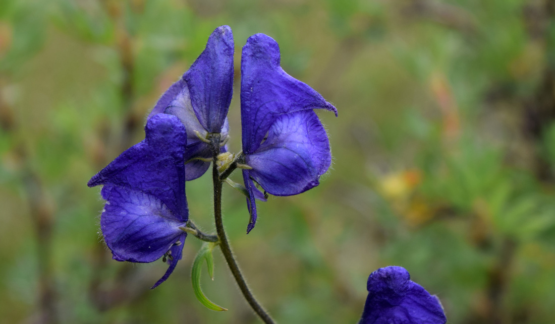
Monkshood blooming in Frosty Park
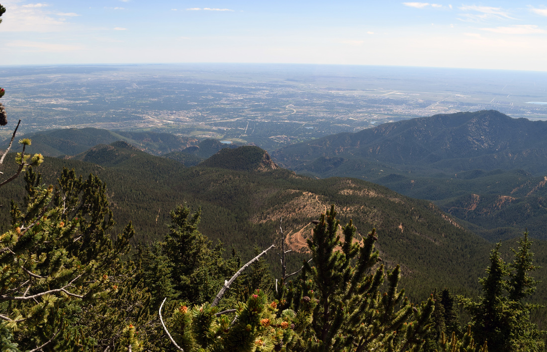
View east from Mt Rosa
Red Penstemon blooming along FS 379 on the way to Mt Rosa
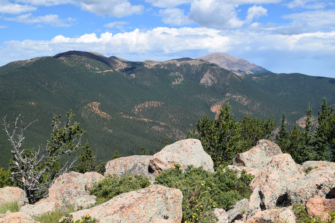
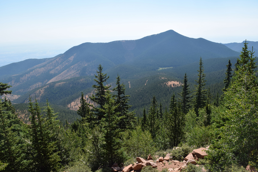
View of Almagre and Pikes Peak from Mt Rosa
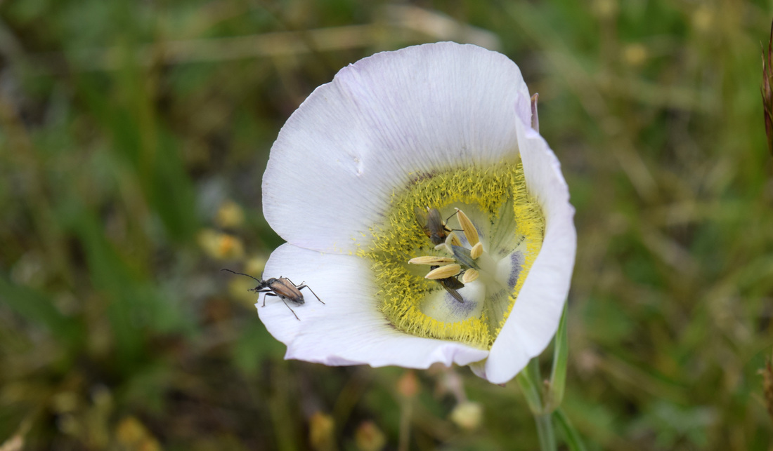
Mariposa Lily blooming in Frosty Park
View of Cheyenne Mountain from Mt Rosa
|
|
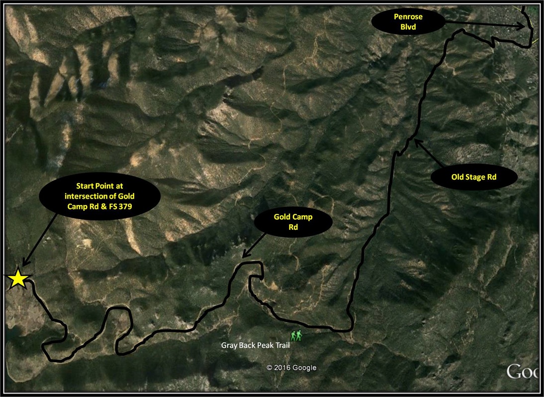
Driving Directions:
The start point for the hike to Mt Rosa is located about 23 miles from the UCCS campus. Both the hike to Mt Rosa and the hike to Almagre Mountain described below begin from the same start point where FS 379 intersects with Gold Camp Rd. From UCCS, turn right onto Austin Bluffs Pkwy and stay on Austin Bluffs Pkwy as it turns into Garden of the Gods Rd. From Garden of the Gods Rd, turn left, merging onto I-25 headed south. Stay on I-25 about 5.9 miles before taking Exit 140. From Exit 140, turn right onto Tejon St and then right onto Cheyenne Blvd. Turn left onto Cresta Rd from Cheyenne Blvd. From Cresta Rd turn right onto Mesa Ave. At the traffic circle, turn right staying on Mesa Ave as it turns into Park Ave and then El Pomar Rd. From El Pomar Rd, turn left onto Penrose Blvd. At a four-way stop, turn right onto Old Stage Rd. As Old Stage Rd makes a hard right, it becomes a soft-surface road. While soft surface, the road is well-maintained and no problem for the majority of vehicles to drive upon. Follow Old Stage Rd for about 11.25 miles before coming to an intersection with FS-379. Old Stage Rd will merge into Gold Camp Rd along the way to the intersection with FS-379. There is plenty of pull-off parking located opposite the intersection with FS 379. There are no toilets located at the start of the hike. Driving directions to the start point for the hike to Mt Rosa using Google Maps is linked here. |
Almagre Road (FS 379) to Almagre Mountain
|
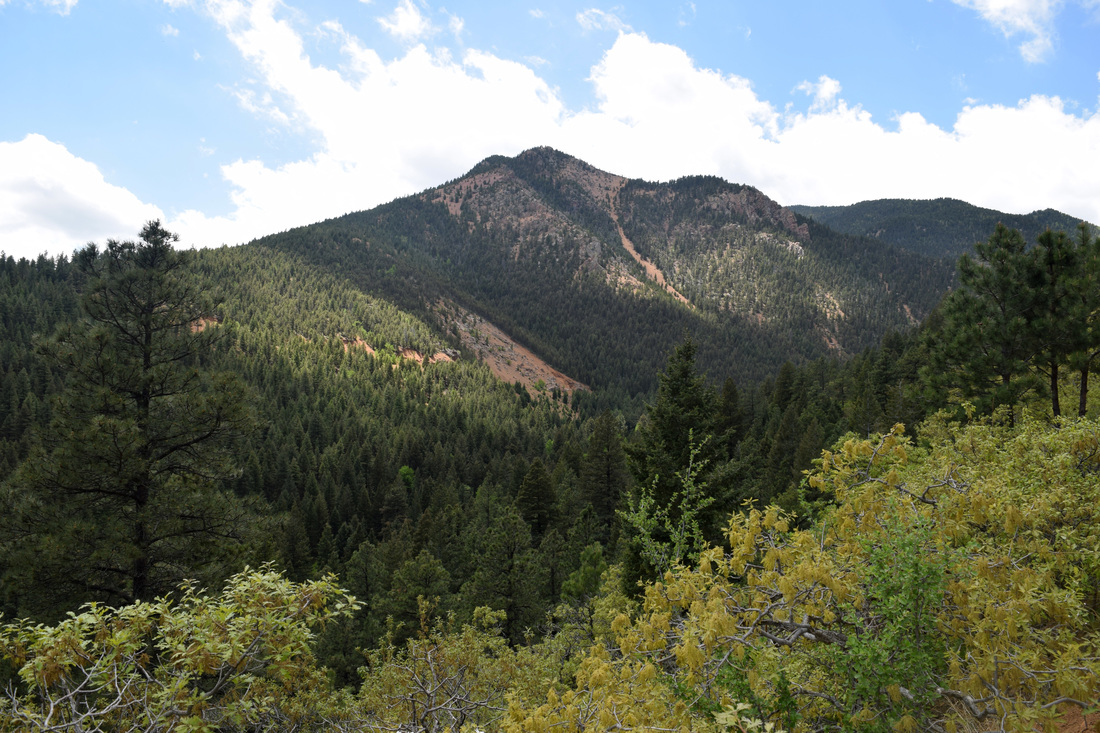
Distance: Approximately 14.4 miles total, 7.2 miles one-way
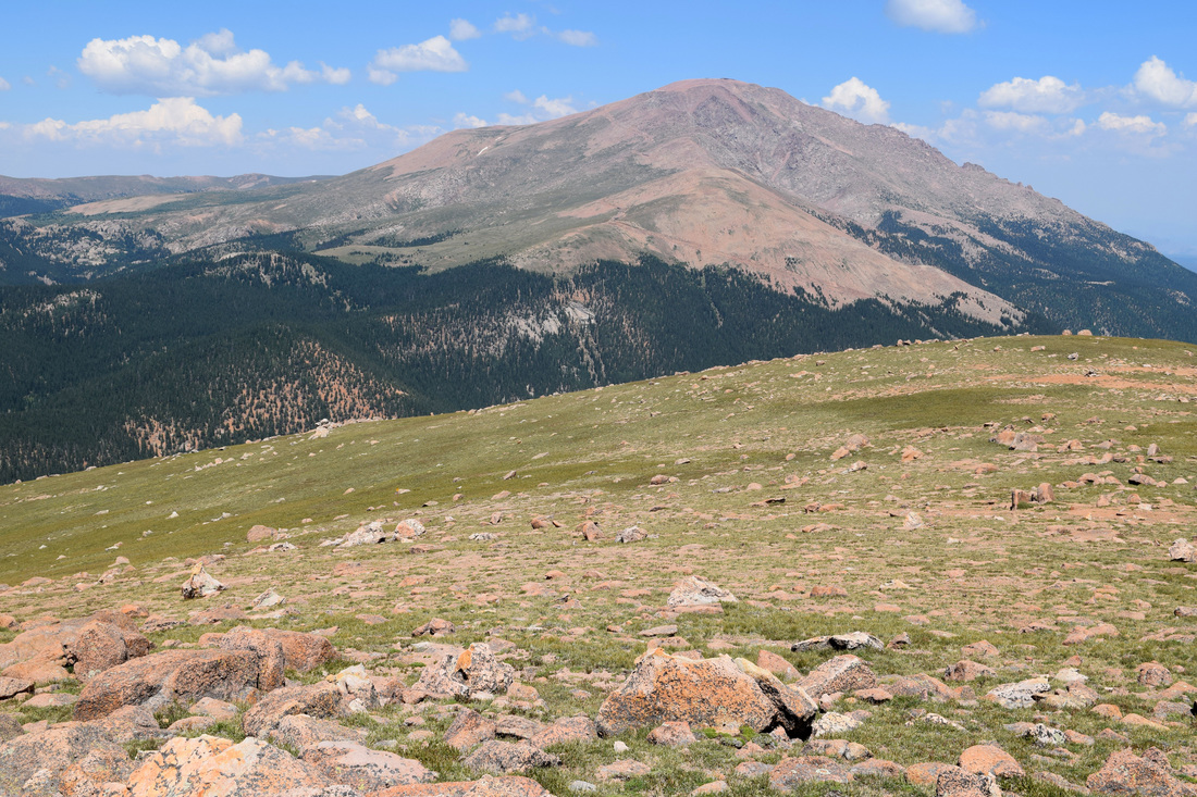
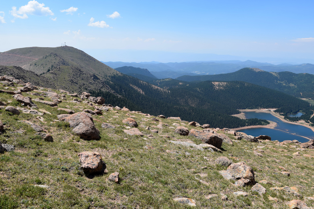
At 12,367 ft, Almagre Mountain is the second tallest peak in the Colorado Springs skyline, offering up incredible views of Pikes Peak, the Seven Lakes area, Cheyenne Canyon and Colorado Springs. Despite the beauty of Almagre’s scenery, the peak is an oasis of solitude when compared to other popular hiking destinations. There is more than one way to get to Almagre Mountain, the hike described here starts from Gold Camp Rd and follows Forest Service Rd 379 (FS 379), also known as Almagre Rd and then FS 379A to Almagre Mountain’s peak. While the route is easy to navigate, it is also long, often steep, and accessible to motor vehicles for a majority of the way. Starting from the intersection of Gold Camp Rd and FS 379, the road steadily climbs through evergreen forest for about a mile and a half before reaching the open mountain meadow known as Frosty Park. On the way to Frosty Park and along the park’s periphery, there are many off-road camping spots and impromptu firearm ranges. There is also a creek crossing before reaching Frosty Park. Rocks have been stacked as a foot bridge, but dependent on recent rain or melt, there might be a chance to get a bit wet. Just past Frosty Park, FS 379 comes to an intersection with Forester and Nelson Trails. The intersection is marked with trail signs. Forester Trail is numerically identified as #701, while Nelson Camp is numerically identified as #672. Turn left, following the Ring the Peak trail sign as the Ring the Peak Trail joins FS 379 at the intersection headed west in the direction of Deer Park. From here the route climbs for two miles, at times steeply so, traveling through pine forest, often under a hot sun, coming to an intersection with FS 370C. Stay straight, following the Ring the Peak trail sign as FS 379 gradually descends toward the serene beaver ponds of Deer Park. As Deer Park is reached, the route comes to another intersection. Stay straight following the Ring the Peak trail sign. FS-379 briefly skirts Deer Park before the forest road heads back up through forest. Just after leaving Deer Park, FS 379 comes to an intersection with FS 379A, approximately four miles from the start of the hike beginning from Gold Camp Rd. Make the hard right turn headed steeply up FS 379A. At first, FS 379A journeys through dense forest but as the route wraps around the mountain side, the road climbs out of the forest to epic eastern panoramas of Cheyenne Canyon and Colorado Springs below. About a mile and a half after turning right onto FS 379A, the road reaches a gate blocking motor vehicular traffic from continuing on. Past the gate, the remaining mile and a half is above the timber line, initially climbing up to the ridge and then crossing by a utility structure. Past the structure, turn right and cross over Stratton Reservoir’s dam. The dam possesses pretty awesome vantages of Cheyenne Canyon and the city. Plus, the route is quicker than circling the natural bowl around Stratton Reservoir. According to Zoltan Molacsay, Stratton Reservoir was originally intended to be used for Colorado Springs’ drinking water, but after the dam’s construction, the spillway did not meet the satisfaction of state inspectors and was drained down to a level that would not cause a flood. Past the dam, the jeep trail steadily climbs and then side-winds up to the solitude of Almagre’s nearby peak. After enjoying the views, the way back is the way you came, approximately 7.2 miles back down to the intersection with Gold Camp Rd. As a there and back again hike, total distance is approximately 14.4 miles. Distance is based on the trail description written by Greg Long in the Colorado Mountain Club Guidebook: The Best Southern Front Range Hikes. Please note, Greg Long describes a much shorter hike, beginning from the gate on FS 379A, having driven the rocky 5.9 miles up FS 379 and then FS 379A. I don’t recommend trying the drive without having four-wheel drive capabilities and most importantly a high-clearance. FS 379A can be rather narrow for oncoming vehicular traffic, with a potentially long reverse or drop-off. FS 379 can get pretty rough at points after crossing the creek on the way to Frosty Park. Parking at Frosty Park will cut about three miles off the total hike. In addition to the distance, the hike to Almagre Mountain is mostly uphill, climbing roughly 2,600 ft. Much of the climb is reasonable, but there are definitely plenty of steep moments. Navigation is pretty straightforward but given the distance and amount of uphill, this hike is rated as difficult. Also, the last mile and an half to Almagre is above the timber line where oxygen just isn’t as plentiful and humans become the biggest target for lightning when the thunderstorms arrive, which during summer should be expected sometime in the afternoon. Most guides recommend being below the timber line before lunch. Further Online Resources: Summit Post: Almagre Mountain by Sarah Simon On Walkabout On: Almagre Mountain via Frosty Park - Part 1 On Walkabout On: Almagre Mountain via Frosty Park - Part 2 |
The image above links to further images of the Hike
View of Mt Rosa from FS 379A
View from FS 379A
View of nearby Signal Mountain and the depression where the very shallow Stratton Reservoir is located
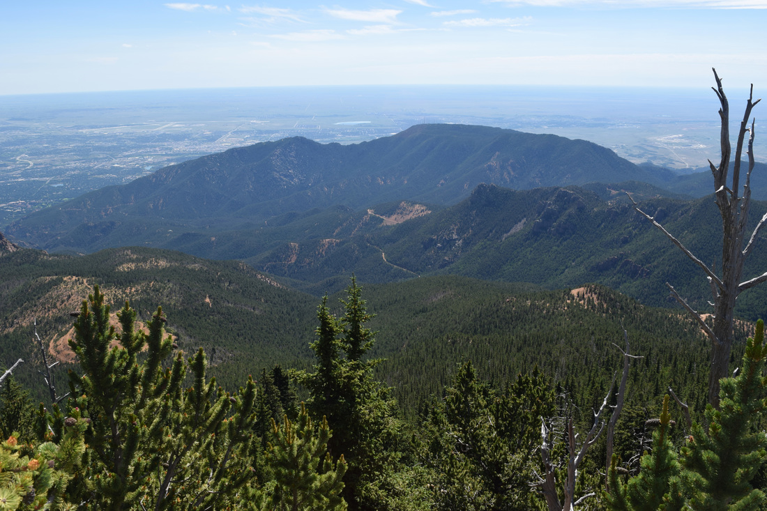
View of Pikes Peak from Almagre Mountain
View from Almagre Mountain
View of Seven Lakes Area from Almagre Mountain
View from Almagre Mountain
View of Cheyenne Mountain from Almagre Mountain
|


|
Driving Directions:
The start point for the hike to Almagre Mountain is located about 23 miles from the UCCS campus. From UCCS, turn right onto Austin Bluffs Pkwy and stay on Austin Bluffs Pkwy as it turns into Garden of the Gods Rd. From Garden of the Gods Rd, turn left, merging onto I-25 headed south. Stay on I-25 about 5.9 miles before taking Exit 140. From Exit 140, turn right onto Tejon St and then right onto Cheyenne Blvd. Turn left onto Cresta Rd from Cheyenne Blvd. From Cresta Rd turn right onto Mesa Ave. At the traffic circle, turn right staying on Mesa Ave as it turns into Park Ave and then El Pomar Rd. From El Pomar Rd, turn left onto Penrose Blvd. At a four-way stop, turn right onto Old Stage Rd. As Old Stage Rd makes a hard right, it becomes a soft-surface road. While soft surface, the road is well-maintained and no problem for the majority of vehicles to drive upon. Follow Old Stage Rd for about 11.25 miles before coming to an intersection with FS-379. Old Stage Rd will merge into Gold Camp Rd along the way to the intersection with FS-379. There is plenty of pull-off parking located opposite the intersection with FS 379. There are no toilets located at the start of the hike. Driving directions to the start point for the hike to Almagre Mountain using Google Maps is linked here. |
