Catamount Ranch Open Space
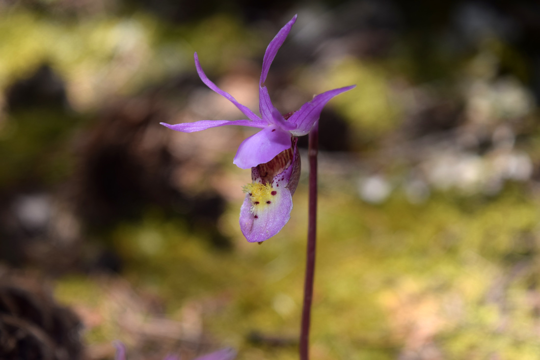 Fairyslipper Orchid blooms along Elder-Fehn Trail
The 1,320 acre Catamount Ranch Open Space is located on the outskirts of Woodland Park, adjacent to Pikes Peak's North Slope Recreation Area. Though mostly forested, the mountainous terrain possesses some really spectacular views of Pikes Peak and the Crags.
Catamount Ranch is home to two trails. They are the Elder-Fehn and Vayhinger Trails. The two share the same path for roughly two miles, before Vayhinger Trail cuts away, headed toward North Catamount Reservoir in the North Slope Recreation Area.
The North Slope Recreation Area is also accessible from Catamount Ranch at a much earlier moment along Elder-Fehn Trail, near the open space's parking area and trailhead. A gate and trail map mark the intersection with North Slope's Limber Pines Trail.
The Limber Pines Trail is a part of the Ring the Peak Trail. Turning right onto Limber Pines Trail from the gate quickly leads down to near North Catamount Reservoir and many use this route instead of entering from the Pikes Peak Highway to enjoy the area's serenity. The North Slope Recreation Area is seasonably open, with access closing for winter, so during the warmer months, Catamount Ranch's parking area may be full, but it's trails are most likely empty of hikers.
While hiking and bicycling are welcome, horseback-riding is not permitted at Catamount Ranch Open Space. Dogs and other pets are permitted up to the intersection with the Limber Pines Trail, but are not allowed past this point. The intersection is also known as portal one. Driving directions, as well as further details on the Elder-Fehn Trail are written below. Linked directly below is additional information on Catamount Ranch Open Space and the North Slope.
Further Online Resources:
Palmer Land Trust: Catamount Ranch Open Space
Catamount Ranch Open Space Map pdf
North Slope Recreation Area Map pdf
ColoradoSprings.gov: North Slope Recreation Area
|
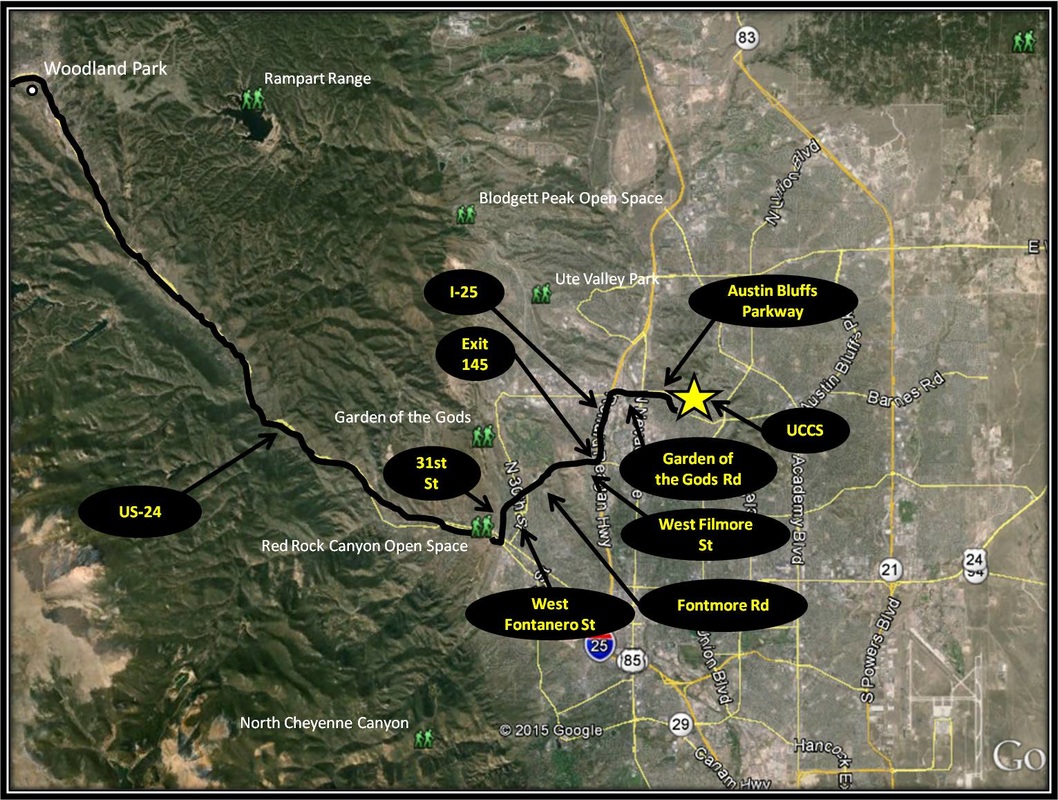
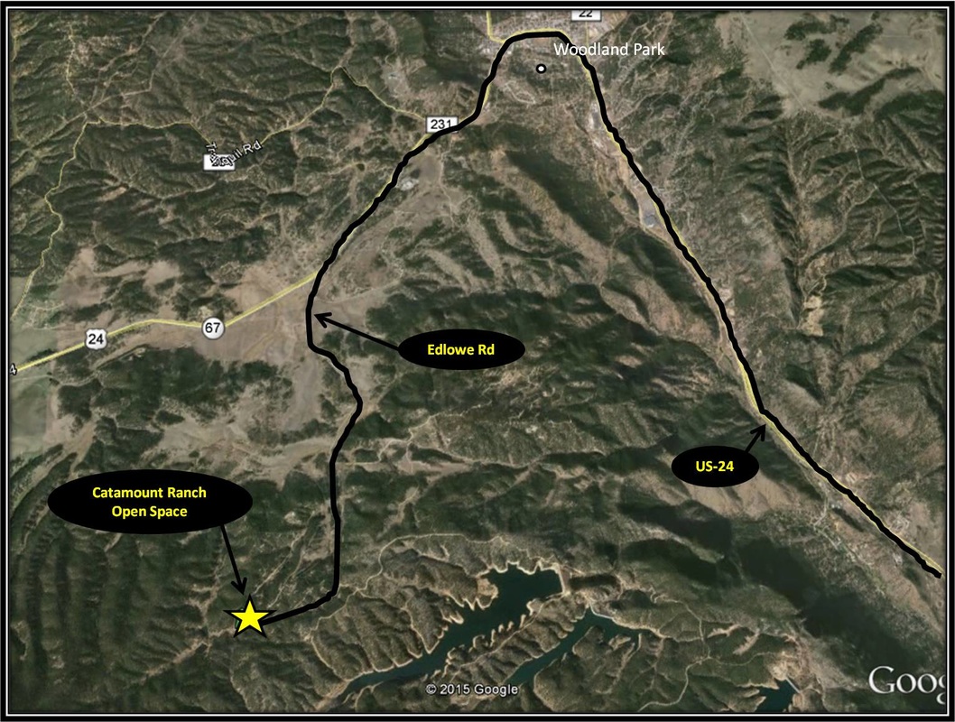
Driving Directions:
From UCCS, turn right onto Austin Bluffs Pkwy. Continue straight as Austin Bluffs Pkwy turns into Garden of the Gods Rd and then turn left onto !-25 headed south. Shortly after merging onto I-25, take Exit 145 and turn right onto West Filmore St. Stay on West Filmore St as it turns into Fontmore Rd and then West Fontanero St. From West Fontanero St turn left onto 31st St. From 31st St, turn right onto US-24. Stay on US-24 for about 18.2 miles, passing through Woodland Park. From US-24 turn left onto Edlowe Rd. Stay on Edlowe Rd for approximately 3.4 miles. A moderately-sized parking area will be on the left, just before reaching a gate. Driving directions to Catamount Ranch Open Space using Google Maps is linked here. Parking is moderately-sized and often busy, esp during summer when the nearby Catamount Reservoir of Pikes Peak's North Slope is open. The parking area has a vault toilet. |
Elder-Fehn Trail
Distance: Approximately 5.5 miles total
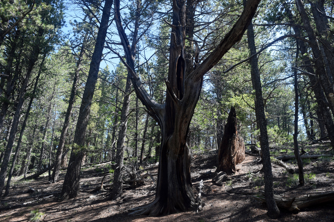
Elder-Fehn Trail is a 5.5 mile, keyhole-loop hike of moderate difficulty that journeys mostly through pine timberland at an elevation just short of 10,000 ft. On several occasions the forest canopy opens to awesome glimpses of Pikes Peak. Additionally, many sources mention the open space as an excellent environment for wildlife viewing. Starting from Catamount Ranch's parking area, Elder-Fehn Trail ascends at first fairly steep toward a gate. Just a few steps before reaching the gate, Elder-Fehn Trail cuts right. The gate marks the intersection with the Limber Pines Trail and is an entrance into the North Slope Recreation Area from Catamount Ranch. The gate is closed when North Slope is closed for the season. From here Elder-Fehn Trail dips and climbs, at moments steeply, coming to the split with Vayhinger Trail about 1.8 miles from the hike's start. About 0.2 miles later, the trail arrives at where Elder-Fehn loops. Either way chosen involves uphill, but I think turning left is a bit friendlier in terms of volume and even steepness. The loop is approximately 1.5 miles in length. After completing the loop, the way back is the way you came, about two miles back to the hike's origin point. The approximate 5.5 mile total distance is based on information provided on Catamount Ranch Open Space's trail map. Trail maps are located at several points along the Elder-Fehn Trail. Though not in the beginning, Elder-Fehn Trail is also marked by green reflectors that have been placed on tree trunks about eye-level. Trail signs and other signs asking one not to stray from the trail for reasons of preservation and scientific observation also help guide the trail's route. Given the straight-forward navigation, distance, and amount of uphill, Elder-Fehn Trail is rated as being moderate in difficulty level, just be aware of the hike's high elevation Further Online Resources: Catamount Ranch Open Space Map pdf Out There Colorado: Elder-Fehn Trail in Catamount Ranch Open Space RootsRated: Catamount Ranch Open Space by Deb Accord |
Above image links to further images of the Hike
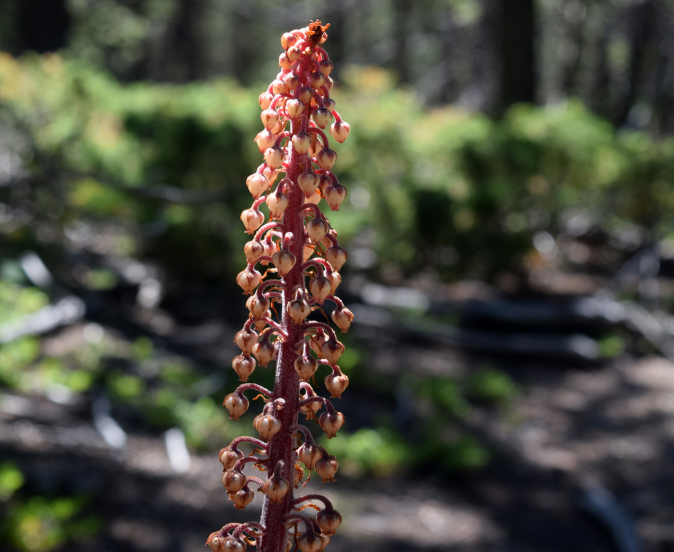
Pinedrops flourish feeding on what is decaying beneath a coniferous forest along Elder-Fehn Trail
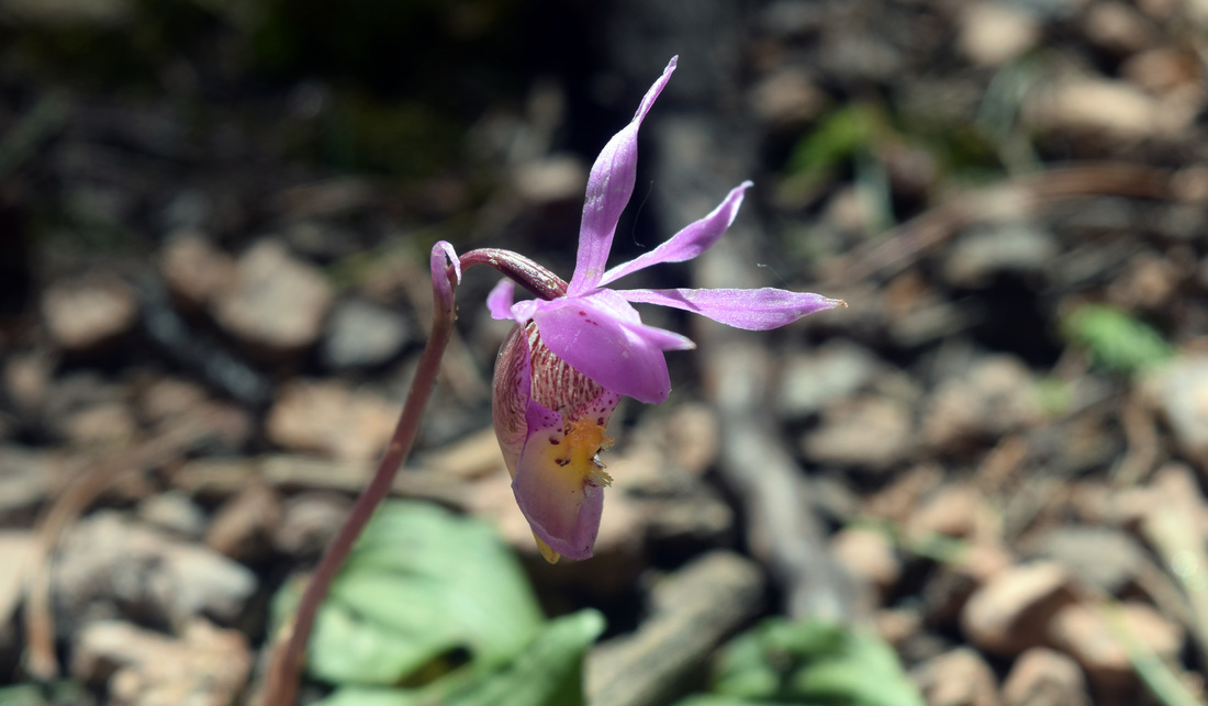
Fairyslipper Orchid along Elder-Fehn Trail
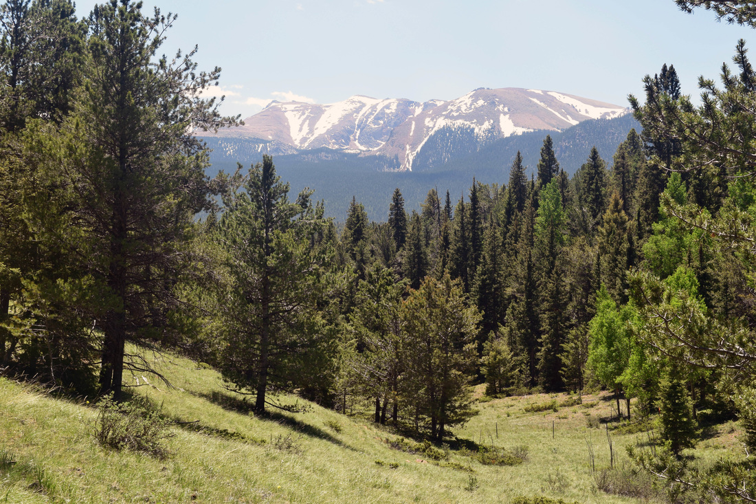
View of Pikes Peak from Elder-Fehn Trail
|
