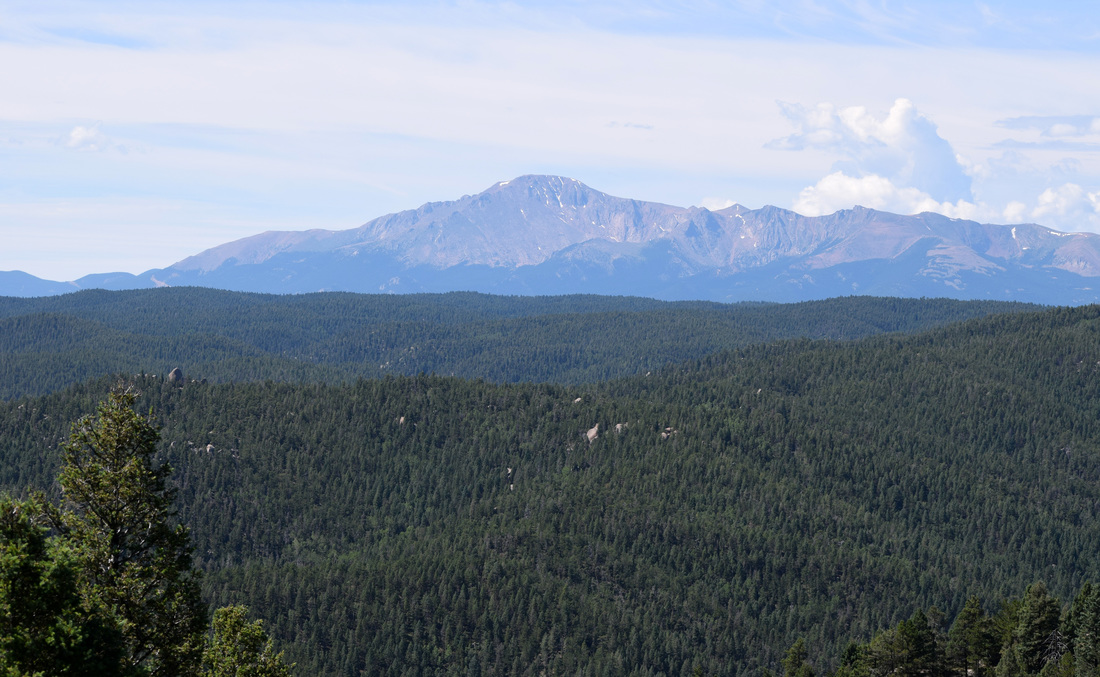
Rampart Range
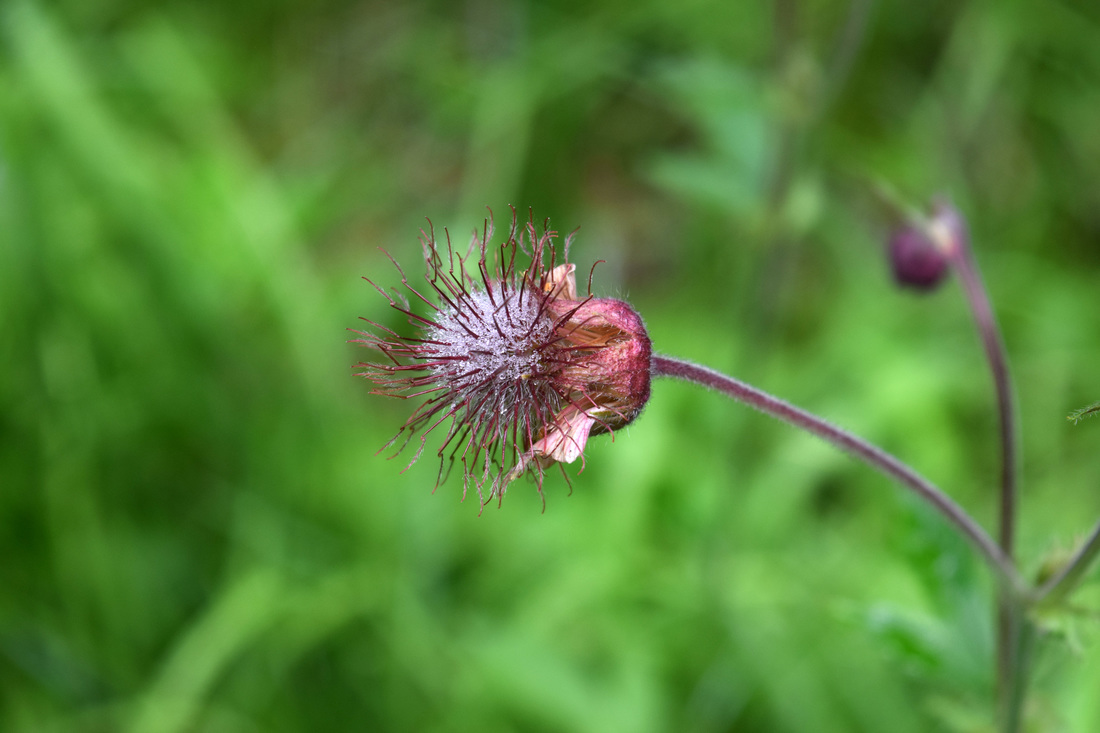
 Elephant Head blooms along Lovell Gulch Trail in Pike National Forest
Located within Pike National Forest, the Rampart Range is a part of the Front Range and among the key land features to define the region, in particular when looking west while driving the I-25 corridor. The mountain range runs from northern Colorado Springs to Denver and is found within El Paso, Douglas, and Teller counties.
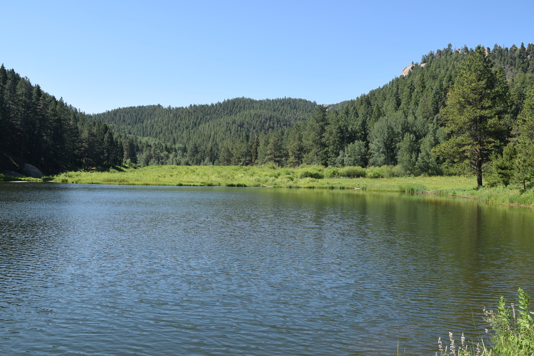
The area is a popular outdoor destination, home to reservoirs open to the public and close to Colorado's two largest cities. Among the most popular activities is off-roading (OHV), but horseback riding, bicycling, and hiking are also welcome.
Some of the best information on Rampart Range's outdoor possibilities is found in the pages between chapter 14 and 15 of Zoltan Malocsay's Trails Guide: Denver to Pikes Peak. The trail guide is slightly dated, so I recommend confirming what is gleamed from this very informative work with more recent sources for possible changes and even closures to trails, likely related to recent weather conditions or previous wildfires.
Additionally, the reservoir and the roads accessing Rampart Range close for the winter and reopen in the spring. Rampart Reservoir Recreation Area has a day-use fee of $6.00, but the price may be changing soon. Further information on Rampart Range is linked directly below.
Rampart Range describes a large swath of territory, with several trailheads located throughout the region. Because of this driving directions are located beneath each hike description. Lovell Gulch Trail, Mt Herman Trail and the Palmer Reservoir Inlet - Ice Cave Creek Loop are described in further detail in this section.
Further Online Resources:
Pike National Forest (FS.USDA.GOV): Rampart Range Overview
Pike National Forest: Rampart Range Recreation Area
fs.usda.gov: Rampart Range Map
Pike National Forest: Rampart Reservoir Recreation Area
Pike National Forest: Devil's Head Trailhead #611
Rampart Range Motorcycle Management Committee
Lovell Gulch Trail
Distance: Approximately 5.5 miles total
Located on the outskirts of Woodland Park, the Lovell Gulch Trail is an approximate 5.5 mile keyhole-loop hike journeying through a lush, narrow hollow and along a forested ridge. Excellent views of Pikes Peak and Ute Pass open up along the ridge, while the verdant, riparian environment formed in the valley's meadows and forest is rich with wildflowers like Mariposa Lily, Death Camas, Columbine, Miner's Candle, and various louseworts, including Elephant Head.. The hike begins from the Lovell Gulch Trailhead, located off of Rampart Range Rd, next to Woodland Park's Road Maintenance Building. The trail's beginning journeys through forest and meadow for about 0.8 miles before descending toward a stream easily crossed on most occasions without getting boots wet. Just past the stream crossing, a wooden sign marks where the trail loops and its approximate 3.75 mile length. Either way leads back to this point, but turning right is often advised because the hill-climbing is much more gradual than the abrupt, steep incline experienced from choosing to turn left. After turning right, the trail journeys through Lovell Gulch's beautiful meadows, paralleling a riparian ecology as dank as any stream-fed draw in the Great Smoky Mountains. The trail eventually passes through a striking boulder garden and another meadow, before cutting back into forest, and winding up to a gated intersection located beneath power lines. A '706' trail sign (the Forest Service's numerical identifier for Lovell Gulch Trail is 706) marks the left turn to continue along the loop hike. From here the path follows the ridge, at first underneath the power lines. Lovell Gulch Trail is mostly level along the ridge, but the route does climb a few times, with the second to last incline being fairly steep. A couple of short spurs lead to vistas of Pikes Peak and Ute Pass. Views also open up along the trail. Wildflowers are plentiful on the ridge, as well as the meadows. After descending steeply, the trail crosses closely by private property, cutting back into forest and arriving back at where the loop began. Turn right, crossing the stream once again, headed back to the hike's start point. Lovell Gulch Trail is approximately 5.5 miles total. This distance is based on Zoltan Malocsay's trail description. Other sources vary but are usually within the 5 - 6 mile range. Navigation is mostly straightforward, but social trails do cut away from the main trail, in particular on the first and last portion of the hike. Fallen branches have been placed across possible intersections in many instances to help illustrate the correct course. There is roughly 1,000 ft of elevation gain along this trail, so no matter which way is chosen, when one reaches the loop there will be uphill moments. Turning left takes all of that uphill mostly in one steep swoop, while turning right is much more gradual. Given these factors, Lovell Gulch Trail is rated as moderate. In addition to hiking and it's winter equivalents, horseback-riding and bicycling are welcome on the trail. Further details and driving directions are linked and described below. Further Online Resources: Pike National Forest (FS.USDA.GOV): Lovell Gulch Trail #706 On Walkabout On: The Lovell Gulch Trail, Colorado by Dobbs Hiking in the Rockies: Lovell Gulch Loop by Josh Friesema |
Above image links to further images of the Hike

Mariposa Lilies bloom in force along Lovell Gulch Trail during summer

Columbines also bloom in the verdant mountain meadows that Lovell Gulch Trail ventures through

Green Gentian, as well as many other species bloom near Lovell Gulch Trail as it journeys along the ridge

Orange Sneezeweed along Lovell Gulch Trail

Scarlet Paintbrush along Lovell Gulch Trail
|

|
Driving Directions:
From UCCS, turn right onto Austin Bluffs Pkwy. Stay on Austin Bluffs Pkwy as it turns into Garden of the Gods Rd and then turn left, merging onto I-25 headed south. Stay on I-25 for 3 miles and then take Exit 145 for West Filmore St. From the exit lane, turn right onto West Filmore St. Stay on West Filmore St as it turns into Fontmore Rd and then turns into West Fontanero St. At the stop sign, turn left onto 31st St from West Fontanero St. From 31st St, turn right onto US-24. Stay on US-24 for 14.6 miles, then turn right onto South Baldwin St, just before the McDonalds having entered Woodland Park. Stay on Baldwin St as it turns into Rampart Range Rd. Parking for Lovell Gulch Trail will be on the left, about 2.2 miles from turning off of US-24. Parking is moderately-size and able to fit up to 10 -12 vehicles. There are no latrines at the trailhead. Driving directions to Lovell Gulch Trail's start point using Google Maps is linked here. |
Mount Herman Trail
|
Distance: Approximately 2.2 miles total
At 9,063 ft, Mt Herman is a prominent, broad-shouldered, eastern sentinel of the Rampart Range. Towering above the community of Monument, the mountain's rocky top offers impeccable views of the eastern plains and Pikes Peak. Two trail signs with '716' vertically painted on both of them mark the hike's start point from the small parking area located just off of Mt Herman Rd. The Forest Service's numerical identifier for Mt Herman Trail is #716. Mt Herman Trail begins by closely following a small stream briefly through forest and then a lush mountain meadow. Black-Eyed Susan, Monkshood, and Cow Parsnip are but a few of the wildflowers to bloom along the initial part of the hike as July turns to August. In the initial meadow, the trail appears to fork on a couple of occasions; stay right as the path sharply curves south ascending the mountainside. After a short climb, Mt Herman Trail veers left in a northeasterly direction, headed up what appears to be a very steep and eroded run-off. The trail then narrows and levels out, journeying through another verdant mountain meadow bordered by aspen groves and radiant with summer wildflowers like lousewort, larkspur and cutleaf coneflower. Not long after cutting back under the forest shade, the route turns right, steeply climbing up what feels more like a rocky wash to a saddle on the ridge-top.. Once on top of the ridge, steer left, at times scrambling over very rocky terrain to get to the nearby 9,063 ft pinnacle of Mt Herman. After enjoying the breath-taking panoramas, the way back is the way you came, about 1.1 mile back down to the hike's start point. As a there and back again hike, the total distance walked is approximately 2.2 miles. Distance is based on information provided in the Falcon Guide Best Hikes Near Colorado Springs by Stewart M. Green, as well as on cospringstrails.com. Despite the short distance, Mt Herman Trail possesses some steep sections. These sections can be tough on the downhill do to rocky footing and a combination of potentially slick gravel and loose soil. Navigation is pretty straightforward, though the trail is largely absent of official marking beyond the initial trail signs at the beginning of the hike. Branches and old tree trunks have been placed to help block possible bad turns and rock cairns have been built to mark the last steep climb up the rocky wash before reaching the ridge. Given these factors, this hike is rated as easy-to-moderately difficult, with the caveat there are a couple of very steep moments to contend with. Further information is linked below. Driving directions to Mount Herman Trail's start point is also described below in greater detail. While exact dates vary from year to year, Mt Herman Rd closes to vehicular traffic during the winter. The forest gate closing the Mt Herman Rd is located approximately one - two miles before Mt Herman Trail's start point. Further Online Resources: Pikes National Forest (fs.usda.gov): Mt Herman Trail #716 Colorado Springs Trails: Mt. Herman |
Above image links to further images of the Hike

Black-Eyed Susan blooming along Mt Herman Trail

View from Mt Herman

Monkshood blooming along Mt Herman Trail

View from Mt Herman
|


|
Driving Directions:
From UCCS, turn right onto Austin Bluffs Pkwy and from Austin Bluffs Pkwy turn right onto Nevada Ave. From Nevada Ave merge onto I-25 headed north toward Monument. Stay on I-25 for about 16.1 miles and then take Exit 161.. From Exit 161, turn left onto CO-105. Continue straight onto 2nd St when CO-105 turns right headed north toward Palmer Lake. Turn left onto Mitchell Ave from 2nd St. Stay on Mitchell Ave for only a half-mile before turning right onto Mt Herman Rd. The start point for Mt Herman Trail is located about 6.6 miles from the intersection with Mitchell Ave. Not long after passing a sign notating the entering of Pike National Forest, Mount Herman Road becomes soft surface.. The road can be narrow, esp on the curves, but is usually well-maintained. Located in a draw, parking near the start point is limited to maybe eight vehicles at best. There are no toilets located at Mt Herman's trailhead. Driving directions to Mt Herman Trail using Google Maps is linked here. |
Palmer Reservoir- Inlet - Ice Cave Creek Loop
|
Distance: Approximately 4.74 miles total
Located in the Rampart Range near the community of Palmer Lake, the Palmer Reservoir area is often mentioned as one of the Front Ranges most scenic outdoor locales. The vistas of the Upper Reservoir with Rampart Range’s level ridges in the backdrop are quite lovely and the area’s reputation for beauty is well-deserved. The Palmer Reservoir area has many trails, social trails and old logging roads cutting through Rampart Range, some offering spectacular views. However, none of these trails, social trails, and old logging roads are very well-marked, if marked at all and it is not unusual for people to find themselves lost. Getting lost has been so common over the years; Zoltan Molacsay forsook mentioning the area in earlier editions of his formative Trails Guide: Denver to Pikes Peak. Not to sound like a wet blanket but take extra care in navigating this area. The hike described here is a moderately difficult, 4.74 mile keyhole loop hike beginning from the trailhead in Palmer Lake, initially following the Palmer Reservoir Trail up, sometimes steeply to the upper reservoir. Having enjoyed the splendor of the upper reservoir, Upper Reservoir Trail comes to an intersection with Inlet Trail, about 1.42 miles from the start of the hike. The Upper Reservoir Trail continues left, crossing a creek as the creek joins the reservoir and follows the boundary of the shore. Veer right, taking the Inlet Trail following the creek. Not far past the intersection with Palmer Reservoir Trail, Inlet Trail comes to an intersection with Winding Stair Road. Winding Stair Rd veers left crossing the creek. Continue straight on Inlet Trail keeping the creek on your left. Not far past the previous intersection, Inlet Trail comes to another unmarked intersection, this time with Swank Trail. Swank Trail cuts to the right, headed up. Veer left continuing to follow Inlet Trail. Inlet Trail continues to follow the creek through a lush and wildflower-rich meadow, eventually climbing into evergreen forest. When Inlet Trail climbs into the forest, the route gets much steeper winding through a boulder garden before reaching the ridge line and the T-intersection with Winding Stairs Trail, about 0.68 mile from the split from the Palmer Reservoir Trail. From here, turn right onto the unmarked Winding Stairs Trail. Through the trees, the ridge offers excellent views of the nearby surrounding mountains. The ridge is not level and the trail can feel a bit like a roller coaster before reaching another unmarked intersection about a half-mile from the turn from Inlet Trail. Turn left onto what is Swank Trail. A right turn onto Swank Trail descends steeply back down to the intersection with Inlet Trail and the Upper Palmer Reservoir. After turning left, Swank Trail descends through dense evergreen forest into another mountain meadow. This meadow is formed by Ice Cave Creek. Swank Trail crosses Ice Cave Creek by a make-shift bridge, but can likely be jumped, if the bridge is out. The trail then briefly journeys through the meadow, crossing a small stream, and then heads back into the forest. About 0.11 mile from crossing Ice Cave Creek, Swank Trail comes to the intersection with Ice Cave Creek Trail. The split is unmarked and easy to miss. Turn right onto Ice Cave Creek Trail. Initially, Ice Cave Creek Trail closely follows Ice Cave Creek, keeping right of the creek before crossing the creek, most likely without getting boots or socks soaked. Ice Cave Creek Trail then climbs the hillside following the course of the creek. Views east open up from the path before Ice Cave Creek Trail side-winds back down to Palmer Reservoir Trail just a little above the lower reservoir. From here, turn left headed down to the parking area and start point for the hike, about 0.82 miles away. Total distance for this keyhole loop hike is about 4.74 miles. Distance is based on adding up the mileage mentioned in the Pocket Pals Map: Rampart Range Wildlands #13. Pound for pound, I think the Pocket Pals Rampart Range Wildlands Area Trail Map #13 is the most helpful map of the Palmer Reservoir region and a map for this area is definitely recommended. This hike offers plenty of uphill, much of it steep, esp. along Inlet Trail just before reaching the intersection with Winding Stairs Trail. The trails are unmarked and intersections are not always well-defined, making the area the likely locale for an evening local news story on lost hikers. Given the uphill and potential navigation difficulties, this hike is rated as moderate. The area’s many trail guides provide a variety of different hikes beginning from the Palmer Reservoir trailhead. In addition to foot traffic, bicycling is also welcome on the trails in the Palmer Reservoir area. Dogs are prohibited. If you hiked here prior to the COVID-19 pandemic just be aware parking regulations have changed and you are no longer allowed to park at Glen Park near the Palmer Reservoir Trailhead.. . Further Online Resources: Gazette.com: "Pikes Peak Region Trail 'One of the Last Remaining Wild Places along the Front Range'" by Lance Benzel Gazette.com: 5 Hiiking Trails Near Colorado Springs where You Can Escape Big Crowds by Lance Benzel Pocket Pals Trail Maps |
Above image links to further images of the Hike

Monkshood Blooming along Inlet Trail

Wild Bergemot blooming along Inlet Trail

Downy Rattlesnake Plantain

Cutleaf Coneflower along Swank Trail

Columbine blooming along Inlet Trail

Black-Eyed Susan blooming along Inlet Trail

Spotted Coralroot blooming along Inlet Trail

Green Gentian blooming along Inlet Trail
|


|
Driving Directions:
The Palmer Reservoir Trailhead is located just about 20 miles from the main campus of UCCS. To get there, turn right onto Austin Bluffs Pkwy. From Austin Buffs Pkwy turn right onto Nevada Ave and merge onto I-25 headed north toward Monument. Stay on I-25 for approximately 12.4 miles and then take Exit 161 for CO-105. Turn left from the exit ramp onto CO-105. After crossing over the interstate, CO-105 turns right at the stoplight. Stay on CO-105 for another 3.4 miles and then turn left onto Lower Glenway St. Stay on Lower Glenway St for 0.3 mile and then turn left onto High St. Continue Straight as High St turns into the one-way Old Carriage Rd. The trailhead is on the left at the bottom of the curve. There are many parking spots near the trailhead, but Palmer Reservoir’s beauty is well known and spots fill up quick. Fortunately there is ample parking further down. There are no toilets at the trailhead or the parking nearest to it. Driving directions to the Palmer Reservoir Trailhead using Google Maps is linked here. |
